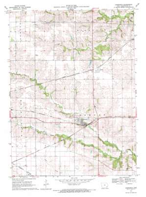
Ainsworth Topo Map Iowa
To zoom in, hover over the map of Ainsworth
USGS Topo Quad 41091c5 - 1:24,000 scale
| Topo Map Name: | Ainsworth |
| USGS Topo Quad ID: | 41091c5 |
| Print Size: | ca. 21 1/4" wide x 27" high |
| Southeast Coordinates: | 41.25° N latitude / 91.5° W longitude |
| Map Center Coordinates: | 41.3125° N latitude / 91.5625° W longitude |
| U.S. State: | IA |
| Filename: | o41091c5.jpg |
| Download Map JPG Image: | Ainsworth topo map 1:24,000 scale |
| Map Type: | Topographic |
| Topo Series: | 7.5´ |
| Map Scale: | 1:24,000 |
| Source of Map Images: | United States Geological Survey (USGS) |
| Alternate Map Versions: |
Ainsworth IA 1970, updated 1972 Download PDF Buy paper map Ainsworth IA 2010 Download PDF Buy paper map Ainsworth IA 2013 Download PDF Buy paper map Ainsworth IA 2015 Download PDF Buy paper map |
1:24,000 Topo Quads surrounding Ainsworth
> Back to 41091a1 at 1:100,000 scale
> Back to 41090a1 at 1:250,000 scale
> Back to U.S. Topo Maps home
Ainsworth topo map: Gazetteer
Ainsworth: Parks
Crawford Pond Park elevation 219m 718′Marr Park elevation 226m 741′
Ainsworth: Populated Places
Ainsworth elevation 216m 708′Haskins elevation 231m 757′
Havre elevation 228m 748′
Ainsworth: Post Offices
Ainsworth Post Office elevation 215m 705′Center Hill Post Office (historical) elevation 226m 741′
Haskins Post Office (historical) elevation 231m 757′
Havre Post Office (historical) elevation 228m 748′
Pottsville Post Office (historical) elevation 226m 741′
Ainsworth: Streams
North Fork Long Creek elevation 198m 649′South Fork Long Creek elevation 198m 649′
Whiskey Run elevation 190m 623′
Ainsworth digital topo map on disk
Buy this Ainsworth topo map showing relief, roads, GPS coordinates and other geographical features, as a high-resolution digital map file on DVD:


