Amish Topo Map Iowa
To zoom in, hover over the map of Amish
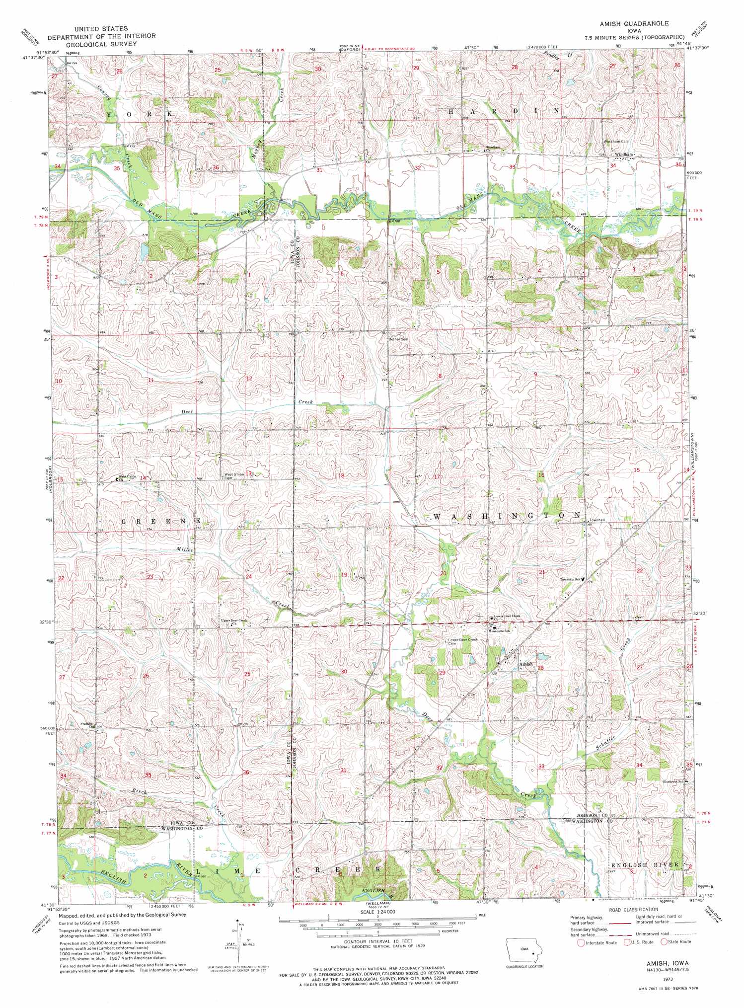
USGS Topo Quad 41091e7 - 1:24,000 scale
| Topo Map Name: | Amish |
| USGS Topo Quad ID: | 41091e7 |
| Print Size: | ca. 21 1/4" wide x 27" high |
| Southeast Coordinates: | 41.5° N latitude / 91.75° W longitude |
| Map Center Coordinates: | 41.5625° N latitude / 91.8125° W longitude |
| U.S. State: | IA |
| Filename: | o41091e7.jpg |
| Download Map JPG Image: | Amish topo map 1:24,000 scale |
| Map Type: | Topographic |
| Topo Series: | 7.5´ |
| Map Scale: | 1:24,000 |
| Source of Map Images: | United States Geological Survey (USGS) |
| Alternate Map Versions: |
Amish IA 1973, updated 1975 Download PDF Buy paper map Amish IA 2010 Download PDF Buy paper map Amish IA 2013 Download PDF Buy paper map Amish IA 2015 Download PDF Buy paper map |
1:24,000 Topo Quads surrounding Amish
Marengo |
Middle Amana |
Amana |
Swisher |
Ely |
Williamsburg |
Conroy |
Oxford |
Tiffin |
Iowa City West |
North English |
Holbrook |
Amish |
Williamstown |
Hills |
South English |
Kinross |
Wellman |
Kalona |
Riverside |
Harper |
Keota |
West Chester |
Washington |
Ainsworth |
> Back to 41091e1 at 1:100,000 scale
> Back to 41090a1 at 1:250,000 scale
> Back to U.S. Topo Maps home
Amish topo map: Gazetteer
Amish: Populated Places
Amish elevation 231m 757′Windham elevation 216m 708′
Amish: Post Offices
Amish Post Office (historical) elevation 231m 757′Frendale Post Office (historical) elevation 223m 731′
Windham Post Office (historical) elevation 216m 708′
Amish: Streams
Convey Creek elevation 216m 708′Miller Creek elevation 210m 688′
Mooney Creek elevation 213m 698′
Schaffer Creek elevation 204m 669′
Amish digital topo map on disk
Buy this Amish topo map showing relief, roads, GPS coordinates and other geographical features, as a high-resolution digital map file on DVD: