Tiffin Topo Map Iowa
To zoom in, hover over the map of Tiffin
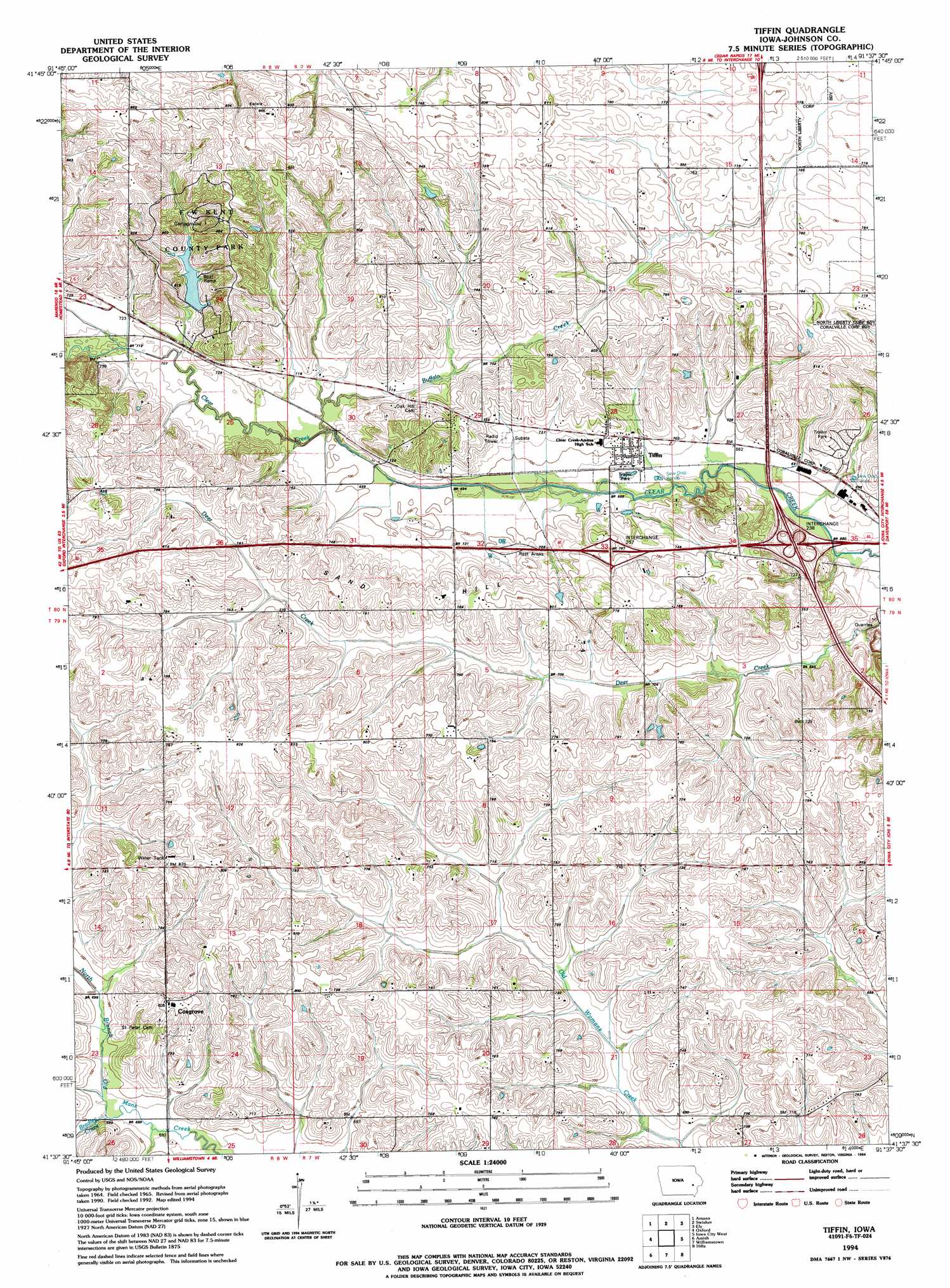
USGS Topo Quad 41091f6 - 1:24,000 scale
| Topo Map Name: | Tiffin |
| USGS Topo Quad ID: | 41091f6 |
| Print Size: | ca. 21 1/4" wide x 27" high |
| Southeast Coordinates: | 41.625° N latitude / 91.625° W longitude |
| Map Center Coordinates: | 41.6875° N latitude / 91.6875° W longitude |
| U.S. State: | IA |
| Filename: | o41091f6.jpg |
| Download Map JPG Image: | Tiffin topo map 1:24,000 scale |
| Map Type: | Topographic |
| Topo Series: | 7.5´ |
| Map Scale: | 1:24,000 |
| Source of Map Images: | United States Geological Survey (USGS) |
| Alternate Map Versions: |
Tiffin IA 1965, updated 1967 Download PDF Buy paper map Tiffin IA 1965, updated 1983 Download PDF Buy paper map Tiffin IA 1994, updated 1994 Download PDF Buy paper map Tiffin IA 2010 Download PDF Buy paper map Tiffin IA 2013 Download PDF Buy paper map Tiffin IA 2015 Download PDF Buy paper map |
1:24,000 Topo Quads surrounding Tiffin
Newhall |
Fairfax |
Cedar Rapids South |
Bertram |
Mount Vernon |
Middle Amana |
Amana |
Swisher |
Ely |
Solon |
Conroy |
Oxford |
Tiffin |
Iowa City West |
Iowa City East |
Holbrook |
Amish |
Williamstown |
Hills |
West Liberty Sw |
Kinross |
Wellman |
Kalona |
Riverside |
Lone Tree |
> Back to 41091e1 at 1:100,000 scale
> Back to 41090a1 at 1:250,000 scale
> Back to U.S. Topo Maps home
Tiffin topo map: Gazetteer
Tiffin: Crossings
Interchange 237 elevation 230m 754′Interchange 238 elevation 218m 715′
Tiffin: Parks
F W Kent County Park elevation 229m 751′Historic Amana Colonies State Historical Marker elevation 215m 705′
Historic Iowa City State Historical Marker elevation 220m 721′
Hoover Historic Site State Historical Marker elevation 220m 721′
Tiffin: Populated Places
Clear Creek Mobile Home Park elevation 207m 679′Cosgrove elevation 245m 803′
Tiffin elevation 215m 705′
Western Hills Mobine Estates elevation 220m 721′
Tiffin: Post Offices
Copi Post Office (historical) elevation 234m 767′Cosgrove Post Office (historical) elevation 245m 803′
Tiffin Post Office elevation 218m 715′
Unity Post Office (historical) elevation 221m 725′
Tiffin: Reservoirs
Coralville Lake elevation 236m 774′Tiffin: Streams
Bradley Creek elevation 210m 688′Buffalo Creek elevation 211m 692′
Tiffin: Summits
Sand Hill elevation 244m 800′Tiffin digital topo map on disk
Buy this Tiffin topo map showing relief, roads, GPS coordinates and other geographical features, as a high-resolution digital map file on DVD: