Middle Amana Topo Map Iowa
To zoom in, hover over the map of Middle Amana
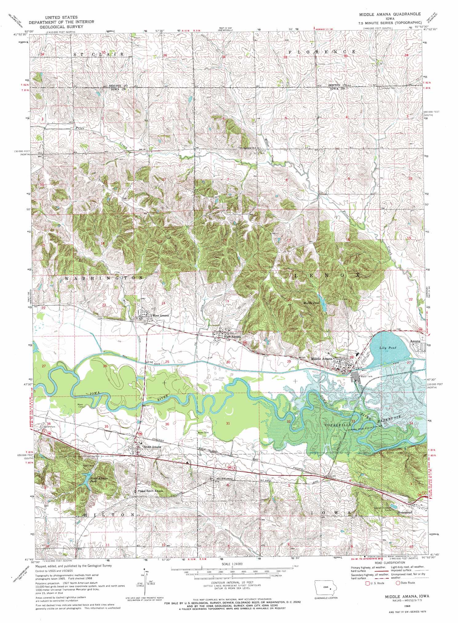
USGS Topo Quad 41091g8 - 1:24,000 scale
| Topo Map Name: | Middle Amana |
| USGS Topo Quad ID: | 41091g8 |
| Print Size: | ca. 21 1/4" wide x 27" high |
| Southeast Coordinates: | 41.75° N latitude / 91.875° W longitude |
| Map Center Coordinates: | 41.8125° N latitude / 91.9375° W longitude |
| U.S. State: | IA |
| Filename: | o41091g8.jpg |
| Download Map JPG Image: | Middle Amana topo map 1:24,000 scale |
| Map Type: | Topographic |
| Topo Series: | 7.5´ |
| Map Scale: | 1:24,000 |
| Source of Map Images: | United States Geological Survey (USGS) |
| Alternate Map Versions: |
Middle Amana IA 1968, updated 1971 Download PDF Buy paper map Middle Amana IA 2010 Download PDF Buy paper map Middle Amana IA 2013 Download PDF Buy paper map Middle Amana IA 2015 Download PDF Buy paper map |
1:24,000 Topo Quads surrounding Middle Amana
Keystone North |
Van Horne |
Center Point Sw |
Shellsburg |
Cedar Rapids North |
Keystone South |
Blairstown |
Newhall |
Fairfax |
Cedar Rapids South |
Ladora |
Marengo |
Middle Amana |
Amana |
Swisher |
Williamsburg Nw |
Williamsburg |
Conroy |
Oxford |
Tiffin |
Millersburg |
North English |
Holbrook |
Amish |
Williamstown |
> Back to 41091e1 at 1:100,000 scale
> Back to 41090a1 at 1:250,000 scale
> Back to U.S. Topo Maps home
Middle Amana topo map: Gazetteer
Middle Amana: Canals
Mill Race elevation 220m 721′Middle Amana: Lakes
Lily Pond elevation 218m 715′Middle Pond elevation 233m 764′
South Amana Pond elevation 246m 807′
Middle Amana: Populated Places
High Amana elevation 234m 767′Middle Amana elevation 226m 741′
South Amana elevation 237m 777′
Upper South Amana elevation 268m 879′
West Amana elevation 237m 777′
Middle Amana: Post Offices
Amana Post Office elevation 224m 734′High Post Office (historical) elevation 230m 754′
Linwood Post Office (historical) elevation 252m 826′
Middle Amana Post Office elevation 229m 751′
South Amana Post Office elevation 235m 770′
West Post Office elevation 237m 777′
Middle Amana: Streams
Willow Creek elevation 229m 751′Middle Amana digital topo map on disk
Buy this Middle Amana topo map showing relief, roads, GPS coordinates and other geographical features, as a high-resolution digital map file on DVD: