Clarence Topo Map Iowa
To zoom in, hover over the map of Clarence
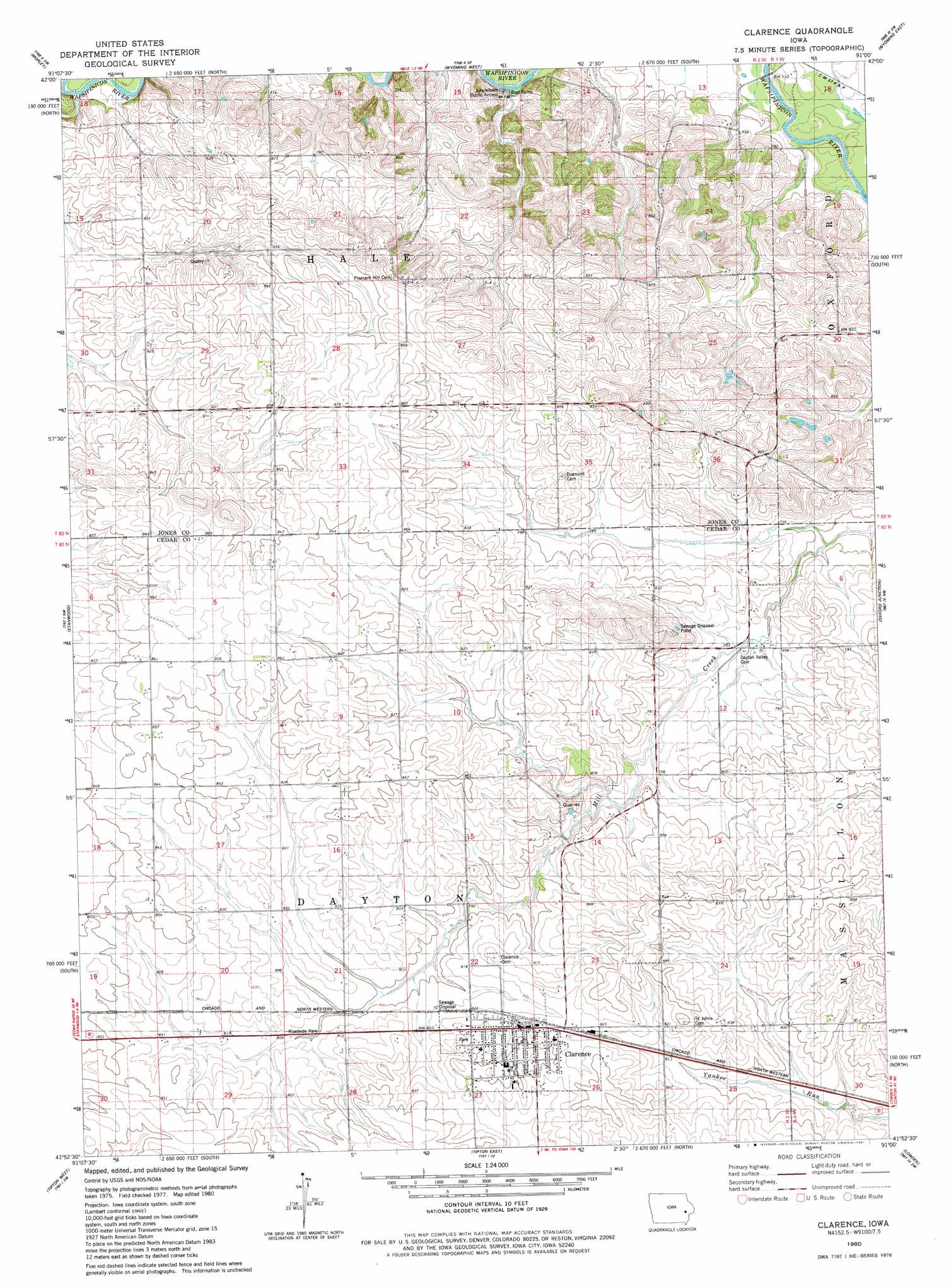
USGS Topo Quad 41091h1 - 1:24,000 scale
| Topo Map Name: | Clarence |
| USGS Topo Quad ID: | 41091h1 |
| Print Size: | ca. 21 1/4" wide x 27" high |
| Southeast Coordinates: | 41.875° N latitude / 91° W longitude |
| Map Center Coordinates: | 41.9375° N latitude / 91.0625° W longitude |
| U.S. State: | IA |
| Filename: | o41091h1.jpg |
| Download Map JPG Image: | Clarence topo map 1:24,000 scale |
| Map Type: | Topographic |
| Topo Series: | 7.5´ |
| Map Scale: | 1:24,000 |
| Source of Map Images: | United States Geological Survey (USGS) |
| Alternate Map Versions: |
Clarence IA 1980, updated 1981 Download PDF Buy paper map Clarence IA 2010 Download PDF Buy paper map Clarence IA 2013 Download PDF Buy paper map Clarence IA 2015 Download PDF Buy paper map |
1:24,000 Topo Quads surrounding Clarence
Anamosa Ne |
Monticello |
Scotch Grove |
Canton |
Leisure Lake |
Anamosa |
Morley |
Wyoming West |
Wyoming East |
Baldwin |
Mechanicsville |
Stanwood |
Clarence |
Oxford Junction |
Lost Nation |
Cedar Bluff |
Tipton West |
Tipton East |
Lowden |
Wheatland |
West Branch |
Rochester |
Lime City |
Bennett |
Dixon |
> Back to 41091e1 at 1:100,000 scale
> Back to 41090a1 at 1:250,000 scale
> Back to U.S. Topo Maps home
Clarence topo map: Gazetteer
Clarence: Bridges
Mill Creek Bridge elevation 237m 777′Clarence: Parks
Clarence Community Park elevation 253m 830′Clarence: Populated Places
Clarence elevation 255m 836′Clarence: Post Offices
Cedar Post Office (historical) elevation 241m 790′Clarence Post Office elevation 259m 849′
Clarence digital topo map on disk
Buy this Clarence topo map showing relief, roads, GPS coordinates and other geographical features, as a high-resolution digital map file on DVD: