Fairfax Topo Map Iowa
To zoom in, hover over the map of Fairfax
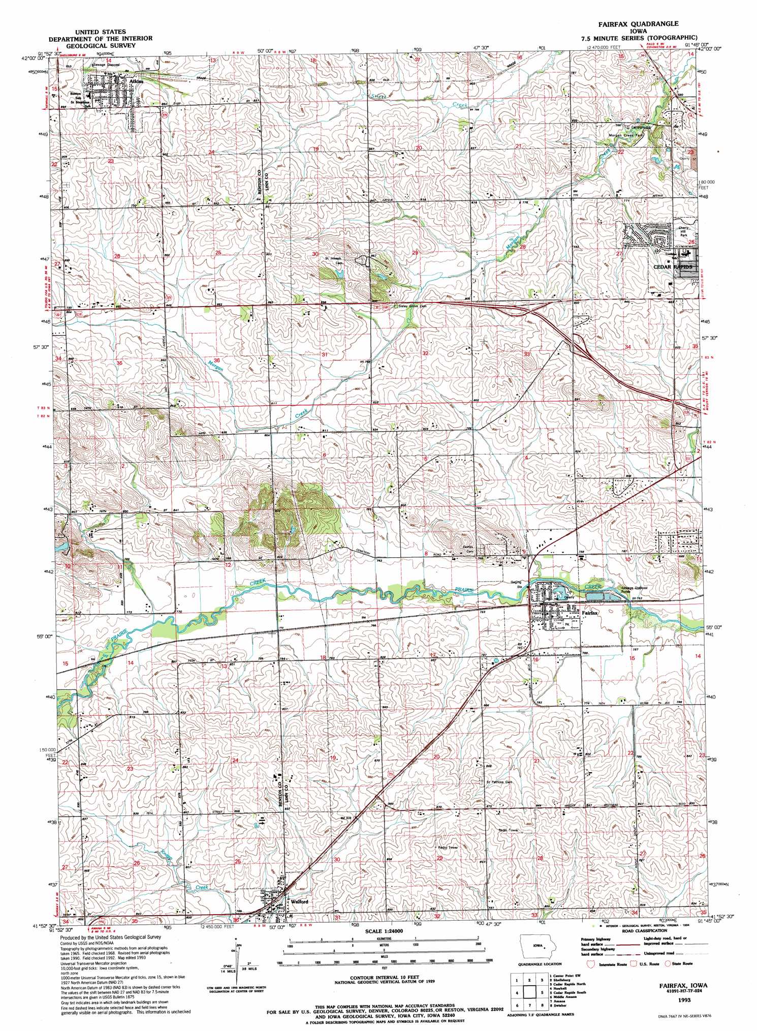
USGS Topo Quad 41091h7 - 1:24,000 scale
| Topo Map Name: | Fairfax |
| USGS Topo Quad ID: | 41091h7 |
| Print Size: | ca. 21 1/4" wide x 27" high |
| Southeast Coordinates: | 41.875° N latitude / 91.75° W longitude |
| Map Center Coordinates: | 41.9375° N latitude / 91.8125° W longitude |
| U.S. State: | IA |
| Filename: | o41091h7.jpg |
| Download Map JPG Image: | Fairfax topo map 1:24,000 scale |
| Map Type: | Topographic |
| Topo Series: | 7.5´ |
| Map Scale: | 1:24,000 |
| Source of Map Images: | United States Geological Survey (USGS) |
| Alternate Map Versions: |
Fairfax IA 1968, updated 1971 Download PDF Buy paper map Fairfax IA 1968, updated 1983 Download PDF Buy paper map Fairfax IA 1993, updated 1994 Download PDF Buy paper map Fairfax IA 2010 Download PDF Buy paper map Fairfax IA 2013 Download PDF Buy paper map Fairfax IA 2015 Download PDF Buy paper map |
1:24,000 Topo Quads surrounding Fairfax
Vinton |
Center Point Nw |
Center Point |
Lafayette |
Central City |
Van Horne |
Center Point Sw |
Shellsburg |
Cedar Rapids North |
Marion |
Blairstown |
Newhall |
Fairfax |
Cedar Rapids South |
Bertram |
Marengo |
Middle Amana |
Amana |
Swisher |
Ely |
Williamsburg |
Conroy |
Oxford |
Tiffin |
Iowa City West |
> Back to 41091e1 at 1:100,000 scale
> Back to 41090a1 at 1:250,000 scale
> Back to U.S. Topo Maps home
Fairfax topo map: Gazetteer
Fairfax: Parks
Atkins Roundhouse Area elevation 269m 882′Cherry Hill Park elevation 253m 830′
Morgan Creek Park elevation 226m 741′
Fairfax: Populated Places
Atkins elevation 260m 853′Country Aire Home Park elevation 259m 849′
Fairfax elevation 236m 774′
Walford elevation 245m 803′
Fairfax: Post Offices
Atkins Post Office elevation 262m 859′Fairfax Post Office elevation 235m 770′
Robin Post Office (historical) elevation 268m 879′
Sisley's Grove Post Office (historical) elevation 241m 790′
Walford Post Office elevation 245m 803′
Fairfax digital topo map on disk
Buy this Fairfax topo map showing relief, roads, GPS coordinates and other geographical features, as a high-resolution digital map file on DVD: