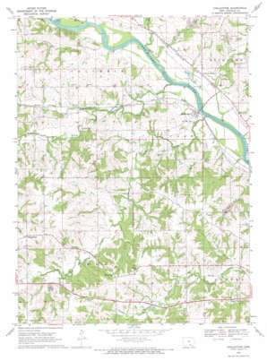
Chillicothe Topo Map Iowa
To zoom in, hover over the map of Chillicothe
USGS Topo Quad 41092a5 - 1:24,000 scale
| Topo Map Name: | Chillicothe |
| USGS Topo Quad ID: | 41092a5 |
| Print Size: | ca. 21 1/4" wide x 27" high |
| Southeast Coordinates: | 41° N latitude / 92.5° W longitude |
| Map Center Coordinates: | 41.0625° N latitude / 92.5625° W longitude |
| U.S. State: | IA |
| Filename: | o41092a5.jpg |
| Download Map JPG Image: | Chillicothe topo map 1:24,000 scale |
| Map Type: | Topographic |
| Topo Series: | 7.5´ |
| Map Scale: | 1:24,000 |
| Source of Map Images: | United States Geological Survey (USGS) |
| Alternate Map Versions: |
Chillicothe IA 1968, updated 1971 Download PDF Buy paper map Chillicothe IA 2010 Download PDF Buy paper map Chillicothe IA 2013 Download PDF Buy paper map Chillicothe IA 2015 Download PDF Buy paper map |
1:24,000 Topo Quads surrounding Chillicothe
> Back to 41092a1 at 1:100,000 scale
> Back to 41092a1 at 1:250,000 scale
> Back to U.S. Topo Maps home
Chillicothe topo map: Gazetteer
Chillicothe: Parks
McNeese Wildlife Area elevation 197m 646′West Gate Rest Area elevation 213m 698′
Chillicothe: Populated Places
Bidwell elevation 217m 711′Chillicothe elevation 209m 685′
Dudley elevation 209m 685′
Munterville elevation 265m 869′
Willard elevation 245m 803′
Chillicothe: Post Offices
Bidwell Post Office (historical) elevation 217m 711′Chillicothe Post Office elevation 209m 685′
Christiansburgh Post Office (historical) elevation 264m 866′
Comstock Post Office (historical) elevation 202m 662′
Dudley Post Office (historical) elevation 198m 649′
Fountain Springs Post Office (historical) elevation 211m 692′
Happy Hollow Post Office (historical) elevation 205m 672′
Munterville Post Office (historical) elevation 263m 862′
Shocks Post Office (historical) elevation 193m 633′
Willard Post Office (historical) elevation 245m 803′
Chillicothe: Streams
Brown Creek elevation 197m 646′Comstock Creek elevation 194m 636′
Fudge Creek elevation 195m 639′
Middle Avery Creek elevation 194m 636′
North Avery Creek elevation 199m 652′
Palestine Creek elevation 195m 639′
South Avery Creek elevation 194m 636′
Chillicothe digital topo map on disk
Buy this Chillicothe topo map showing relief, roads, GPS coordinates and other geographical features, as a high-resolution digital map file on DVD:


