Delta Topo Map Iowa
To zoom in, hover over the map of Delta
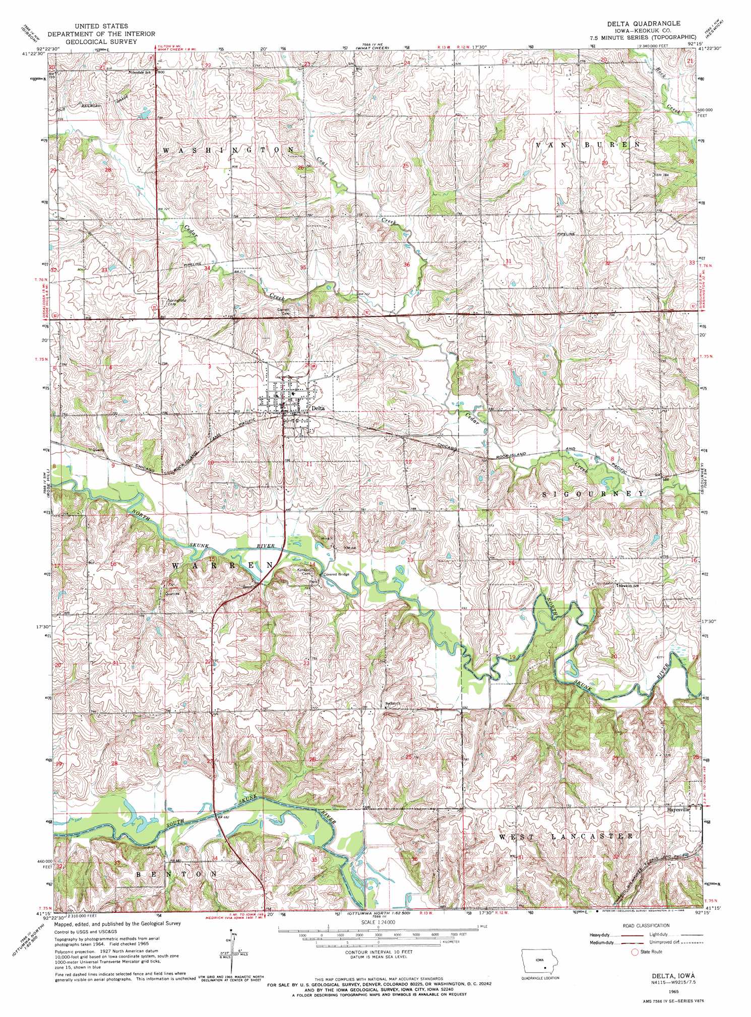
USGS Topo Quad 41092c3 - 1:24,000 scale
| Topo Map Name: | Delta |
| USGS Topo Quad ID: | 41092c3 |
| Print Size: | ca. 21 1/4" wide x 27" high |
| Southeast Coordinates: | 41.25° N latitude / 92.25° W longitude |
| Map Center Coordinates: | 41.3125° N latitude / 92.3125° W longitude |
| U.S. State: | IA |
| Filename: | o41092c3.jpg |
| Download Map JPG Image: | Delta topo map 1:24,000 scale |
| Map Type: | Topographic |
| Topo Series: | 7.5´ |
| Map Scale: | 1:24,000 |
| Source of Map Images: | United States Geological Survey (USGS) |
| Alternate Map Versions: |
Delta IA 1965, updated 1966 Download PDF Buy paper map Delta IA 2010 Download PDF Buy paper map Delta IA 2013 Download PDF Buy paper map Delta IA 2015 Download PDF Buy paper map |
1:24,000 Topo Quads surrounding Delta
Montezuma |
Barnes City |
Deep River |
Millersburg |
North English |
Union Mills |
Gibson |
What Cheer |
Keswick |
South English |
University Park |
Rose Hill |
Delta |
Sigourney |
Harper |
Kirkville |
Fremont |
Hedrick |
Pekin |
Ollie |
Chillicothe |
Ottumwa North |
Farson |
Abingdon |
Brookville |
> Back to 41092a1 at 1:100,000 scale
> Back to 41092a1 at 1:250,000 scale
> Back to U.S. Topo Maps home
Delta topo map: Gazetteer
Delta: Bridges
Delta Covered Bridge elevation 207m 679′Delta: Populated Places
Delta elevation 244m 800′Delta: Post Offices
Delta Post Office elevation 244m 800′Divide Post Office (historical) elevation 245m 803′
Slagle Post Office (historical) elevation 237m 777′
Springfield Post Office (historical) elevation 237m 777′
Delta: Streams
Coal Creek elevation 210m 688′Delta digital topo map on disk
Buy this Delta topo map showing relief, roads, GPS coordinates and other geographical features, as a high-resolution digital map file on DVD: