University Park Topo Map Iowa
To zoom in, hover over the map of University Park
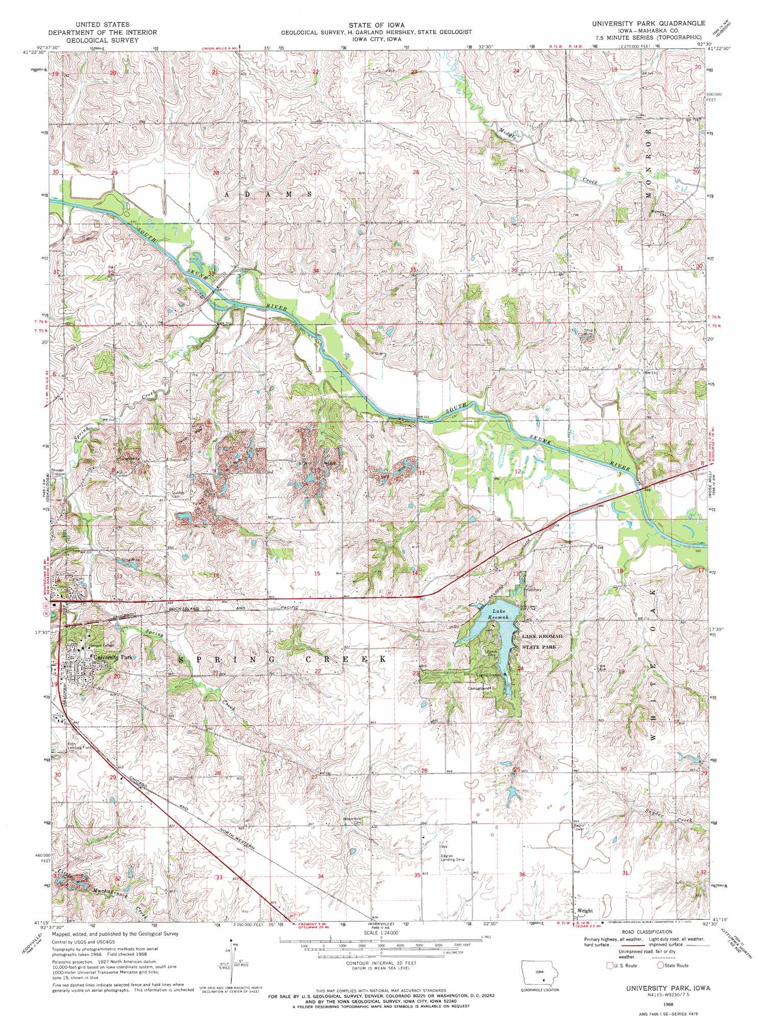
USGS Topo Quad 41092c5 - 1:24,000 scale
| Topo Map Name: | University Park |
| USGS Topo Quad ID: | 41092c5 |
| Print Size: | ca. 21 1/4" wide x 27" high |
| Southeast Coordinates: | 41.25° N latitude / 92.5° W longitude |
| Map Center Coordinates: | 41.3125° N latitude / 92.5625° W longitude |
| U.S. State: | IA |
| Filename: | o41092c5.jpg |
| Download Map JPG Image: | University Park topo map 1:24,000 scale |
| Map Type: | Topographic |
| Topo Series: | 7.5´ |
| Map Scale: | 1:24,000 |
| Source of Map Images: | United States Geological Survey (USGS) |
| Alternate Map Versions: |
University Park IA 1968, updated 1970 Download PDF Buy paper map University Park IA 2010 Download PDF Buy paper map University Park IA 2013 Download PDF Buy paper map University Park IA 2015 Download PDF Buy paper map |
1:24,000 Topo Quads surrounding University Park
Sully |
Searsboro |
Montezuma |
Barnes City |
Deep River |
Peoria |
New Sharon |
Union Mills |
Gibson |
What Cheer |
Leighton |
Oskaloosa |
University Park |
Rose Hill |
Delta |
Buxton |
Eddyville |
Kirkville |
Fremont |
Hedrick |
Albia |
Avery |
Chillicothe |
Ottumwa North |
Farson |
> Back to 41092a1 at 1:100,000 scale
> Back to 41092a1 at 1:250,000 scale
> Back to U.S. Topo Maps home
University Park topo map: Gazetteer
University Park: Airports
Edgren Airport elevation 255m 836′University Park: Dams
Keomah Dam elevation 221m 725′University Park: Parks
First Mahaska County Schoolhouse Historical Marker elevation 251m 823′Lake Keomah State Park elevation 241m 790′
Maskunky Marsh elevation 210m 688′
University Park: Populated Places
Exeelsior elevation 256m 839′Keomah Village elevation 240m 787′
University Park elevation 249m 816′
University Park: Post Offices
Blythe Post Office (historical) elevation 226m 741′Carbondale Post Office (historical) elevation 230m 754′
Comet Post Office (historical) elevation 241m 790′
Gainford Post Office (historical) elevation 257m 843′
University Park Post Office elevation 249m 816′
University Park: Reservoirs
Lake Keomah elevation 223m 731′University Park: Streams
Spring Creek elevation 210m 688′University Park digital topo map on disk
Buy this University Park topo map showing relief, roads, GPS coordinates and other geographical features, as a high-resolution digital map file on DVD: