Leighton Topo Map Iowa
To zoom in, hover over the map of Leighton
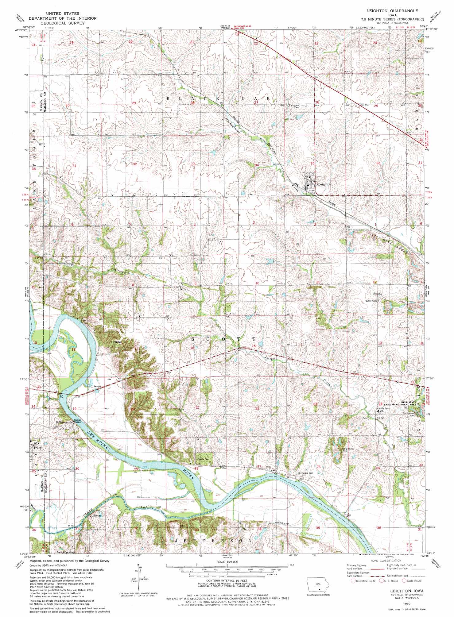
USGS Topo Quad 41092c7 - 1:24,000 scale
| Topo Map Name: | Leighton |
| USGS Topo Quad ID: | 41092c7 |
| Print Size: | ca. 21 1/4" wide x 27" high |
| Southeast Coordinates: | 41.25° N latitude / 92.75° W longitude |
| Map Center Coordinates: | 41.3125° N latitude / 92.8125° W longitude |
| U.S. State: | IA |
| Filename: | o41092c7.jpg |
| Download Map JPG Image: | Leighton topo map 1:24,000 scale |
| Map Type: | Topographic |
| Topo Series: | 7.5´ |
| Map Scale: | 1:24,000 |
| Source of Map Images: | United States Geological Survey (USGS) |
| Alternate Map Versions: |
Leighton IA 1980, updated 1980 Download PDF Buy paper map Leighton IA 2010 Download PDF Buy paper map Leighton IA 2013 Download PDF Buy paper map Leighton IA 2015 Download PDF Buy paper map |
1:24,000 Topo Quads surrounding Leighton
Monroe |
Killduff |
Sully |
Searsboro |
Montezuma |
Otley |
Pella |
Peoria |
New Sharon |
Union Mills |
Knoxville |
Harvey |
Leighton |
Oskaloosa |
University Park |
Attica |
Lovilia |
Buxton |
Eddyville |
Kirkville |
Wales |
Hiteman |
Albia |
Avery |
Chillicothe |
> Back to 41092a1 at 1:100,000 scale
> Back to 41092a1 at 1:250,000 scale
> Back to U.S. Topo Maps home
Leighton topo map: Gazetteer
Leighton: Bridges
Bellefountain Bridge elevation 205m 672′Leighton: Parks
Cedar Bluffs Natural Area elevation 231m 757′Hull State Game Management Area elevation 228m 748′
Leighton: Populated Places
Bellefountain elevation 223m 731′Leighton elevation 236m 774′
Olivet elevation 244m 800′
Leighton: Post Offices
Auburn Post Office (historical) elevation 212m 695′Belle Fountain Post Office (historical) elevation 223m 731′
Leighton Post Office elevation 236m 774′
Olivet Post Office (historical) elevation 244m 800′
Leighton: Streams
Cedar Creek elevation 205m 672′Walnut Creek elevation 209m 685′
Leighton digital topo map on disk
Buy this Leighton topo map showing relief, roads, GPS coordinates and other geographical features, as a high-resolution digital map file on DVD: