Peoria Topo Map Iowa
To zoom in, hover over the map of Peoria
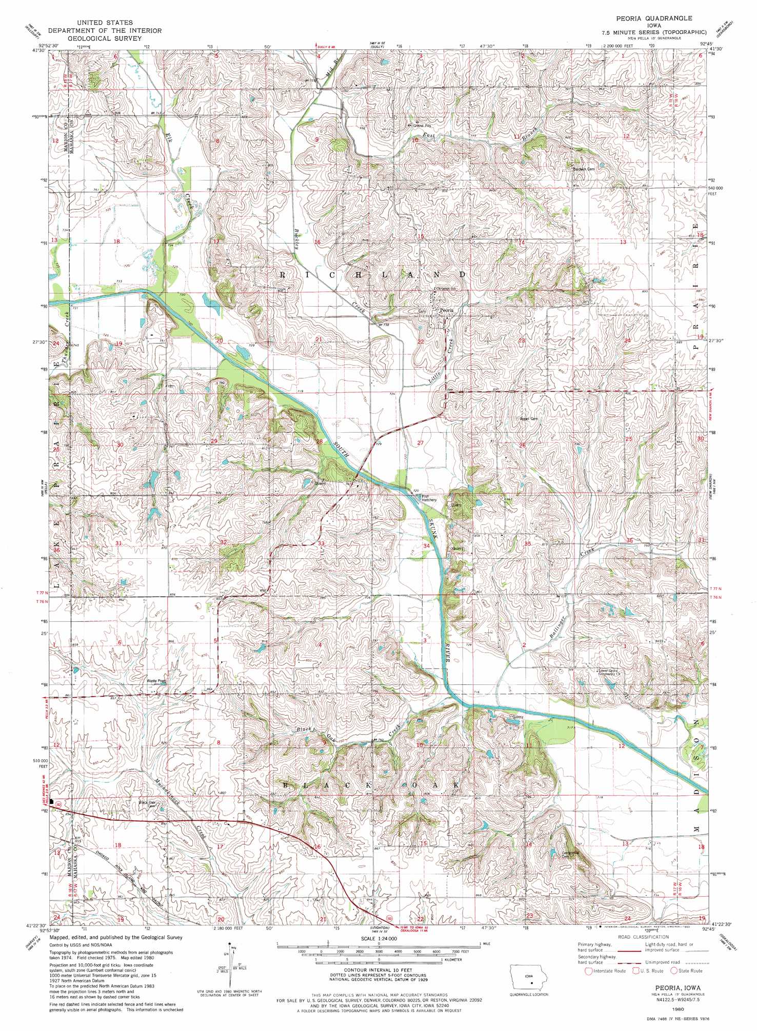
USGS Topo Quad 41092d7 - 1:24,000 scale
| Topo Map Name: | Peoria |
| USGS Topo Quad ID: | 41092d7 |
| Print Size: | ca. 21 1/4" wide x 27" high |
| Southeast Coordinates: | 41.375° N latitude / 92.75° W longitude |
| Map Center Coordinates: | 41.4375° N latitude / 92.8125° W longitude |
| U.S. State: | IA |
| Filename: | o41092d7.jpg |
| Download Map JPG Image: | Peoria topo map 1:24,000 scale |
| Map Type: | Topographic |
| Topo Series: | 7.5´ |
| Map Scale: | 1:24,000 |
| Source of Map Images: | United States Geological Survey (USGS) |
| Alternate Map Versions: |
Peoria IA 1980, updated 1980 Download PDF Buy paper map Peoria IA 2010 Download PDF Buy paper map Peoria IA 2013 Download PDF Buy paper map Peoria IA 2015 Download PDF Buy paper map |
1:24,000 Topo Quads surrounding Peoria
Newton |
Kellogg |
Oakland Acres |
Grinnell South |
Malcom |
Monroe |
Killduff |
Sully |
Searsboro |
Montezuma |
Otley |
Pella |
Peoria |
New Sharon |
Union Mills |
Knoxville |
Harvey |
Leighton |
Oskaloosa |
University Park |
Attica |
Lovilia |
Buxton |
Eddyville |
Kirkville |
> Back to 41092a1 at 1:100,000 scale
> Back to 41092a1 at 1:250,000 scale
> Back to U.S. Topo Maps home
Peoria topo map: Gazetteer
Peoria: Parks
Lower Grove Park elevation 218m 715′Peoria: Populated Places
Bernina elevation 230m 754′Granville (historical) elevation 251m 823′
Peoria elevation 239m 784′
Peoria: Post Offices
Bernina Post Office (historical) elevation 230m 754′Flint Post Office (historical) elevation 266m 872′
Peoria Post Office (historical) elevation 239m 784′
Peoria: Streams
Ballinger Creek elevation 217m 711′Black Oak Creek elevation 216m 708′
Buckley Creek elevation 217m 711′
East Branch Buckley Creek elevation 227m 744′
Elk Creek elevation 219m 718′
Middle Branch Buckley Creek elevation 229m 751′
Thunder Creek elevation 219m 718′
Peoria digital topo map on disk
Buy this Peoria topo map showing relief, roads, GPS coordinates and other geographical features, as a high-resolution digital map file on DVD: