North English Topo Map Iowa
To zoom in, hover over the map of North English
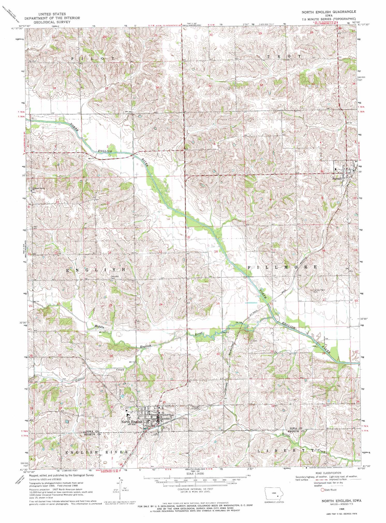
USGS Topo Quad 41092e1 - 1:24,000 scale
| Topo Map Name: | North English |
| USGS Topo Quad ID: | 41092e1 |
| Print Size: | ca. 21 1/4" wide x 27" high |
| Southeast Coordinates: | 41.5° N latitude / 92° W longitude |
| Map Center Coordinates: | 41.5625° N latitude / 92.0625° W longitude |
| U.S. State: | IA |
| Filename: | o41092e1.jpg |
| Download Map JPG Image: | North English topo map 1:24,000 scale |
| Map Type: | Topographic |
| Topo Series: | 7.5´ |
| Map Scale: | 1:24,000 |
| Source of Map Images: | United States Geological Survey (USGS) |
| Alternate Map Versions: |
North English IA 1968, updated 1970 Download PDF Buy paper map North English IA 2010 Download PDF Buy paper map North English IA 2013 Download PDF Buy paper map North English IA 2015 Download PDF Buy paper map |
1:24,000 Topo Quads surrounding North English
Hartwick |
Ladora |
Marengo |
Middle Amana |
Amana |
Victor |
Williamsburg Nw |
Williamsburg |
Conroy |
Oxford |
Deep River |
Millersburg |
North English |
Holbrook |
Amish |
What Cheer |
Keswick |
South English |
Kinross |
Wellman |
Delta |
Sigourney |
Harper |
Keota |
West Chester |
> Back to 41092e1 at 1:100,000 scale
> Back to 41092a1 at 1:250,000 scale
> Back to U.S. Topo Maps home
North English topo map: Gazetteer
North English: Populated Places
North English elevation 250m 820′Parnell elevation 263m 862′
North English: Post Offices
Carter Post Office (historical) elevation 217m 711′North English Post Office elevation 256m 839′
Parnell Post Office elevation 263m 862′
North English: Streams
Gritter Creek elevation 219m 718′Middle English River elevation 213m 698′
North English digital topo map on disk
Buy this North English topo map showing relief, roads, GPS coordinates and other geographical features, as a high-resolution digital map file on DVD: