Deep River Topo Map Iowa
To zoom in, hover over the map of Deep River
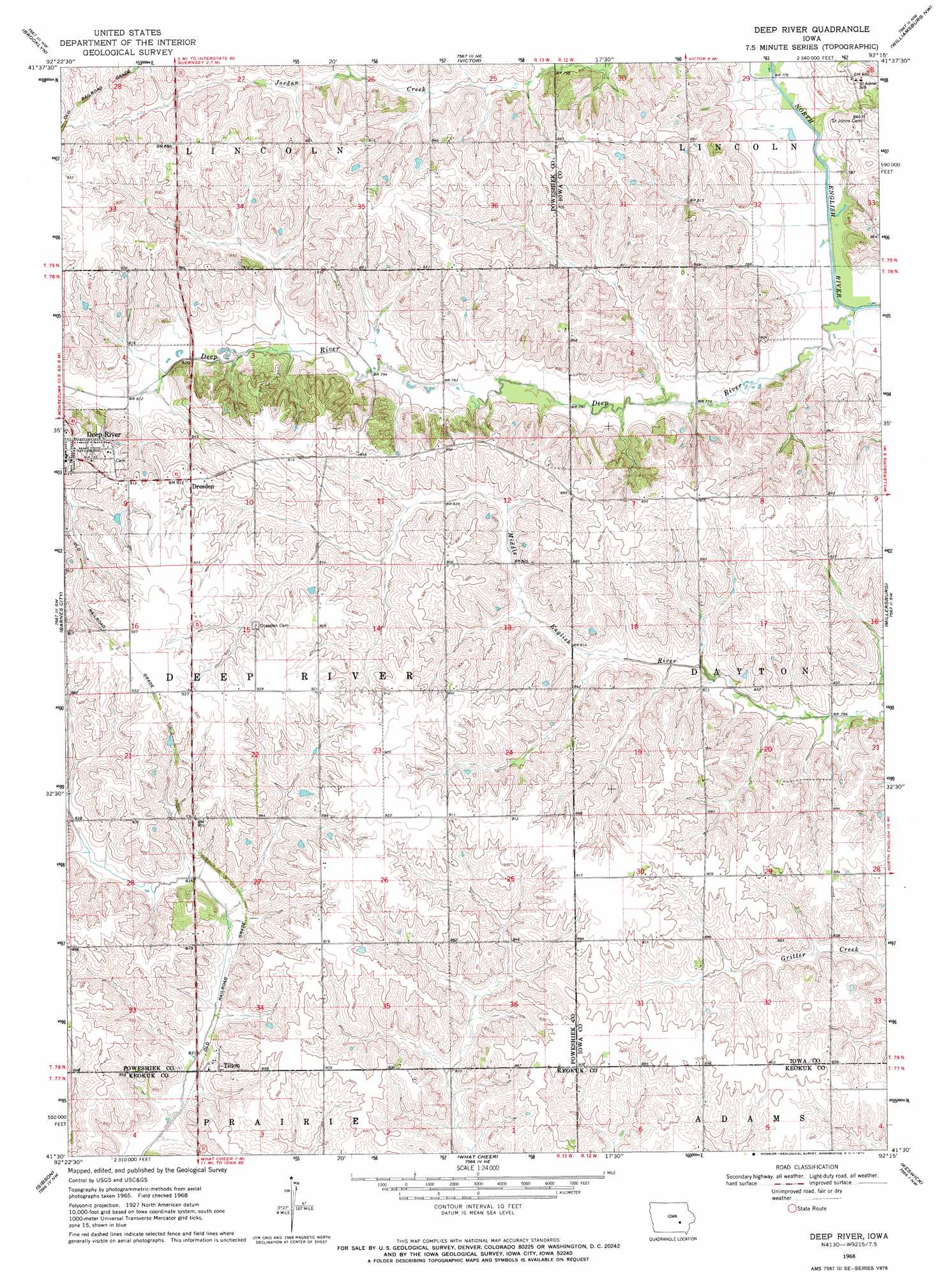
USGS Topo Quad 41092e3 - 1:24,000 scale
| Topo Map Name: | Deep River |
| USGS Topo Quad ID: | 41092e3 |
| Print Size: | ca. 21 1/4" wide x 27" high |
| Southeast Coordinates: | 41.5° N latitude / 92.25° W longitude |
| Map Center Coordinates: | 41.5625° N latitude / 92.3125° W longitude |
| U.S. State: | IA |
| Filename: | o41092e3.jpg |
| Download Map JPG Image: | Deep River topo map 1:24,000 scale |
| Map Type: | Topographic |
| Topo Series: | 7.5´ |
| Map Scale: | 1:24,000 |
| Source of Map Images: | United States Geological Survey (USGS) |
| Alternate Map Versions: |
Deep River IA 1968, updated 1970 Download PDF Buy paper map Deep River IA 2010 Download PDF Buy paper map Deep River IA 2013 Download PDF Buy paper map Deep River IA 2015 Download PDF Buy paper map |
1:24,000 Topo Quads surrounding Deep River
Sheridan |
Belle Plaine Sw |
Hartwick |
Ladora |
Marengo |
Malcom |
Brooklyn |
Victor |
Williamsburg Nw |
Williamsburg |
Montezuma |
Barnes City |
Deep River |
Millersburg |
North English |
Union Mills |
Gibson |
What Cheer |
Keswick |
South English |
University Park |
Rose Hill |
Delta |
Sigourney |
Harper |
> Back to 41092e1 at 1:100,000 scale
> Back to 41092a1 at 1:250,000 scale
> Back to U.S. Topo Maps home
Deep River topo map: Gazetteer
Deep River: Parks
Deep River Timber Reserve elevation 244m 800′Deep River: Populated Places
Deep River elevation 277m 908′Dresden elevation 278m 912′
Tilton elevation 258m 846′
Deep River: Post Offices
Deep River Post Office elevation 277m 908′Hedge Post Office (historical) elevation 269m 882′
Tilton Post Office (historical) elevation 258m 846′
Deep River: Streams
Deep River elevation 231m 757′Deep River digital topo map on disk
Buy this Deep River topo map showing relief, roads, GPS coordinates and other geographical features, as a high-resolution digital map file on DVD: