Sully Topo Map Iowa
To zoom in, hover over the map of Sully
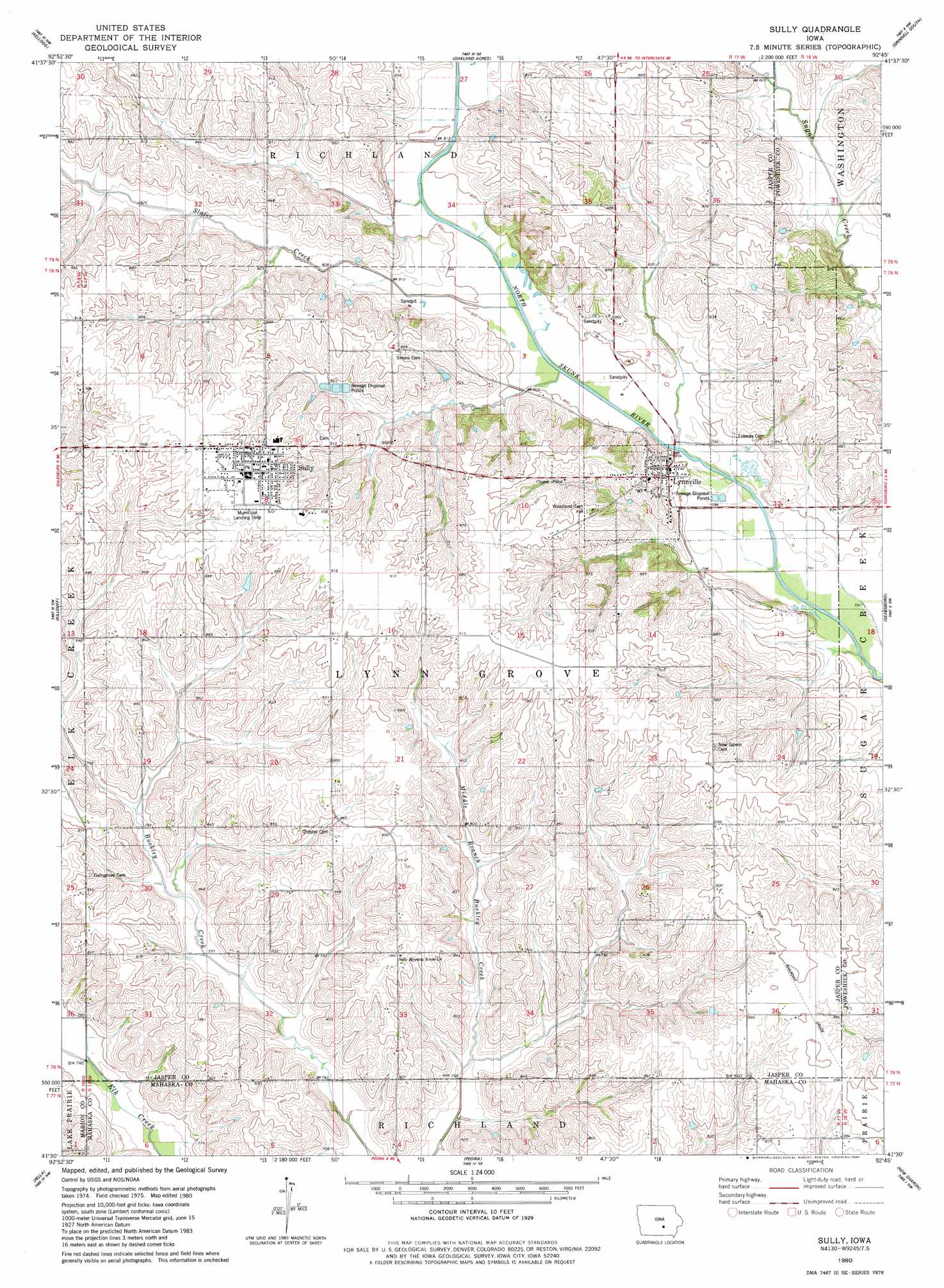
USGS Topo Quad 41092e7 - 1:24,000 scale
| Topo Map Name: | Sully |
| USGS Topo Quad ID: | 41092e7 |
| Print Size: | ca. 21 1/4" wide x 27" high |
| Southeast Coordinates: | 41.5° N latitude / 92.75° W longitude |
| Map Center Coordinates: | 41.5625° N latitude / 92.8125° W longitude |
| U.S. State: | IA |
| Filename: | o41092e7.jpg |
| Download Map JPG Image: | Sully topo map 1:24,000 scale |
| Map Type: | Topographic |
| Topo Series: | 7.5´ |
| Map Scale: | 1:24,000 |
| Source of Map Images: | United States Geological Survey (USGS) |
| Alternate Map Versions: |
Sully IA 1980, updated 1980 Download PDF Buy paper map Sully IA 2010 Download PDF Buy paper map Sully IA 2013 Download PDF Buy paper map Sully IA 2015 Download PDF Buy paper map |
1:24,000 Topo Quads surrounding Sully
Baxter Se |
Alloway Creek |
Newburg |
Grinnell North |
Sheridan |
Newton |
Kellogg |
Oakland Acres |
Grinnell South |
Malcom |
Monroe |
Killduff |
Sully |
Searsboro |
Montezuma |
Otley |
Pella |
Peoria |
New Sharon |
Union Mills |
Knoxville |
Harvey |
Leighton |
Oskaloosa |
University Park |
> Back to 41092e1 at 1:100,000 scale
> Back to 41092a1 at 1:250,000 scale
> Back to U.S. Topo Maps home
Sully topo map: Gazetteer
Sully: Airports
Sully Municipal Landing Strip elevation 280m 918′Sully: Populated Places
Lynnville elevation 253m 830′Sully elevation 280m 918′
Sully: Post Offices
Lynnville Post Office elevation 250m 820′Sugar Creek Post Office (historical) elevation 272m 892′
Sully Post Office elevation 280m 918′
Sully: Streams
Slater Creek elevation 241m 790′Sully digital topo map on disk
Buy this Sully topo map showing relief, roads, GPS coordinates and other geographical features, as a high-resolution digital map file on DVD: