Brooklyn Topo Map Iowa
To zoom in, hover over the map of Brooklyn
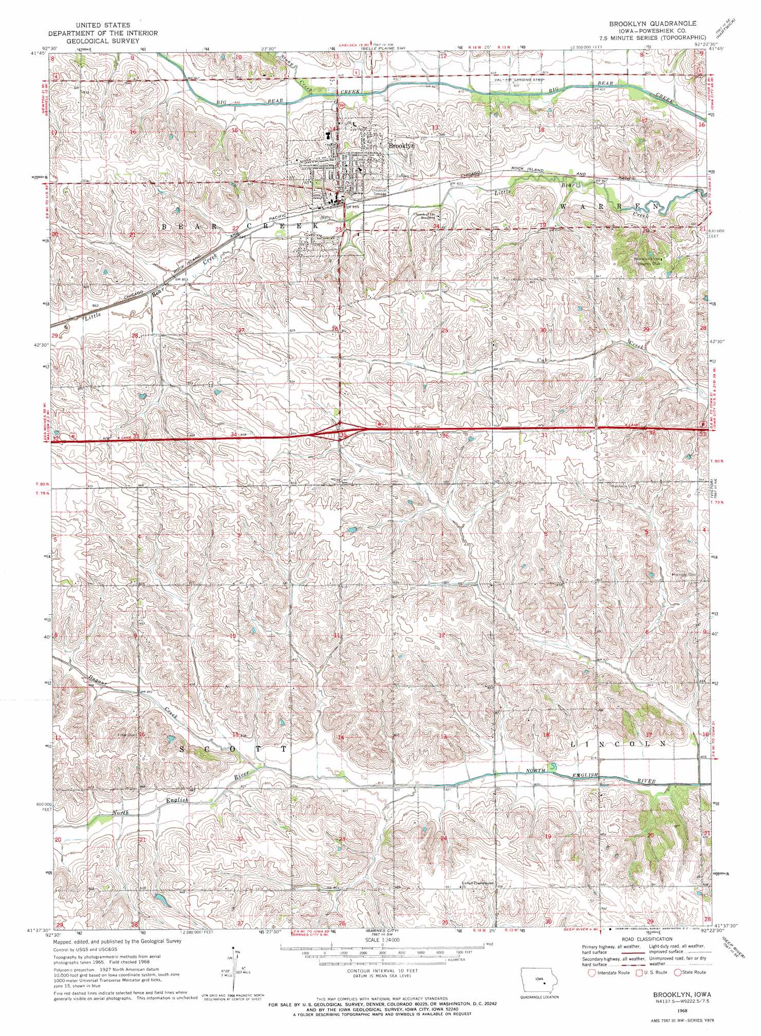
USGS Topo Quad 41092f4 - 1:24,000 scale
| Topo Map Name: | Brooklyn |
| USGS Topo Quad ID: | 41092f4 |
| Print Size: | ca. 21 1/4" wide x 27" high |
| Southeast Coordinates: | 41.625° N latitude / 92.375° W longitude |
| Map Center Coordinates: | 41.6875° N latitude / 92.4375° W longitude |
| U.S. State: | IA |
| Filename: | o41092f4.jpg |
| Download Map JPG Image: | Brooklyn topo map 1:24,000 scale |
| Map Type: | Topographic |
| Topo Series: | 7.5´ |
| Map Scale: | 1:24,000 |
| Source of Map Images: | United States Geological Survey (USGS) |
| Alternate Map Versions: |
Brooklyn IA 1968, updated 1970 Download PDF Buy paper map Brooklyn IA 2010 Download PDF Buy paper map Brooklyn IA 2013 Download PDF Buy paper map Brooklyn IA 2015 Download PDF Buy paper map |
1:24,000 Topo Quads surrounding Brooklyn
Montour |
Tama |
Chelsea |
Belle Plaine |
Keystone South |
Grinnell North |
Sheridan |
Belle Plaine Sw |
Hartwick |
Ladora |
Grinnell South |
Malcom |
Brooklyn |
Victor |
Williamsburg Nw |
Searsboro |
Montezuma |
Barnes City |
Deep River |
Millersburg |
New Sharon |
Union Mills |
Gibson |
What Cheer |
Keswick |
> Back to 41092e1 at 1:100,000 scale
> Back to 41092a1 at 1:250,000 scale
> Back to U.S. Topo Maps home
Brooklyn topo map: Gazetteer
Brooklyn: Airports
Val-Air Airport elevation 250m 820′Brooklyn: Crossings
Interchange 197 elevation 276m 905′Brooklyn: Populated Places
Brooklyn elevation 278m 912′Lone Pine Mobile Home Court elevation 272m 892′
Brooklyn: Post Offices
Brooklyn Post Office elevation 260m 853′Brooklyn Post Office (historical) elevation 259m 849′
East Brooklyn Post Office (historical) elevation 259m 849′
Brooklyn: Streams
Dugout Creek elevation 249m 816′Stony Creek elevation 250m 820′
Brooklyn digital topo map on disk
Buy this Brooklyn topo map showing relief, roads, GPS coordinates and other geographical features, as a high-resolution digital map file on DVD: