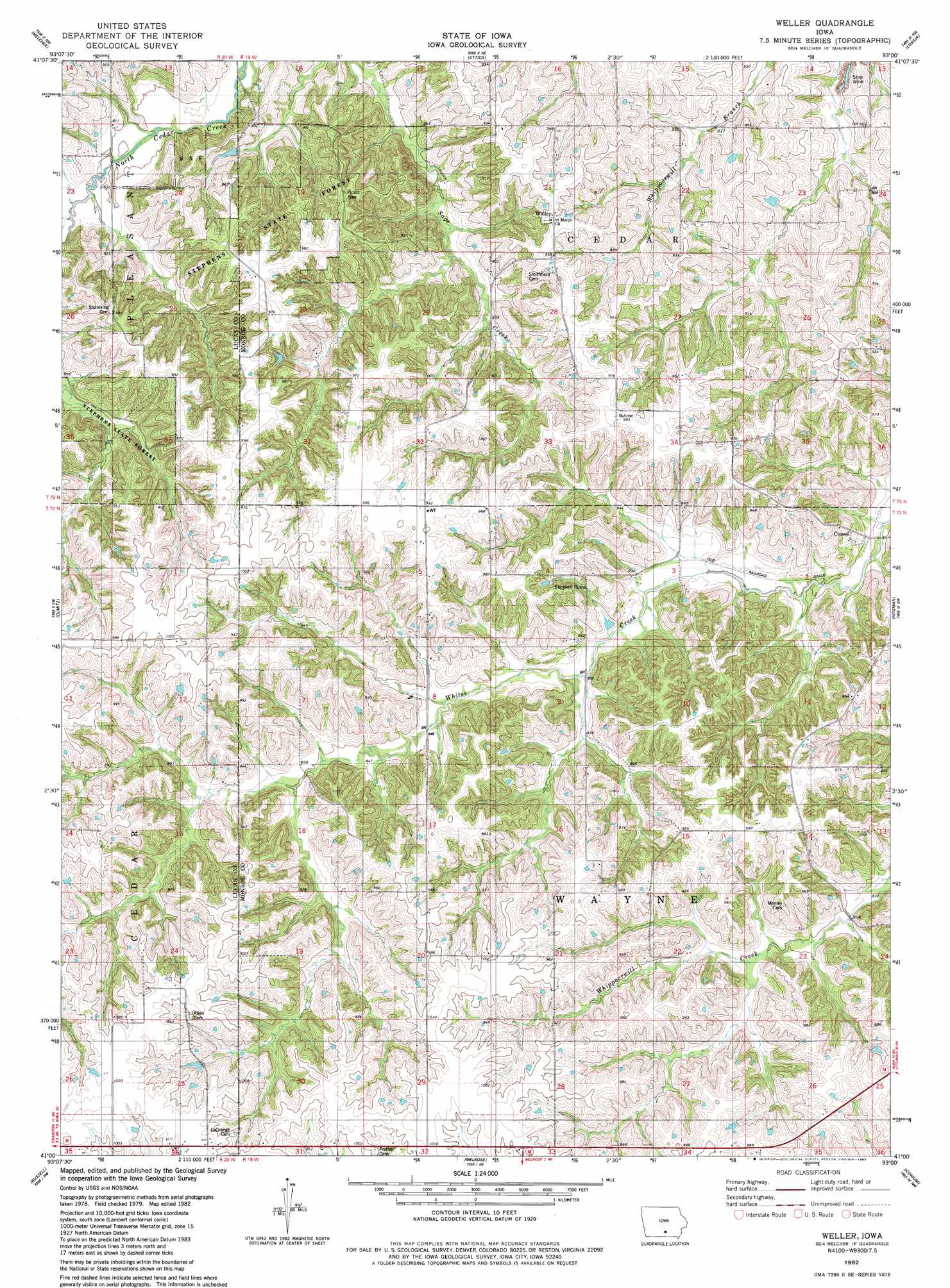
Wales Topo Map Iowa
To zoom in, hover over the map of Wales
USGS Topo Quad 41093a1 - 1:24,000 scale
| Topo Map Name: | Wales |
| USGS Topo Quad ID: | 41093a1 |
| Print Size: | ca. 21 1/4" wide x 27" high |
| Southeast Coordinates: | 41° N latitude / 93° W longitude |
| Map Center Coordinates: | 41.0625° N latitude / 93.0625° W longitude |
| U.S. State: | IA |
| Filename: | o41093a1.jpg |
| Download Map JPG Image: | Wales topo map 1:24,000 scale |
| Map Type: | Topographic |
| Topo Series: | 7.5´ |
| Map Scale: | 1:24,000 |
| Source of Map Images: | United States Geological Survey (USGS) |
| Alternate Map Versions: |
Weller IA 1982, updated 1983 Download PDF Buy paper map Weller IA 2010 Download PDF Buy paper map Weller IA 2013 Download PDF Buy paper map Weller IA 2015 Download PDF Buy paper map |
1:24,000 Topo Quads surrounding Wales
Beech |
Knoxville Sw |
Knoxville |
Harvey |
Leighton |
Newbern |
Melcher |
Attica |
Lovilia |
Buxton |
Chariton |
Olmitz |
Wales |
Hiteman |
Albia |
Corydon Ne |
Russell |
Melrose |
Iconium |
Moravia |
Corydon |
Confidence |
Plano |
Mystic |
Hiattsville |
> Back to 41093a1 at 1:100,000 scale
> Back to 41092a1 at 1:250,000 scale
> Back to U.S. Topo Maps home
Wales topo map: Gazetteer
Wales: Forests
Stephens State Forest - Thousand Acre Unit elevation 295m 967′Wales: Populated Places
Bucknell elevation 281m 921′Consol elevation 240m 787′
Weller elevation 292m 958′
Wales: Post Offices
Bucknell Post Office (historical) elevation 281m 921′Consol Post Office (historical) elevation 240m 787′
Haydock Post Office (historical) elevation 253m 830′
La Grange Post Office (historical) elevation 309m 1013′
Weller Post Office (historical) elevation 294m 964′
Wales digital topo map on disk
Buy this Wales topo map showing relief, roads, GPS coordinates and other geographical features, as a high-resolution digital map file on DVD: