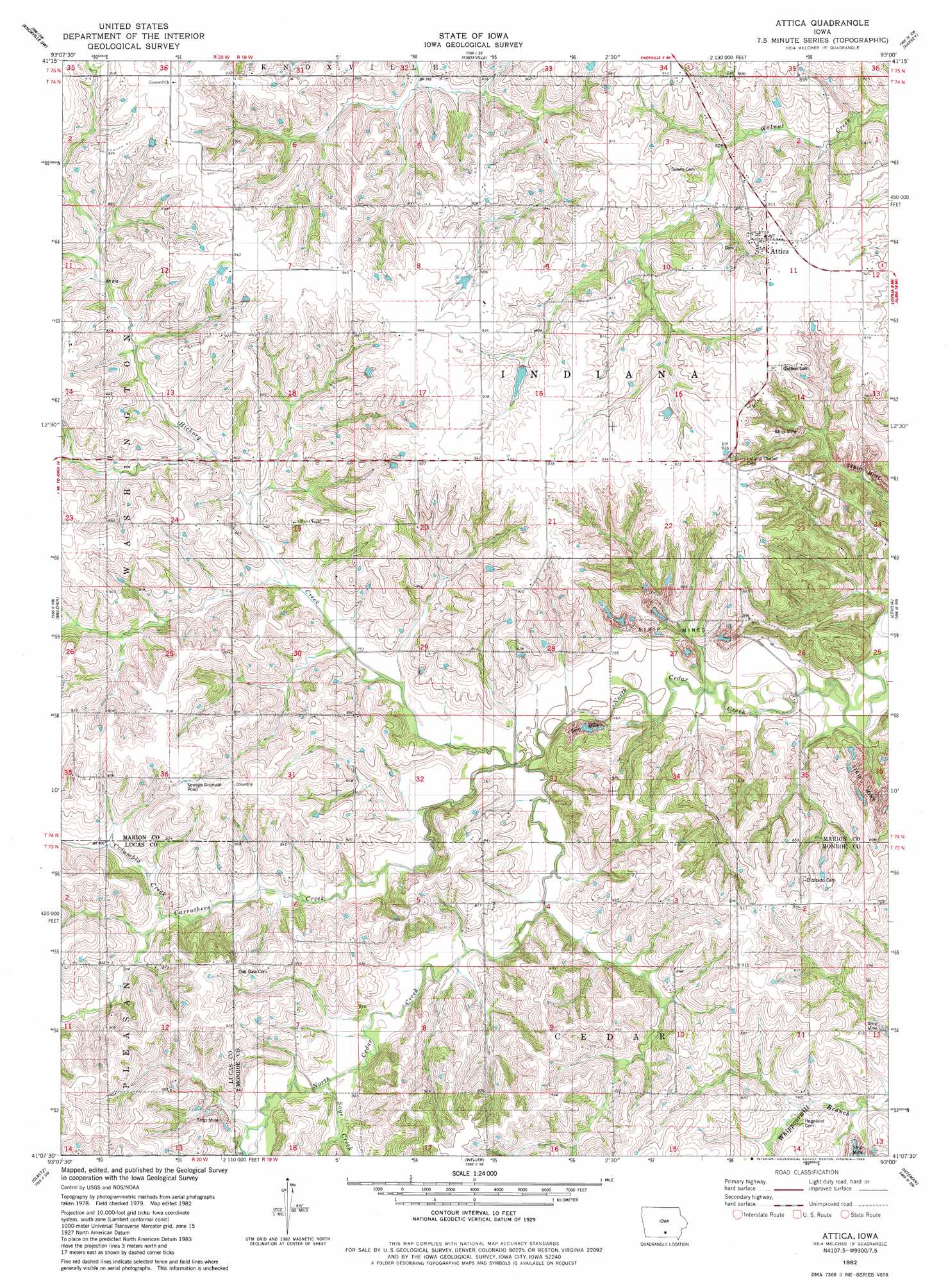
Attica Topo Map Iowa
To zoom in, hover over the map of Attica
USGS Topo Quad 41093b1 - 1:24,000 scale
| Topo Map Name: | Attica |
| USGS Topo Quad ID: | 41093b1 |
| Print Size: | ca. 21 1/4" wide x 27" high |
| Southeast Coordinates: | 41.125° N latitude / 93° W longitude |
| Map Center Coordinates: | 41.1875° N latitude / 93.0625° W longitude |
| U.S. State: | IA |
| Filename: | o41093b1.jpg |
| Download Map JPG Image: | Attica topo map 1:24,000 scale |
| Map Type: | Topographic |
| Topo Series: | 7.5´ |
| Map Scale: | 1:24,000 |
| Source of Map Images: | United States Geological Survey (USGS) |
| Alternate Map Versions: |
Attica IA 1982, updated 1983 Download PDF Buy paper map Attica IA 2010 Download PDF Buy paper map Attica IA 2013 Download PDF Buy paper map Attica IA 2015 Download PDF Buy paper map |
1:24,000 Topo Quads surrounding Attica
Pleasantville |
Knoxville Nw |
Otley |
Pella |
Peoria |
Beech |
Knoxville Sw |
Knoxville |
Harvey |
Leighton |
Newbern |
Melcher |
Attica |
Lovilia |
Buxton |
Chariton |
Olmitz |
Wales |
Hiteman |
Albia |
Corydon Ne |
Russell |
Melrose |
Iconium |
Moravia |
> Back to 41093a1 at 1:100,000 scale
> Back to 41092a1 at 1:250,000 scale
> Back to U.S. Topo Maps home
Attica topo map: Gazetteer
Attica: Bridges
Hammond Bridge elevation 222m 728′Attica: Populated Places
Attica elevation 280m 918′Indiana elevation 281m 921′
Attica: Post Offices
Attica Post Office (historical) elevation 280m 918′Cooper Springs Post Office (historical) elevation 244m 800′
Thompsonville Post Office (historical) elevation 281m 921′
Attica: Streams
Carruthers Creek elevation 229m 751′Columbia Creek elevation 237m 777′
Hickory Creek elevation 239m 784′
Sage Creek elevation 233m 764′
Attica digital topo map on disk
Buy this Attica topo map showing relief, roads, GPS coordinates and other geographical features, as a high-resolution digital map file on DVD: