Lacona Topo Map Iowa
To zoom in, hover over the map of Lacona
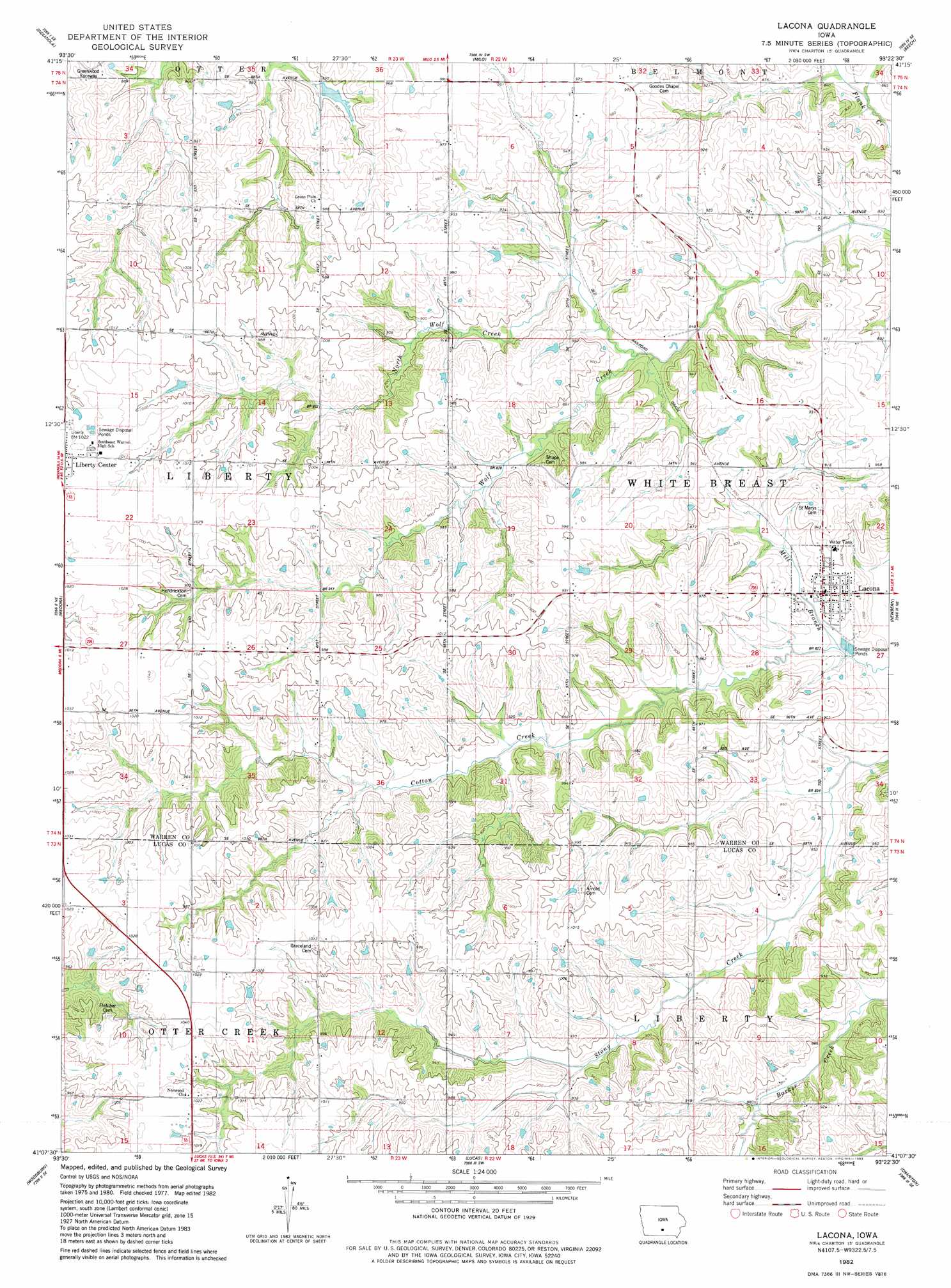
USGS Topo Quad 41093b4 - 1:24,000 scale
| Topo Map Name: | Lacona |
| USGS Topo Quad ID: | 41093b4 |
| Print Size: | ca. 21 1/4" wide x 27" high |
| Southeast Coordinates: | 41.125° N latitude / 93.375° W longitude |
| Map Center Coordinates: | 41.1875° N latitude / 93.4375° W longitude |
| U.S. State: | IA |
| Filename: | o41093b4.jpg |
| Download Map JPG Image: | Lacona topo map 1:24,000 scale |
| Map Type: | Topographic |
| Topo Series: | 7.5´ |
| Map Scale: | 1:24,000 |
| Source of Map Images: | United States Geological Survey (USGS) |
| Alternate Map Versions: |
Lacona IA 1982, updated 1983 Download PDF Buy paper map Lacona IA 2010 Download PDF Buy paper map Lacona IA 2013 Download PDF Buy paper map Lacona IA 2015 Download PDF Buy paper map |
1:24,000 Topo Quads surrounding Lacona
Norwalk |
Scotch Ridge |
Hartford |
Pleasantville |
Knoxville Nw |
Martensdale |
Indianola |
Milo |
Beech |
Knoxville Sw |
New Virginia |
Medora |
Lacona |
Newbern |
Melcher |
Jamison |
Woodburn |
Lucas |
Chariton |
Olmitz |
Weldon |
Le Roy |
Derby |
Corydon Ne |
Russell |
> Back to 41093a1 at 1:100,000 scale
> Back to 41092a1 at 1:250,000 scale
> Back to U.S. Topo Maps home
Lacona topo map: Gazetteer
Lacona: Populated Places
Lacona elevation 265m 869′Liberty Center elevation 312m 1023′
Lacona: Post Offices
Lacona Post Office elevation 265m 869′Liberty Center Post Office elevation 313m 1026′
Lacona digital topo map on disk
Buy this Lacona topo map showing relief, roads, GPS coordinates and other geographical features, as a high-resolution digital map file on DVD: