New Virginia Topo Map Iowa
To zoom in, hover over the map of New Virginia
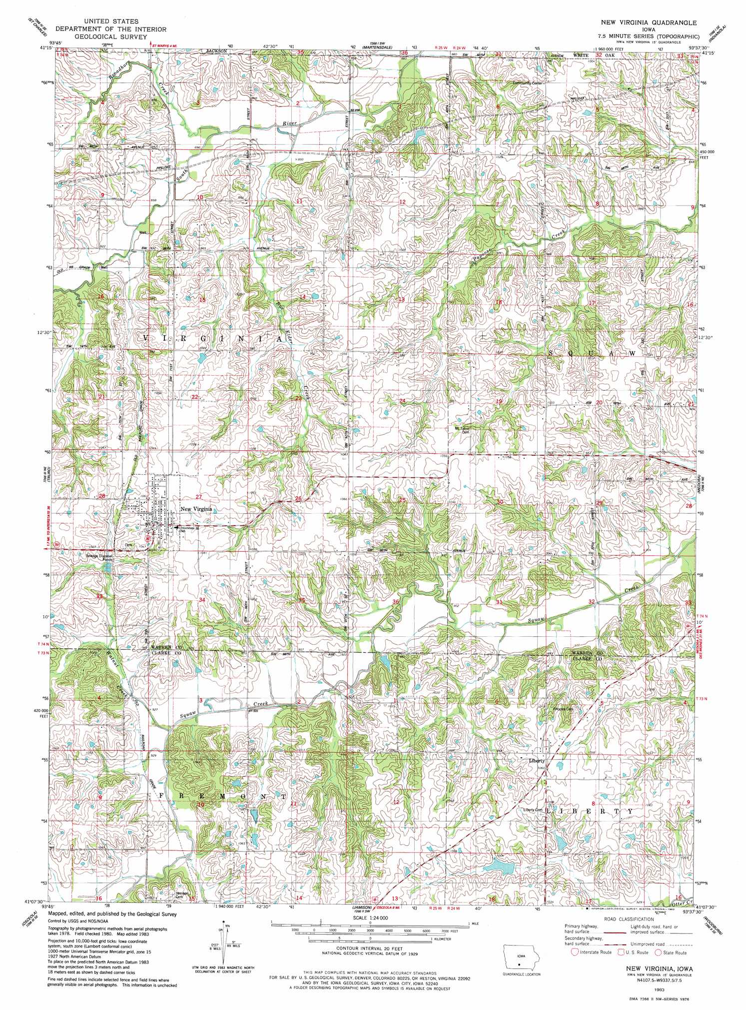
USGS Topo Quad 41093b6 - 1:24,000 scale
| Topo Map Name: | New Virginia |
| USGS Topo Quad ID: | 41093b6 |
| Print Size: | ca. 21 1/4" wide x 27" high |
| Southeast Coordinates: | 41.125° N latitude / 93.625° W longitude |
| Map Center Coordinates: | 41.1875° N latitude / 93.6875° W longitude |
| U.S. State: | IA |
| Filename: | o41093b6.jpg |
| Download Map JPG Image: | New Virginia topo map 1:24,000 scale |
| Map Type: | Topographic |
| Topo Series: | 7.5´ |
| Map Scale: | 1:24,000 |
| Source of Map Images: | United States Geological Survey (USGS) |
| Alternate Map Versions: |
New Virginia IA 1983, updated 1983 Download PDF Buy paper map New Virginia IA 2010 Download PDF Buy paper map New Virginia IA 2013 Download PDF Buy paper map New Virginia IA 2015 Download PDF Buy paper map |
1:24,000 Topo Quads surrounding New Virginia
Saint Charles Nw |
Cumming |
Norwalk |
Scotch Ridge |
Hartford |
Patterson |
Saint Charles |
Martensdale |
Indianola |
Milo |
East Peru |
Truro |
New Virginia |
Medora |
Lacona |
Murray |
Osceola |
Jamison |
Woodburn |
Lucas |
Hopeville |
Lacelle |
Weldon |
Le Roy |
Derby |
> Back to 41093a1 at 1:100,000 scale
> Back to 41092a1 at 1:250,000 scale
> Back to U.S. Topo Maps home
New Virginia topo map: Gazetteer
New Virginia: Parks
Green Pines Wildlife Area elevation 297m 974′Rolling Thunder Prairie elevation 285m 935′
New Virginia: Populated Places
Liberty elevation 323m 1059′New Virginia elevation 332m 1089′
South River Crossing (historical) elevation 279m 915′
New Virginia: Post Offices
Folger Post Office (historical) elevation 321m 1053′Liberty Post Office (historical) elevation 323m 1059′
New Virginia Post Office elevation 330m 1082′
New Virginia: Streams
Box Elder Creek elevation 268m 879′Broadhorn Creek elevation 268m 879′
Papoose Creek elevation 263m 862′
Walnut Creek elevation 282m 925′
New Virginia digital topo map on disk
Buy this New Virginia topo map showing relief, roads, GPS coordinates and other geographical features, as a high-resolution digital map file on DVD: