Truro Topo Map Iowa
To zoom in, hover over the map of Truro
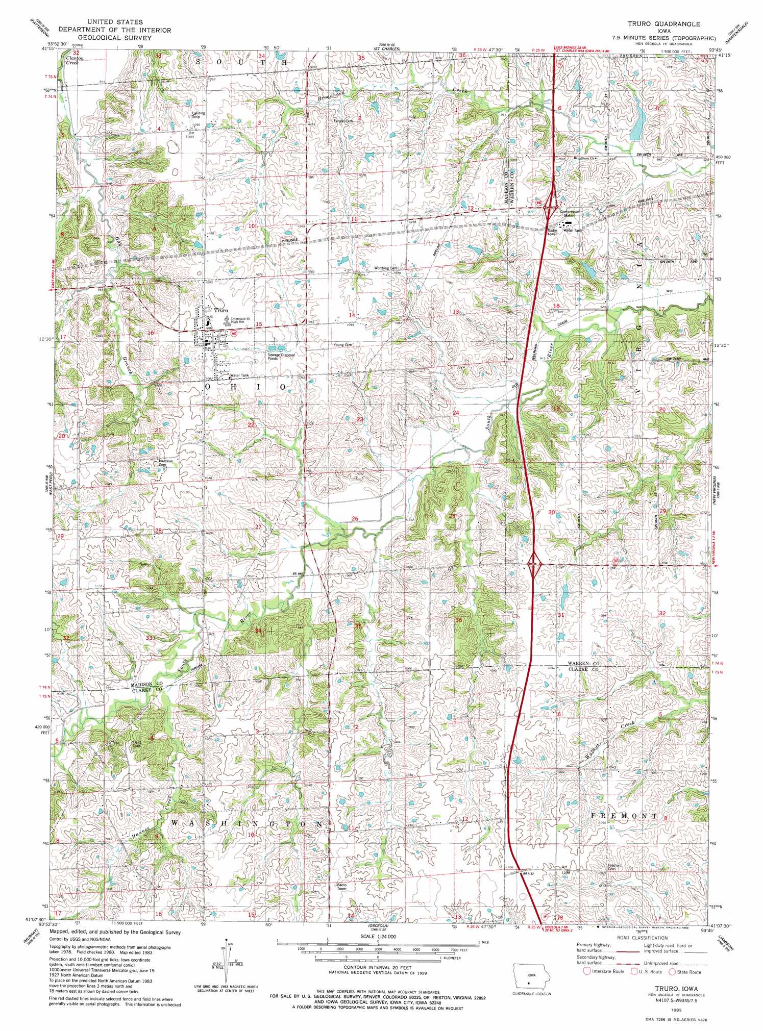
USGS Topo Quad 41093b7 - 1:24,000 scale
| Topo Map Name: | Truro |
| USGS Topo Quad ID: | 41093b7 |
| Print Size: | ca. 21 1/4" wide x 27" high |
| Southeast Coordinates: | 41.125° N latitude / 93.75° W longitude |
| Map Center Coordinates: | 41.1875° N latitude / 93.8125° W longitude |
| U.S. State: | IA |
| Filename: | o41093b7.jpg |
| Download Map JPG Image: | Truro topo map 1:24,000 scale |
| Map Type: | Topographic |
| Topo Series: | 7.5´ |
| Map Scale: | 1:24,000 |
| Source of Map Images: | United States Geological Survey (USGS) |
| Alternate Map Versions: |
Truro IA 1983, updated 1983 Download PDF Buy paper map Truro IA 2010 Download PDF Buy paper map Truro IA 2013 Download PDF Buy paper map Truro IA 2015 Download PDF Buy paper map |
1:24,000 Topo Quads surrounding Truro
Earlham East |
Saint Charles Nw |
Cumming |
Norwalk |
Scotch Ridge |
Winterset |
Patterson |
Saint Charles |
Martensdale |
Indianola |
Lorimor North |
East Peru |
Truro |
New Virginia |
Medora |
Lorimor South |
Murray |
Osceola |
Jamison |
Woodburn |
Tingley Ne |
Hopeville |
Lacelle |
Weldon |
Le Roy |
> Back to 41093a1 at 1:100,000 scale
> Back to 41092a1 at 1:250,000 scale
> Back to U.S. Topo Maps home
Truro topo map: Gazetteer
Truro: Airports
South River Field elevation 280m 918′Truro: Crossings
Interchange 43 elevation 336m 1102′Interchange 47 elevation 317m 1040′
Truro: Populated Places
Truro elevation 330m 1082′Truro: Post Offices
Dorrville Post Office (historical) elevation 330m 1082′Prairie Grove Post Office (historical) elevation 318m 1043′
Truro Post Office elevation 329m 1079′
Truro: Streams
Hanner Creek elevation 294m 964′Hay Branch elevation 274m 898′
Limestone Creek elevation 306m 1003′
Truro digital topo map on disk
Buy this Truro topo map showing relief, roads, GPS coordinates and other geographical features, as a high-resolution digital map file on DVD: