East Peru Topo Map Iowa
To zoom in, hover over the map of East Peru
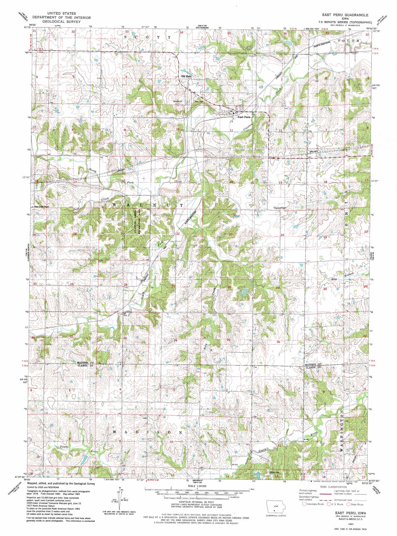
USGS Topo Quad 41093b8 - 1:24,000 scale
| Topo Map Name: | East Peru |
| USGS Topo Quad ID: | 41093b8 |
| Print Size: | ca. 21 1/4" wide x 27" high |
| Southeast Coordinates: | 41.125° N latitude / 93.875° W longitude |
| Map Center Coordinates: | 41.1875° N latitude / 93.9375° W longitude |
| U.S. State: | IA |
| Filename: | o41093b8.jpg |
| Download Map JPG Image: | East Peru topo map 1:24,000 scale |
| Map Type: | Topographic |
| Topo Series: | 7.5´ |
| Map Scale: | 1:24,000 |
| Source of Map Images: | United States Geological Survey (USGS) |
| Alternate Map Versions: |
East Peru IA 1983, updated 1983 Download PDF Buy paper map East Peru IA 2010 Download PDF Buy paper map East Peru IA 2013 Download PDF Buy paper map East Peru IA 2015 Download PDF Buy paper map |
1:24,000 Topo Quads surrounding East Peru
Earlham West |
Earlham East |
Saint Charles Nw |
Cumming |
Norwalk |
Pitzer |
Winterset |
Patterson |
Saint Charles |
Martensdale |
Macksburg |
Lorimor North |
East Peru |
Truro |
New Virginia |
Afton |
Lorimor South |
Murray |
Osceola |
Jamison |
Arispe |
Tingley Ne |
Hopeville |
Lacelle |
Weldon |
> Back to 41093a1 at 1:100,000 scale
> Back to 41092a1 at 1:250,000 scale
> Back to U.S. Topo Maps home
East Peru topo map: Gazetteer
East Peru: Bridges
Morgan Bridge elevation 337m 1105′East Peru: Parks
Clanton Creek Recreation Area elevation 323m 1059′East Peru: Populated Places
East Peru elevation 292m 958′Old Peru elevation 342m 1122′
East Peru: Post Offices
Brooklyn Post Office (historical) elevation 343m 1125′East Peru Post Office elevation 292m 958′
Foster Post Office (historical) elevation 331m 1085′
Laporte Post Office (historical) elevation 355m 1164′
Ohio Post Office (historical) elevation 341m 1118′
Peru Post Office (historical) elevation 342m 1122′
East Peru: Streams
Bird Creek elevation 290m 951′Deer Creek elevation 291m 954′
North Fork Clanton Creek elevation 287m 941′
South Fork Clanton Creek elevation 287m 941′
East Peru digital topo map on disk
Buy this East Peru topo map showing relief, roads, GPS coordinates and other geographical features, as a high-resolution digital map file on DVD: