Knoxville Topo Map Iowa
To zoom in, hover over the map of Knoxville
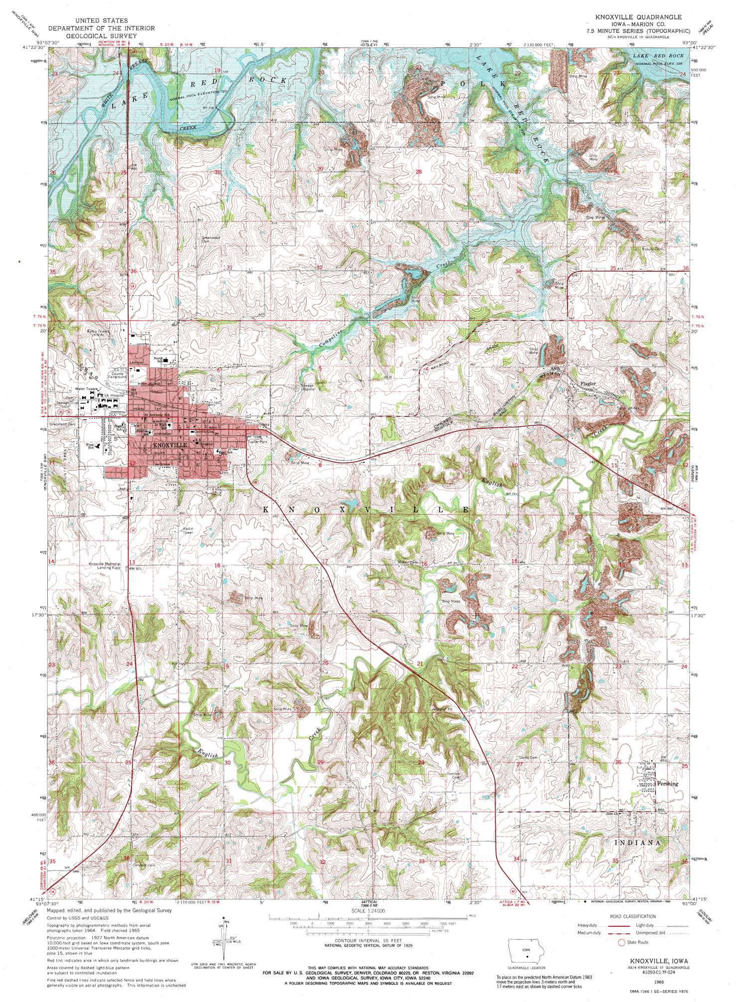
USGS Topo Quad 41093c1 - 1:24,000 scale
| Topo Map Name: | Knoxville |
| USGS Topo Quad ID: | 41093c1 |
| Print Size: | ca. 21 1/4" wide x 27" high |
| Southeast Coordinates: | 41.25° N latitude / 93° W longitude |
| Map Center Coordinates: | 41.3125° N latitude / 93.0625° W longitude |
| U.S. State: | IA |
| Filename: | o41093c1.jpg |
| Download Map JPG Image: | Knoxville topo map 1:24,000 scale |
| Map Type: | Topographic |
| Topo Series: | 7.5´ |
| Map Scale: | 1:24,000 |
| Source of Map Images: | United States Geological Survey (USGS) |
| Alternate Map Versions: |
Knoxville IA 1965, updated 1966 Download PDF Buy paper map Knoxville IA 1965, updated 1989 Download PDF Buy paper map Knoxville IA 2010 Download PDF Buy paper map Knoxville IA 2013 Download PDF Buy paper map Knoxville IA 2015 Download PDF Buy paper map |
1:24,000 Topo Quads surrounding Knoxville
Runnells |
Prairie City |
Monroe |
Killduff |
Sully |
Pleasantville |
Knoxville Nw |
Otley |
Pella |
Peoria |
Beech |
Knoxville Sw |
Knoxville |
Harvey |
Leighton |
Newbern |
Melcher |
Attica |
Lovilia |
Buxton |
Chariton |
Olmitz |
Wales |
Hiteman |
Albia |
> Back to 41093a1 at 1:100,000 scale
> Back to 41092a1 at 1:250,000 scale
> Back to U.S. Topo Maps home
Knoxville topo map: Gazetteer
Knoxville: Airports
Knoxville Area Community Hospital Heliport elevation 278m 912′Knoxville Municipal Airport elevation 284m 931′
Knoxville: Dams
Knoxville Pond Dam elevation 277m 908′Knoxville: Parks
Auld Park elevation 274m 898′Designer of the Iowa Flag Historical Marker elevation 266m 872′
Edwards City Park elevation 264m 866′
Governor William Stone Historical Marker elevation 269m 882′
Home of Governor William Stone Historical Marker elevation 274m 898′
Home of Judge Lorin N Hayes Historical Marker elevation 275m 902′
Memorial for President George Washington Historical Marker elevation 276m 905′
Red Rock Line Indian Treaty Historical Marker elevation 279m 915′
USS Maine Historical Marker elevation 279m 915′
Youngs Park elevation 278m 912′
Knoxville: Populated Places
Colonial Terrace Mobile Home Park elevation 259m 849′Flagler elevation 227m 744′
Knoxville elevation 277m 908′
Pershing elevation 271m 889′
Wensel Mobile Home Park elevation 272m 892′
Wheel Estates Mobile Home Park elevation 274m 898′
Knoxville: Post Offices
Fairmont Post Office (historical) elevation 283m 928′Flagler Post Office (historical) elevation 227m 744′
Knoxville Post Office elevation 278m 912′
Pershing Post Office elevation 274m 898′
Rizors Post Office (historical) elevation 271m 889′
Knoxville: Reservoirs
Knoxville Pond elevation 277m 908′Knoxville: Streams
Campetine Creek elevation 221m 725′Wolf Run elevation 230m 754′
Knoxville digital topo map on disk
Buy this Knoxville topo map showing relief, roads, GPS coordinates and other geographical features, as a high-resolution digital map file on DVD: