Beech Topo Map Iowa
To zoom in, hover over the map of Beech
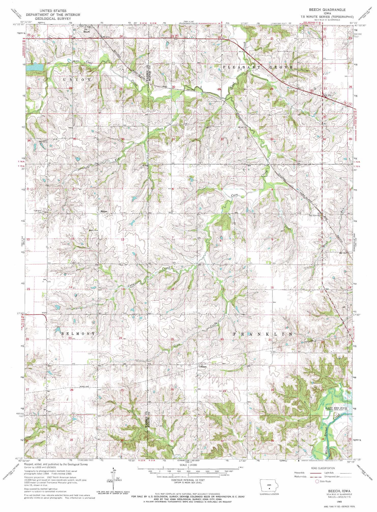
USGS Topo Quad 41093c3 - 1:24,000 scale
| Topo Map Name: | Beech |
| USGS Topo Quad ID: | 41093c3 |
| Print Size: | ca. 21 1/4" wide x 27" high |
| Southeast Coordinates: | 41.25° N latitude / 93.25° W longitude |
| Map Center Coordinates: | 41.3125° N latitude / 93.3125° W longitude |
| U.S. State: | IA |
| Filename: | o41093c3.jpg |
| Download Map JPG Image: | Beech topo map 1:24,000 scale |
| Map Type: | Topographic |
| Topo Series: | 7.5´ |
| Map Scale: | 1:24,000 |
| Source of Map Images: | United States Geological Survey (USGS) |
| Alternate Map Versions: |
Beech IA 1965, updated 1966 Download PDF Buy paper map Beech IA 2010 Download PDF Buy paper map Beech IA 2013 Download PDF Buy paper map Beech IA 2015 Download PDF Buy paper map |
1:24,000 Topo Quads surrounding Beech
Des Moines Se |
Rising Sun |
Runnells |
Prairie City |
Monroe |
Scotch Ridge |
Hartford |
Pleasantville |
Knoxville Nw |
Otley |
Indianola |
Milo |
Beech |
Knoxville Sw |
Knoxville |
Medora |
Lacona |
Newbern |
Melcher |
Attica |
Woodburn |
Lucas |
Chariton |
Olmitz |
Wales |
> Back to 41093a1 at 1:100,000 scale
> Back to 41092a1 at 1:250,000 scale
> Back to U.S. Topo Maps home
Beech topo map: Gazetteer
Beech: Parks
Beech Community Park elevation 272m 892′Beech: Populated Places
Beech elevation 278m 912′Caloma elevation 290m 951′
Beech: Post Offices
Beech Post Office (historical) elevation 278m 912′Caloma Post Office (historical) elevation 291m 954′
Felix Post Office (historical) elevation 293m 961′
Motor Post Office (historical) elevation 294m 964′
Star Post Office (historical) elevation 268m 879′
Beech: Streams
Coon Creek elevation 244m 800′Crow Creek elevation 253m 830′
Fly Creek elevation 244m 800′
Beech digital topo map on disk
Buy this Beech topo map showing relief, roads, GPS coordinates and other geographical features, as a high-resolution digital map file on DVD: