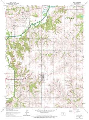
Milo Topo Map Iowa
To zoom in, hover over the map of Milo
USGS Topo Quad 41093c4 - 1:24,000 scale
| Topo Map Name: | Milo |
| USGS Topo Quad ID: | 41093c4 |
| Print Size: | ca. 21 1/4" wide x 27" high |
| Southeast Coordinates: | 41.25° N latitude / 93.375° W longitude |
| Map Center Coordinates: | 41.3125° N latitude / 93.4375° W longitude |
| U.S. State: | IA |
| Filename: | o41093c4.jpg |
| Download Map JPG Image: | Milo topo map 1:24,000 scale |
| Map Type: | Topographic |
| Topo Series: | 7.5´ |
| Map Scale: | 1:24,000 |
| Source of Map Images: | United States Geological Survey (USGS) |
| Alternate Map Versions: |
Milo IA 1965, updated 1966 Download PDF Buy paper map Milo IA 2010 Download PDF Buy paper map Milo IA 2013 Download PDF Buy paper map Milo IA 2015 Download PDF Buy paper map |
1:24,000 Topo Quads surrounding Milo
> Back to 41093a1 at 1:100,000 scale
> Back to 41092a1 at 1:250,000 scale
> Back to U.S. Topo Maps home
Milo topo map: Gazetteer
Milo: Parks
Woodland Mounds State Preserve elevation 258m 846′Milo: Populated Places
Ackworth elevation 273m 895′Clarkson (historical) elevation 284m 931′
Hammondsburgh (historical) elevation 293m 961′
Milo elevation 296m 971′
Sandyville elevation 286m 938′
Milo: Post Offices
Ackworth Post Office elevation 275m 902′Hammondsburgh Post Office (historical) elevation 293m 961′
Milo Post Office elevation 294m 964′
Planeville Post Office (historical) elevation 244m 800′
Sandyville Post Office (historical) elevation 286m 938′
Schonberg Post Office (historical) elevation 293m 961′
Wisconsin Post Office (historical) elevation 296m 971′
Milo: Streams
Buck Creek elevation 254m 833′Otter Creek elevation 241m 790′
Milo digital topo map on disk
Buy this Milo topo map showing relief, roads, GPS coordinates and other geographical features, as a high-resolution digital map file on DVD:


