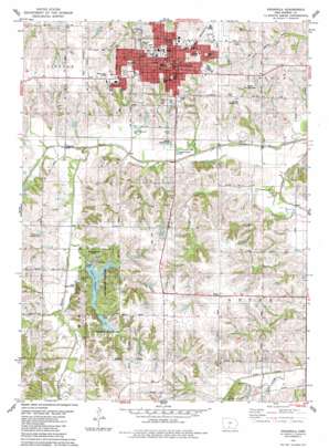
Indianola Topo Map Iowa
To zoom in, hover over the map of Indianola
USGS Topo Quad 41093c5 - 1:24,000 scale
| Topo Map Name: | Indianola |
| USGS Topo Quad ID: | 41093c5 |
| Print Size: | ca. 21 1/4" wide x 27" high |
| Southeast Coordinates: | 41.25° N latitude / 93.5° W longitude |
| Map Center Coordinates: | 41.3125° N latitude / 93.5625° W longitude |
| U.S. State: | IA |
| Filename: | o41093c5.jpg |
| Download Map JPG Image: | Indianola topo map 1:24,000 scale |
| Map Type: | Topographic |
| Topo Series: | 7.5´ |
| Map Scale: | 1:24,000 |
| Source of Map Images: | United States Geological Survey (USGS) |
| Alternate Map Versions: |
Indianola IA 1983, updated 1983 Download PDF Buy paper map Indianola IA 2010 Download PDF Buy paper map Indianola IA 2013 Download PDF Buy paper map Indianola IA 2015 Download PDF Buy paper map |
1:24,000 Topo Quads surrounding Indianola
> Back to 41093a1 at 1:100,000 scale
> Back to 41092a1 at 1:250,000 scale
> Back to U.S. Topo Maps home
Indianola topo map: Gazetteer
Indianola: Airports
Durham Landing Strip elevation 288m 944′Indianola Heliport elevation 296m 971′
Nash Field elevation 299m 980′
Indianola: Canals
South River Ditch elevation 247m 810′Indianola: Lakes
Lake Ahquabi elevation 262m 859′Indianola: Parks
Barker Park elevation 293m 961′Bill Buxton Stadium elevation 291m 954′
Buxton Park elevation 293m 961′
Buxton Park Arboretum elevation 293m 961′
Dayton Park elevation 293m 961′
Downey Memorial Park elevation 250m 820′
Easton Park elevation 280m 918′
Hooper State Game Area elevation 286m 938′
Lake Ahquabi State Park elevation 262m 859′
Lake Ahquabi State Park elevation 285m 935′
Lions Park elevation 294m 964′
McBride Field elevation 289m 948′
McCord Park elevation 287m 941′
Memorial Park elevation 275m 902′
Moats Park elevation 283m 928′
Pickard Recreation Area elevation 270m 885′
President Richard Nixon's Iowa Ancestor Historical Marker elevation 290m 951′
Sesquicentennial Park elevation 296m 971′
Simpson Soccer Field elevation 286m 938′
Simpson Softball Field elevation 289m 948′
South Town Park elevation 280m 918′
Wallace Hall and George Washington Carver State Historical Marker elevation 293m 961′
Willow Creek Totlot elevation 271m 889′
Indianola: Populated Places
Indian Ridge Mobile Home Park elevation 293m 961′Indianola elevation 295m 967′
North American Trailer Park elevation 254m 833′
Ottawa elevation 246m 807′
Sunfield Mobile Home Park elevation 292m 958′
Indianola: Post Offices
Derrough Post Office (historical) elevation 292m 958′Indianola Post Office elevation 292m 958′
Indianola: Streams
Squaw Creek elevation 247m 810′Turkery Creek elevation 248m 813′
Indianola: Trails
McVay Trail elevation 290m 951′Indianola digital topo map on disk
Buy this Indianola topo map showing relief, roads, GPS coordinates and other geographical features, as a high-resolution digital map file on DVD:


