Saint Charles Topo Map Iowa
To zoom in, hover over the map of Saint Charles
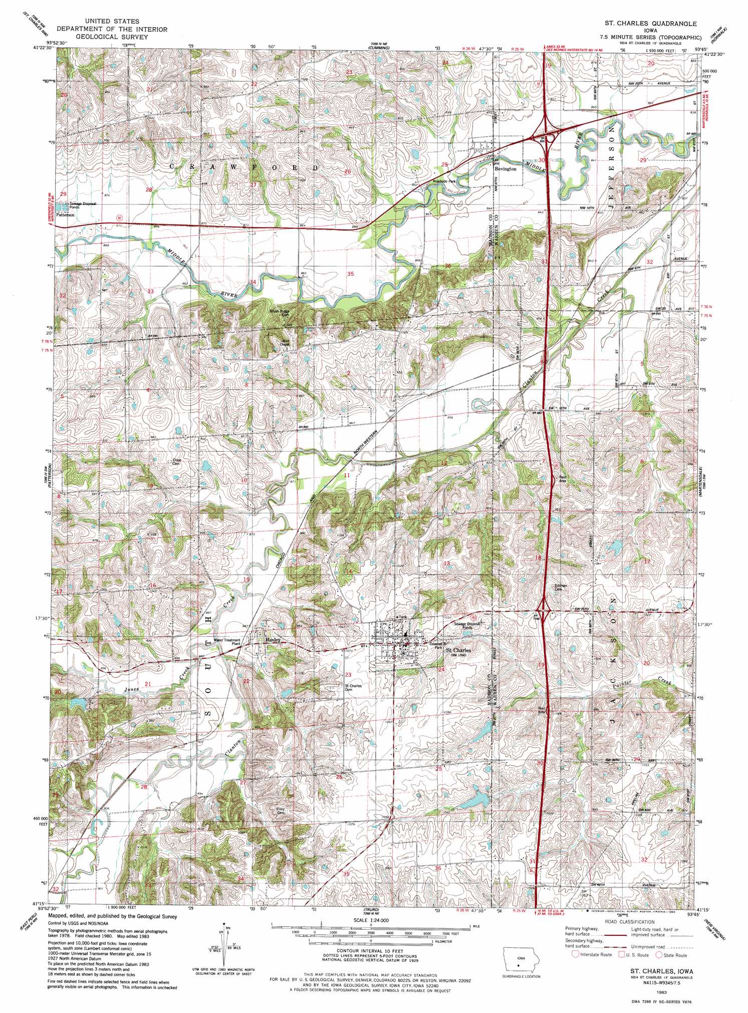
USGS Topo Quad 41093c7 - 1:24,000 scale
| Topo Map Name: | Saint Charles |
| USGS Topo Quad ID: | 41093c7 |
| Print Size: | ca. 21 1/4" wide x 27" high |
| Southeast Coordinates: | 41.25° N latitude / 93.75° W longitude |
| Map Center Coordinates: | 41.3125° N latitude / 93.8125° W longitude |
| U.S. State: | IA |
| Filename: | o41093c7.jpg |
| Download Map JPG Image: | Saint Charles topo map 1:24,000 scale |
| Map Type: | Topographic |
| Topo Series: | 7.5´ |
| Map Scale: | 1:24,000 |
| Source of Map Images: | United States Geological Survey (USGS) |
| Alternate Map Versions: |
St. Charles IA 1983, updated 1983 Download PDF Buy paper map Saint Charles IA 2010 Download PDF Buy paper map Saint Charles IA 2013 Download PDF Buy paper map Saint Charles IA 2015 Download PDF Buy paper map |
1:24,000 Topo Quads surrounding Saint Charles
Adel |
Waukee |
Commerce |
Des Moines Sw |
Des Moines Se |
Earlham East |
Saint Charles Nw |
Cumming |
Norwalk |
Scotch Ridge |
Winterset |
Patterson |
Saint Charles |
Martensdale |
Indianola |
Lorimor North |
East Peru |
Truro |
New Virginia |
Medora |
Lorimor South |
Murray |
Osceola |
Jamison |
Woodburn |
> Back to 41093a1 at 1:100,000 scale
> Back to 41092a1 at 1:250,000 scale
> Back to U.S. Topo Maps home
Saint Charles topo map: Gazetteer
Saint Charles: Bridges
Imes Covered Bridge elevation 309m 1013′Saint Charles: Crossings
Interchange 52 elevation 313m 1026′Interchange 56 elevation 260m 853′
Saint Charles: Parks
Covered Bridge Park elevation 309m 1013′Saint Charles: Populated Places
Bevington elevation 257m 843′Conger elevation 259m 849′
Hanley elevation 286m 938′
Saint Charles elevation 324m 1062′
Saint Charles: Post Offices
Bells Ridge Post Office (historical) elevation 308m 1010′Bevington Post Office elevation 257m 843′
Conger Post Office (historical) elevation 259m 849′
Ellsworth Post Office (historical) elevation 301m 987′
Hanley Post Office (historical) elevation 286m 938′
Saint Charles Post Office elevation 323m 1059′
Saint Charles: Streams
Jones Creek elevation 263m 862′Saint Charles digital topo map on disk
Buy this Saint Charles topo map showing relief, roads, GPS coordinates and other geographical features, as a high-resolution digital map file on DVD: