Hartford Topo Map Iowa
To zoom in, hover over the map of Hartford
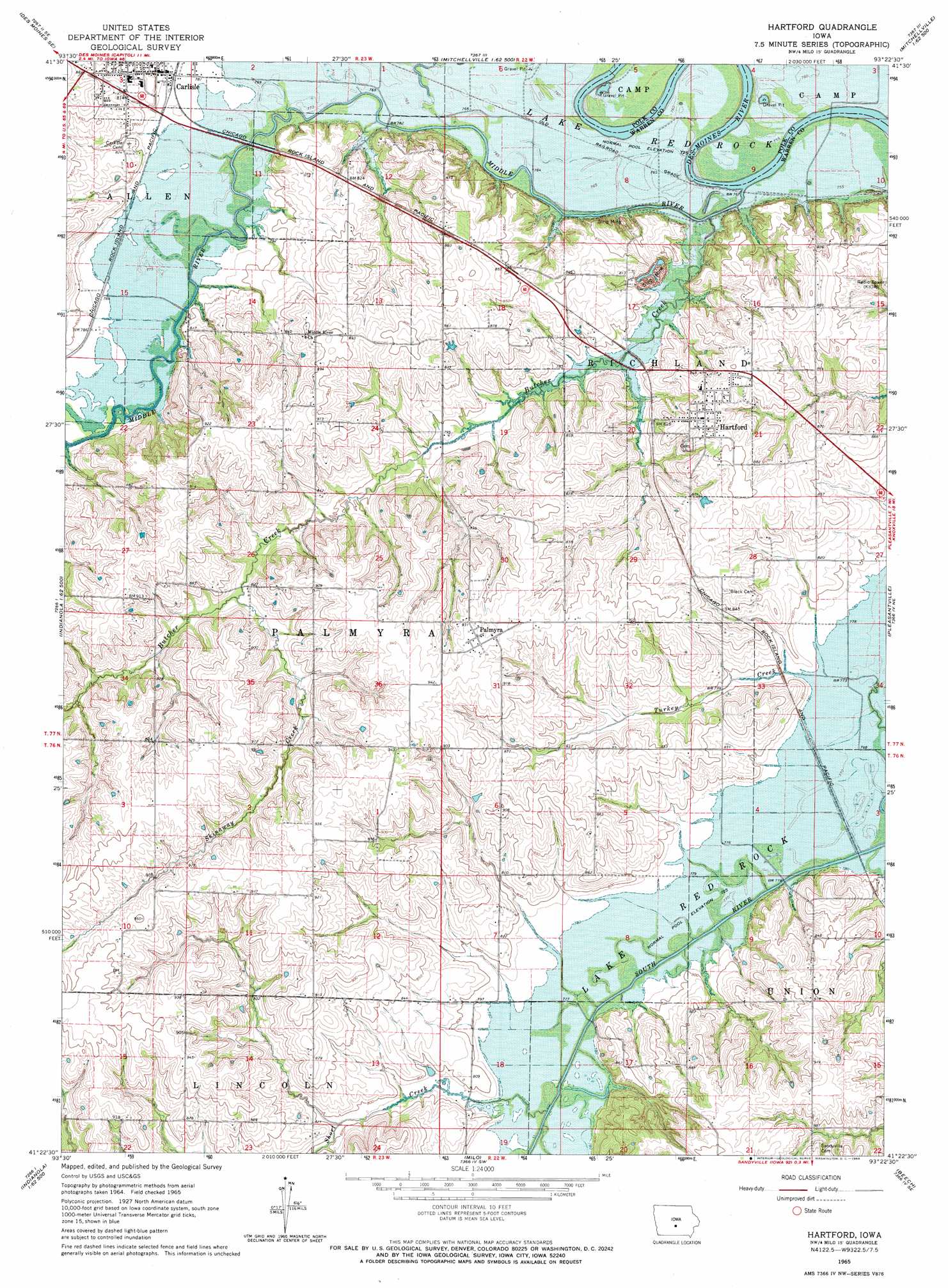
USGS Topo Quad 41093d4 - 1:24,000 scale
| Topo Map Name: | Hartford |
| USGS Topo Quad ID: | 41093d4 |
| Print Size: | ca. 21 1/4" wide x 27" high |
| Southeast Coordinates: | 41.375° N latitude / 93.375° W longitude |
| Map Center Coordinates: | 41.4375° N latitude / 93.4375° W longitude |
| U.S. State: | IA |
| Filename: | o41093d4.jpg |
| Download Map JPG Image: | Hartford topo map 1:24,000 scale |
| Map Type: | Topographic |
| Topo Series: | 7.5´ |
| Map Scale: | 1:24,000 |
| Source of Map Images: | United States Geological Survey (USGS) |
| Alternate Map Versions: |
Hartford IA 1965, updated 1966 Download PDF Buy paper map Hartford IA 2010 Download PDF Buy paper map Hartford IA 2013 Download PDF Buy paper map Hartford IA 2015 Download PDF Buy paper map |
1:24,000 Topo Quads surrounding Hartford
Des Moines Nw |
Des Moines Ne |
Altoona |
Mitchellville |
Colfax |
Des Moines Sw |
Des Moines Se |
Rising Sun |
Runnells |
Prairie City |
Norwalk |
Scotch Ridge |
Hartford |
Pleasantville |
Knoxville Nw |
Martensdale |
Indianola |
Milo |
Beech |
Knoxville Sw |
New Virginia |
Medora |
Lacona |
Newbern |
Melcher |
> Back to 41093a1 at 1:100,000 scale
> Back to 41092a1 at 1:250,000 scale
> Back to U.S. Topo Maps home
Hartford topo map: Gazetteer
Hartford: Parks
Lindhardt Park elevation 248m 813′Volunteer Park elevation 250m 820′
Hartford: Populated Places
Ford elevation 232m 761′Greenbush elevation 287m 941′
Hartford elevation 268m 879′
Hartford Mobile Home Park elevation 268m 879′
Palmyra elevation 283m 928′
Western Acres Mobile Home Park elevation 241m 790′
Hartford: Post Offices
Carlisle Post Office elevation 243m 797′Ford Post Office (historical) elevation 229m 751′
Freel Post Office (historical) elevation 231m 757′
Friends Grove Post Office (historical) elevation 266m 872′
Hartford Post Office elevation 268m 879′
Palmyra Post Office (historical) elevation 283m 928′
Sutton Post Office (historical) elevation 287m 941′
Wilmington Post Office (historical) elevation 265m 869′
Hartford: Streams
Butcher Creek elevation 231m 757′Middle River elevation 231m 757′
Short Creek elevation 233m 764′
Skinaway Creek elevation 247m 810′
Hartford digital topo map on disk
Buy this Hartford topo map showing relief, roads, GPS coordinates and other geographical features, as a high-resolution digital map file on DVD: