Cumming Topo Map Iowa
To zoom in, hover over the map of Cumming
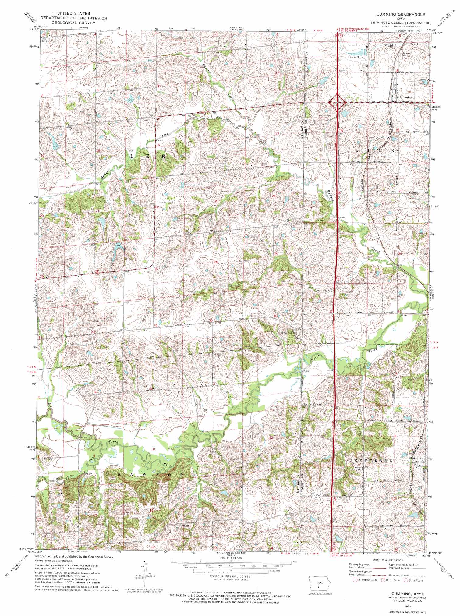
USGS Topo Quad 41093d7 - 1:24,000 scale
| Topo Map Name: | Cumming |
| USGS Topo Quad ID: | 41093d7 |
| Print Size: | ca. 21 1/4" wide x 27" high |
| Southeast Coordinates: | 41.375° N latitude / 93.75° W longitude |
| Map Center Coordinates: | 41.4375° N latitude / 93.8125° W longitude |
| U.S. State: | IA |
| Filename: | o41093d7.jpg |
| Download Map JPG Image: | Cumming topo map 1:24,000 scale |
| Map Type: | Topographic |
| Topo Series: | 7.5´ |
| Map Scale: | 1:24,000 |
| Source of Map Images: | United States Geological Survey (USGS) |
| Alternate Map Versions: |
Cumming IA 1972, updated 1975 Download PDF Buy paper map Cumming IA 2010 Download PDF Buy paper map Cumming IA 2013 Download PDF Buy paper map Cumming IA 2015 Download PDF Buy paper map |
1:24,000 Topo Quads surrounding Cumming
Panther |
Dallas Center |
Grimes |
Des Moines Nw |
Des Moines Ne |
Adel |
Waukee |
Commerce |
Des Moines Sw |
Des Moines Se |
Earlham East |
Saint Charles Nw |
Cumming |
Norwalk |
Scotch Ridge |
Winterset |
Patterson |
Saint Charles |
Martensdale |
Indianola |
Lorimor North |
East Peru |
Truro |
New Virginia |
Medora |
> Back to 41093a1 at 1:100,000 scale
> Back to 41092a1 at 1:250,000 scale
> Back to U.S. Topo Maps home
Cumming topo map: Gazetteer
Cumming: Bridges
Cunningham Bridge elevation 259m 849′Cumming: Crossings
Interchange 65 elevation 296m 971′Cumming: Parks
Cumming City Park elevation 299m 980′Cumming: Populated Places
Churchville elevation 297m 974′Cumming elevation 299m 980′
Cumming: Post Offices
Churchville elevation 297m 974′Cumming Post Office elevation 299m 980′
Heaton Post Office (historical) elevation 308m 1010′
Montpelier Post Office (historical) elevation 303m 994′
Cumming: Streams
Cedar Creek elevation 256m 839′Cherry Creek elevation 256m 839′
Cumming: Trails
Great Western Trail elevation 261m 856′Cumming digital topo map on disk
Buy this Cumming topo map showing relief, roads, GPS coordinates and other geographical features, as a high-resolution digital map file on DVD: