Saint Charles Nw Topo Map Iowa
To zoom in, hover over the map of Saint Charles Nw
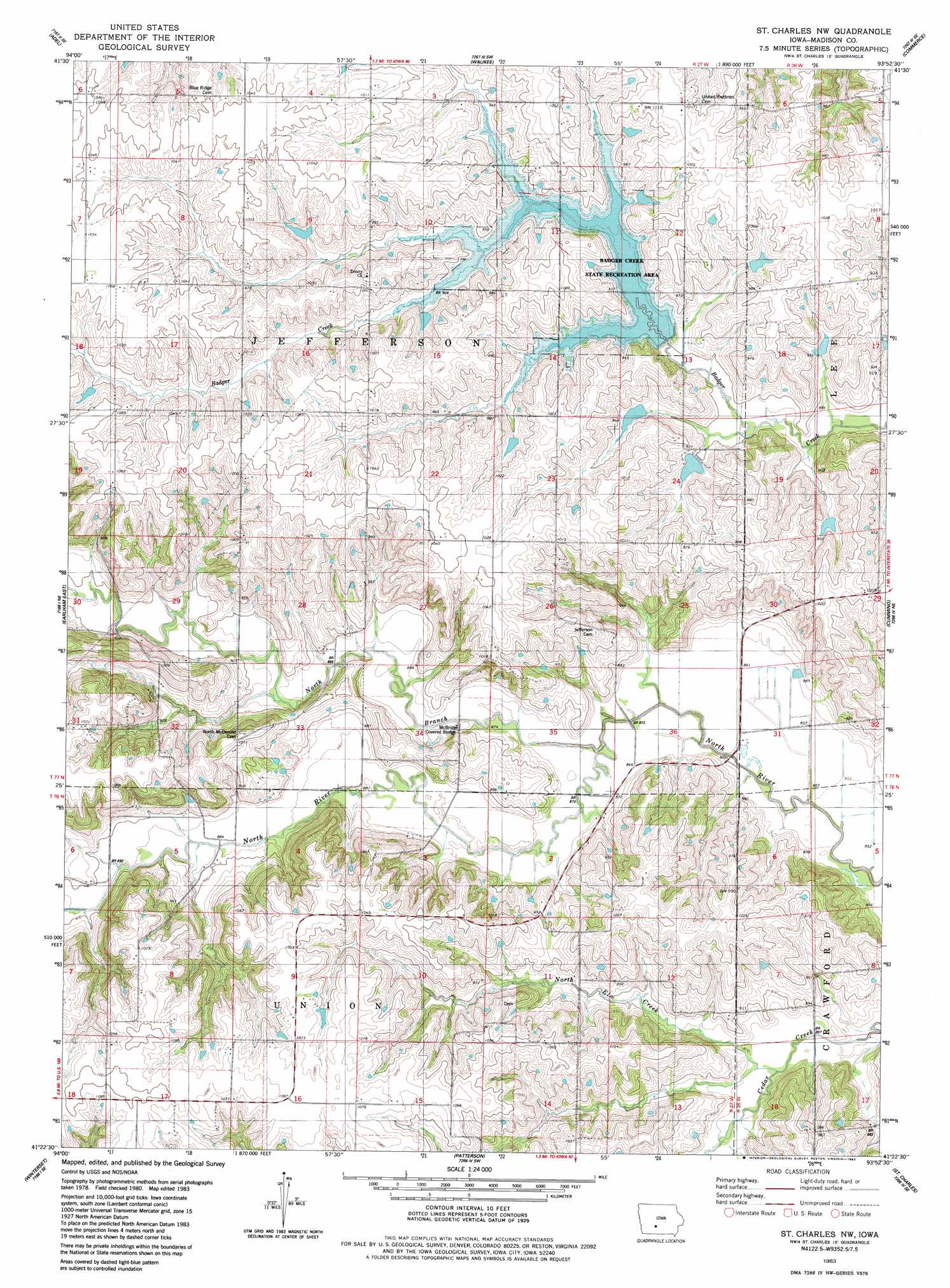
USGS Topo Quad 41093d8 - 1:24,000 scale
| Topo Map Name: | Saint Charles Nw |
| USGS Topo Quad ID: | 41093d8 |
| Print Size: | ca. 21 1/4" wide x 27" high |
| Southeast Coordinates: | 41.375° N latitude / 93.875° W longitude |
| Map Center Coordinates: | 41.4375° N latitude / 93.9375° W longitude |
| U.S. State: | IA |
| Filename: | o41093d8.jpg |
| Download Map JPG Image: | Saint Charles Nw topo map 1:24,000 scale |
| Map Type: | Topographic |
| Topo Series: | 7.5´ |
| Map Scale: | 1:24,000 |
| Source of Map Images: | United States Geological Survey (USGS) |
| Alternate Map Versions: |
St. Charles NW IA 1983, updated 1983 Download PDF Buy paper map Saint Charles NW IA 2010 Download PDF Buy paper map Saint Charles NW IA 2013 Download PDF Buy paper map Saint Charles NW IA 2015 Download PDF Buy paper map |
1:24,000 Topo Quads surrounding Saint Charles Nw
Adel Nw |
Panther |
Dallas Center |
Grimes |
Des Moines Nw |
Redfield |
Adel |
Waukee |
Commerce |
Des Moines Sw |
Earlham West |
Earlham East |
Saint Charles Nw |
Cumming |
Norwalk |
Pitzer |
Winterset |
Patterson |
Saint Charles |
Martensdale |
Macksburg |
Lorimor North |
East Peru |
Truro |
New Virginia |
> Back to 41093a1 at 1:100,000 scale
> Back to 41092a1 at 1:250,000 scale
> Back to U.S. Topo Maps home
Saint Charles Nw topo map: Gazetteer
Saint Charles Nw: Bridges
McBride Covered Bridge elevation 266m 872′Miller Bridge elevation 265m 869′
Saint Charles Nw: Parks
Badger Creek State Recreation Area elevation 276m 905′Saint Charles Nw: Populated Places
McBride elevation 309m 1013′Saint Charles Nw: Post Offices
Bloomingdale Post Office (historical) elevation 272m 892′Gilpin Post Office (historical) elevation 312m 1023′
McBride Post Office (historical) elevation 308m 1010′
Saint Charles Nw: Streams
North Branch North River elevation 259m 849′North Elm Creek elevation 262m 859′
Saint Charles Nw digital topo map on disk
Buy this Saint Charles Nw topo map showing relief, roads, GPS coordinates and other geographical features, as a high-resolution digital map file on DVD: