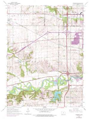
Commerce Topo Map Iowa
To zoom in, hover over the map of Commerce
USGS Topo Quad 41093e7 - 1:24,000 scale
| Topo Map Name: | Commerce |
| USGS Topo Quad ID: | 41093e7 |
| Print Size: | ca. 21 1/4" wide x 27" high |
| Southeast Coordinates: | 41.5° N latitude / 93.75° W longitude |
| Map Center Coordinates: | 41.5625° N latitude / 93.8125° W longitude |
| U.S. State: | IA |
| Filename: | o41093e7.jpg |
| Download Map JPG Image: | Commerce topo map 1:24,000 scale |
| Map Type: | Topographic |
| Topo Series: | 7.5´ |
| Map Scale: | 1:24,000 |
| Source of Map Images: | United States Geological Survey (USGS) |
| Alternate Map Versions: |
Commerce IA 1965, updated 1966 Download PDF Buy paper map Commerce IA 1965, updated 1977 Download PDF Buy paper map Commerce IA 2010 Download PDF Buy paper map Commerce IA 2013 Download PDF Buy paper map Commerce IA 2015 Download PDF Buy paper map |
1:24,000 Topo Quads surrounding Commerce
> Back to 41093e1 at 1:100,000 scale
> Back to 41092a1 at 1:250,000 scale
> Back to U.S. Topo Maps home
Commerce topo map: Gazetteer
Commerce: Crossings
Interchange 121 elevation 301m 987′Interchange 123 elevation 296m 971′
Interchange 124 elevation 289m 948′
Interchange 125 elevation 273m 895′
Interchange 68 elevation 254m 833′
Interchange 69 elevation 263m 862′
Commerce: Dams
Sugar Creek Lake Dam elevation 272m 892′Commerce: Lakes
Sugar Creek Lake elevation 272m 892′Commerce: Parks
Ashawa Park elevation 277m 908′Campbell Recreation Area elevation 266m 872′
Chautauqua Grounds elevation 265m 869′
Crossroads Park elevation 285m 935′
Huntington Ridge Park elevation 293m 961′
Jaycee Park elevation 291m 954′
Karp Park elevation 271m 889′
Knolls Park elevation 281m 921′
Living History Farms elevation 284m 931′
Meadow View Park elevation 283m 928′
Rio Valley Park elevation 266m 872′
Southwood Park elevation 272m 892′
Walnut Ridge Park elevation 281m 921′
Wellington Ridge Park elevation 288m 944′
Western Hills Park elevation 277m 908′
Commerce: Populated Places
Ashawa elevation 267m 875′Campbell elevation 273m 895′
Commerce elevation 271m 889′
Midwest Country Estates elevation 316m 1036′
Commerce: Post Offices
Ashawa Post Office (historical) elevation 267m 875′Campbell Post Office (historical) elevation 273m 895′
Commerce Post Office (historical) elevation 271m 889′
Nordyke Post Office (historical) elevation 291m 954′
Commerce: Reservoirs
Dale Maffit Reservoir elevation 278m 912′Lake Country Club elevation 272m 892′
Commerce: Streams
Fox Creek elevation 262m 859′Johnson Creek elevation 253m 830′
Sugar Creek elevation 250m 820′
Commerce digital topo map on disk
Buy this Commerce topo map showing relief, roads, GPS coordinates and other geographical features, as a high-resolution digital map file on DVD:


