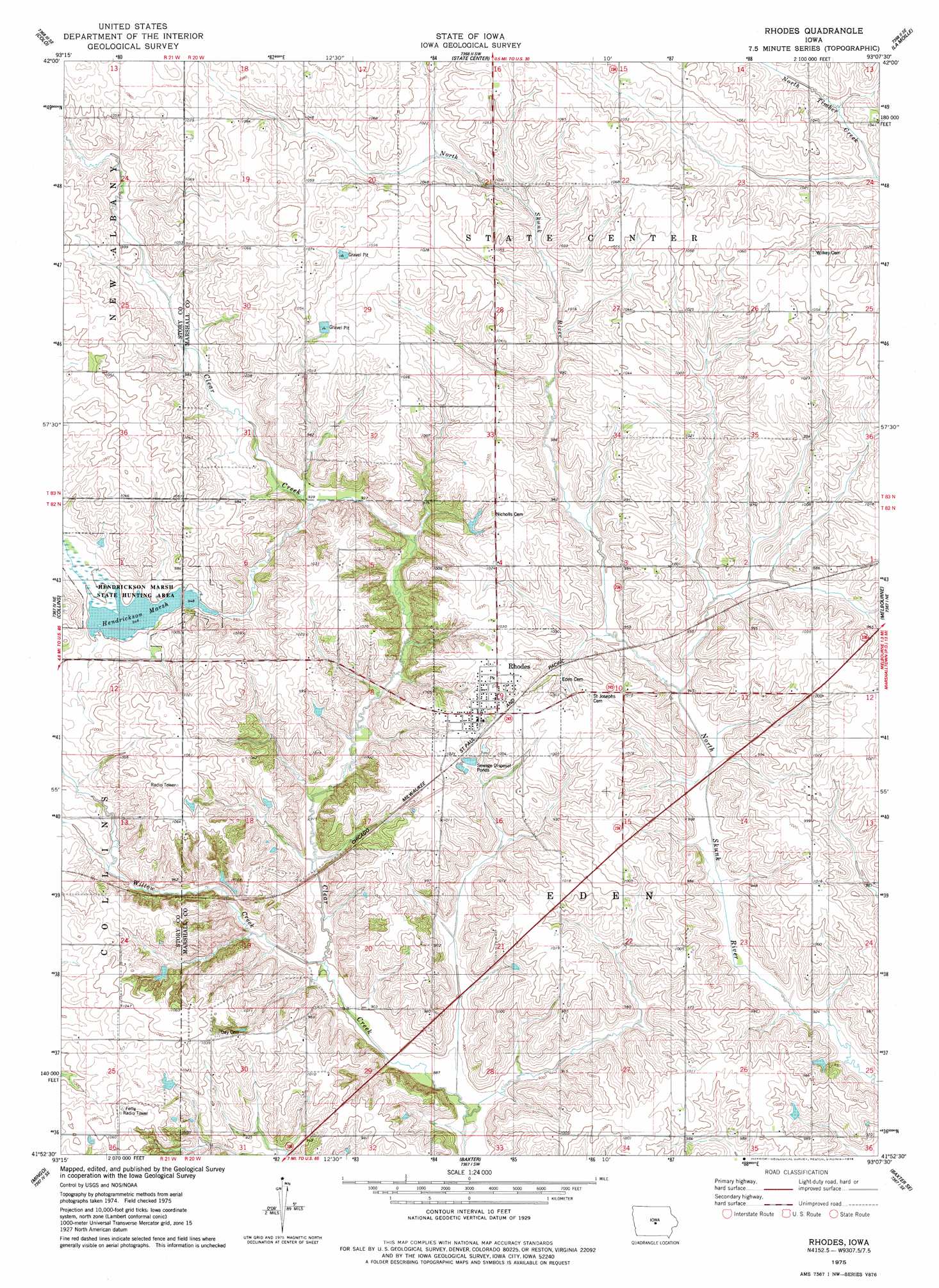
Rhodes Topo Map Iowa
To zoom in, hover over the map of Rhodes
USGS Topo Quad 41093h2 - 1:24,000 scale
| Topo Map Name: | Rhodes |
| USGS Topo Quad ID: | 41093h2 |
| Print Size: | ca. 21 1/4" wide x 27" high |
| Southeast Coordinates: | 41.875° N latitude / 93.125° W longitude |
| Map Center Coordinates: | 41.9375° N latitude / 93.1875° W longitude |
| U.S. State: | IA |
| Filename: | o41093h2.jpg |
| Download Map JPG Image: | Rhodes topo map 1:24,000 scale |
| Map Type: | Topographic |
| Topo Series: | 7.5´ |
| Map Scale: | 1:24,000 |
| Source of Map Images: | United States Geological Survey (USGS) |
| Alternate Map Versions: |
Rhodes IA 1975, updated 1978 Download PDF Buy paper map Rhodes IA 2010 Download PDF Buy paper map Rhodes IA 2013 Download PDF Buy paper map Rhodes IA 2015 Download PDF Buy paper map |
1:24,000 Topo Quads surrounding Rhodes
Mccallsburg |
Zearing |
State Center Nw |
Union |
Conrad West |
Nevada |
Colo |
State Center |
La Moille |
Marshalltown |
Maxwell |
Collins |
Rhodes |
Melbourne |
Laurel |
Loring |
Mingo |
Baxter |
Baxter Se |
Alloway Creek |
Altoona |
Mitchellville |
Colfax |
Newton |
Kellogg |
> Back to 41093e1 at 1:100,000 scale
> Back to 41092a1 at 1:250,000 scale
> Back to U.S. Topo Maps home
Rhodes topo map: Gazetteer
Rhodes: Dams
Hendrickson Marsh Dam elevation 289m 948′Rhodes: Lakes
Hendrickson Marsh Lake elevation 289m 948′Rhodes: Parks
Hendrickson Marsh State Hunting Area elevation 290m 951′Rhodes: Populated Places
Edenville elevation 312m 1023′Rhodes elevation 311m 1020′
Rhodes: Post Offices
Rhodes Post Office elevation 311m 1020′Rhodes: Streams
Willow Creek elevation 273m 895′Rhodes digital topo map on disk
Buy this Rhodes topo map showing relief, roads, GPS coordinates and other geographical features, as a high-resolution digital map file on DVD: