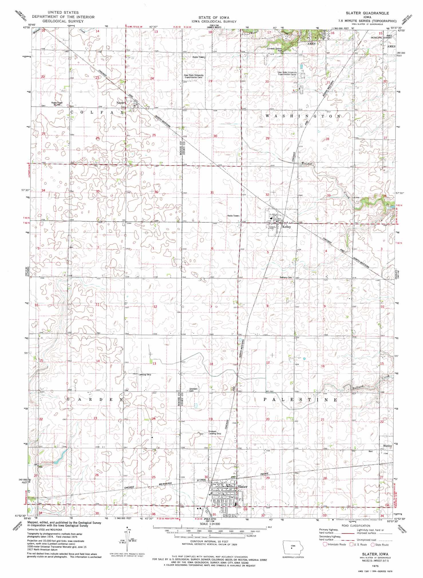
Slater Topo Map Iowa
To zoom in, hover over the map of Slater
USGS Topo Quad 41093h6 - 1:24,000 scale
| Topo Map Name: | Slater |
| USGS Topo Quad ID: | 41093h6 |
| Print Size: | ca. 21 1/4" wide x 27" high |
| Southeast Coordinates: | 41.875° N latitude / 93.625° W longitude |
| Map Center Coordinates: | 41.9375° N latitude / 93.6875° W longitude |
| U.S. State: | IA |
| Filename: | o41093h6.jpg |
| Download Map JPG Image: | Slater topo map 1:24,000 scale |
| Map Type: | Topographic |
| Topo Series: | 7.5´ |
| Map Scale: | 1:24,000 |
| Source of Map Images: | United States Geological Survey (USGS) |
| Alternate Map Versions: |
Slater IA 1975, updated 1978 Download PDF Buy paper map Slater IA 2010 Download PDF Buy paper map Slater IA 2013 Download PDF Buy paper map Slater IA 2015 Download PDF Buy paper map |
1:24,000 Topo Quads surrounding Slater
Fraser |
Mackey |
Ames Nw |
Story City |
Mccallsburg |
Boone West |
Boone East |
Ames West |
Ames East |
Nevada |
Madrid Nw |
Luther |
Slater |
Huxley |
Maxwell |
Woodward |
Granger |
Polk City |
Elkhart |
Loring |
Dallas Center |
Grimes |
Des Moines Nw |
Des Moines Ne |
Altoona |
> Back to 41093e1 at 1:100,000 scale
> Back to 41092a1 at 1:250,000 scale
> Back to U.S. Topo Maps home
Slater topo map: Gazetteer
Slater: Parks
Zumwalt Station Park elevation 299m 980′Slater: Populated Places
Kelley elevation 314m 1030′Napier elevation 320m 1049′
Slater elevation 316m 1036′
Slater: Post Offices
Kelley Post Office elevation 314m 1030′Slater Post Office elevation 316m 1036′
Slater digital topo map on disk
Buy this Slater topo map showing relief, roads, GPS coordinates and other geographical features, as a high-resolution digital map file on DVD: