Madrid Nw Topo Map Iowa
To zoom in, hover over the map of Madrid Nw
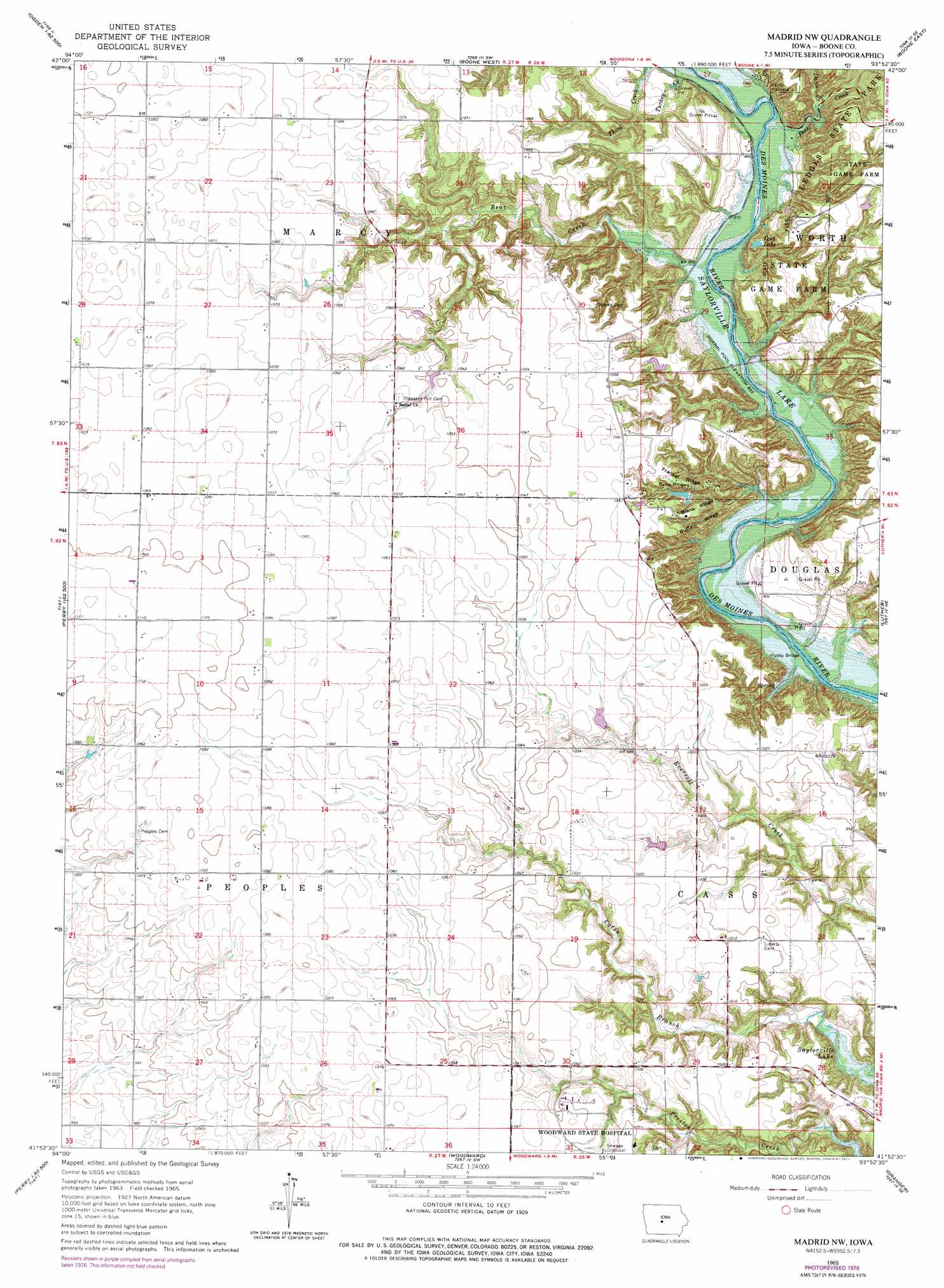
USGS Topo Quad 41093h8 - 1:24,000 scale
| Topo Map Name: | Madrid Nw |
| USGS Topo Quad ID: | 41093h8 |
| Print Size: | ca. 21 1/4" wide x 27" high |
| Southeast Coordinates: | 41.875° N latitude / 93.875° W longitude |
| Map Center Coordinates: | 41.9375° N latitude / 93.9375° W longitude |
| U.S. State: | IA |
| Filename: | o41093h8.jpg |
| Download Map JPG Image: | Madrid Nw topo map 1:24,000 scale |
| Map Type: | Topographic |
| Topo Series: | 7.5´ |
| Map Scale: | 1:24,000 |
| Source of Map Images: | United States Geological Survey (USGS) |
| Alternate Map Versions: |
Madrid NW IA 1965, updated 1967 Download PDF Buy paper map Madrid NW IA 1965, updated 1977 Download PDF Buy paper map Madrid NW IA 2010 Download PDF Buy paper map Madrid NW IA 2013 Download PDF Buy paper map Madrid NW IA 2015 Download PDF Buy paper map |
1:24,000 Topo Quads surrounding Madrid Nw
Lanyon |
Boxholm |
Fraser |
Mackey |
Ames Nw |
Grand Junction |
Ogden |
Boone West |
Boone East |
Ames West |
Rippey |
Berkley |
Madrid Nw |
Luther |
Slater |
Dawson |
Perry |
Woodward |
Granger |
Polk City |
Adel Nw |
Panther |
Dallas Center |
Grimes |
Des Moines Nw |
> Back to 41093e1 at 1:100,000 scale
> Back to 41092a1 at 1:250,000 scale
> Back to U.S. Topo Maps home
Madrid Nw topo map: Gazetteer
Madrid Nw: Lakes
Lost Lake elevation 271m 889′Madrid Nw: Parks
Ledges State Park elevation 319m 1046′McCoy Wildlife Area elevation 297m 974′
Worth State Game Farm elevation 318m 1043′
Madrid Nw: Post Offices
Jehu Post Office (historical) elevation 317m 1040′Marcy Post Office (historical) elevation 330m 1082′
Prairie Hill Post Office (historical) elevation 330m 1082′
Madrid Nw: Ridges
Blank Ridge elevation 314m 1030′Buffalo Ridge elevation 309m 1013′
Frankel Ridge elevation 310m 1017′
Madrid Nw: Streams
Bear Creek elevation 261m 856′Davis Creek elevation 268m 879′
Peas Creek elevation 262m 859′
Shady Branch elevation 292m 958′
Turkey Creek elevation 262m 859′
Madrid Nw digital topo map on disk
Buy this Madrid Nw topo map showing relief, roads, GPS coordinates and other geographical features, as a high-resolution digital map file on DVD: