Morton Mills Topo Map Iowa
To zoom in, hover over the map of Morton Mills
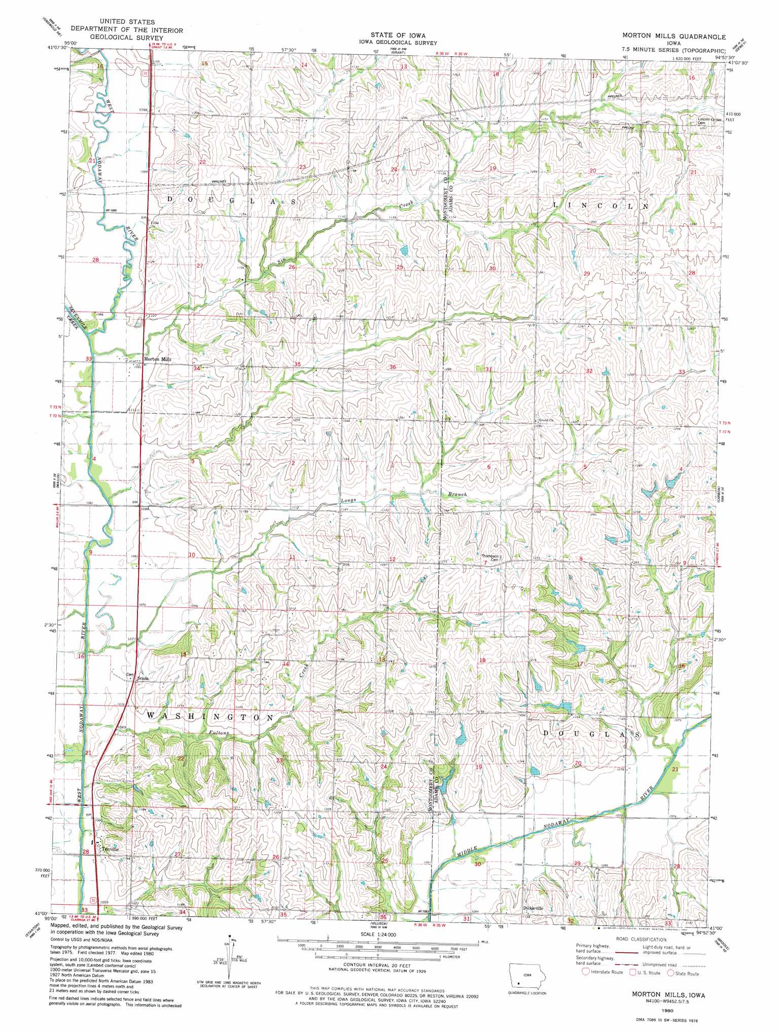
USGS Topo Quad 41094a8 - 1:24,000 scale
| Topo Map Name: | Morton Mills |
| USGS Topo Quad ID: | 41094a8 |
| Print Size: | ca. 21 1/4" wide x 27" high |
| Southeast Coordinates: | 41° N latitude / 94.875° W longitude |
| Map Center Coordinates: | 41.0625° N latitude / 94.9375° W longitude |
| U.S. State: | IA |
| Filename: | o41094a8.jpg |
| Download Map JPG Image: | Morton Mills topo map 1:24,000 scale |
| Map Type: | Topographic |
| Topo Series: | 7.5´ |
| Map Scale: | 1:24,000 |
| Source of Map Images: | United States Geological Survey (USGS) |
| Alternate Map Versions: |
Morton Mills IA 1980, updated 1981 Download PDF Buy paper map Morton Mills IA 2010 Download PDF Buy paper map Morton Mills IA 2013 Download PDF Buy paper map Morton Mills IA 2015 Download PDF Buy paper map |
1:24,000 Topo Quads surrounding Morton Mills
Atlantic Sw |
Lewis |
Anita Sw |
Massena |
Fontanelle Sw |
Griswold |
Griswold Ne |
Grant |
Dewey |
Bridgewater |
Red Oak North |
Wallin |
Morton Mills |
Carbon |
Corning North |
Red Oak South |
Stanton |
Villisca |
Brooks |
Corning South |
Stanton Sw |
Clarinda North |
Hawleyville |
Guss |
Gravity |
> Back to 41094a1 at 1:100,000 scale
> Back to 41094a1 at 1:250,000 scale
> Back to U.S. Topo Maps home
Morton Mills topo map: Gazetteer
Morton Mills: Populated Places
Dickieville elevation 366m 1200′Morton Mills elevation 332m 1089′
Sciola elevation 333m 1092′
Strand elevation 371m 1217′
Tenville elevation 323m 1059′
Morton Mills: Post Offices
Alix Post Office (historical) elevation 337m 1105′Morton Mills Post Office (historical) elevation 332m 1089′
Sciola Post Office (historical) elevation 322m 1056′
Strand Post Office (historical) elevation 371m 1217′
Tenville Post Office (historical) elevation 323m 1059′
Wallace Post Office (historical) elevation 334m 1095′
Morton Mills: Streams
Fultons Creek elevation 317m 1040′Longs Branch elevation 318m 1043′
Sevenmile Creek elevation 329m 1079′
Sin Creek elevation 329m 1079′
Morton Mills digital topo map on disk
Buy this Morton Mills topo map showing relief, roads, GPS coordinates and other geographical features, as a high-resolution digital map file on DVD: