Macksburg Topo Map Iowa
To zoom in, hover over the map of Macksburg
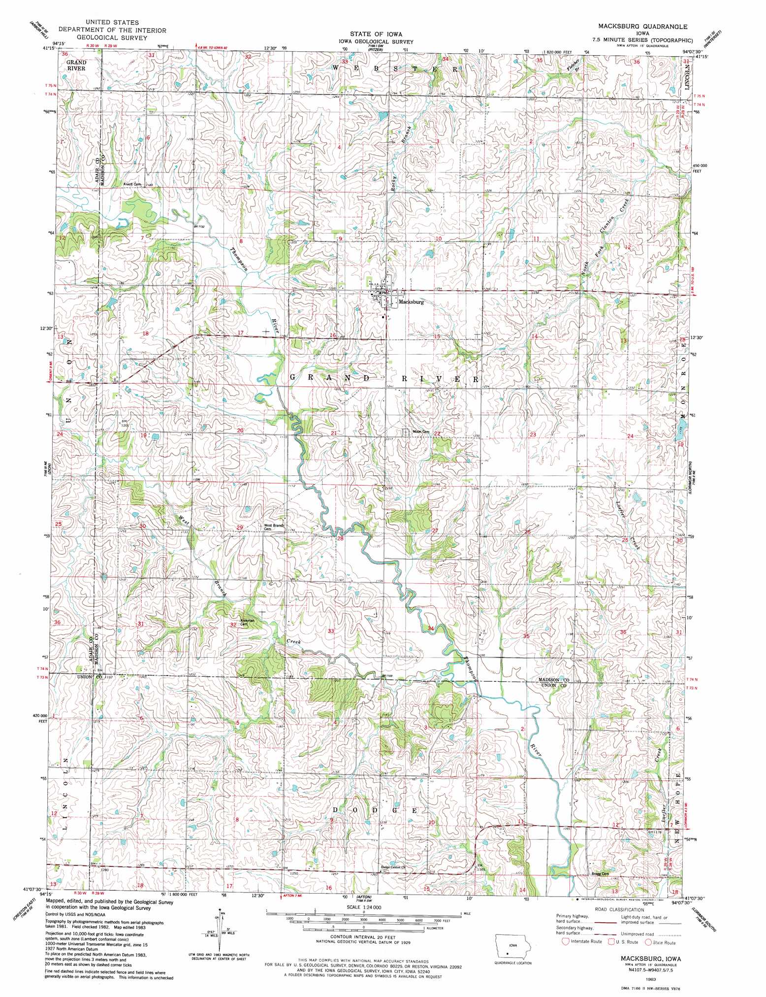
USGS Topo Quad 41094b2 - 1:24,000 scale
| Topo Map Name: | Macksburg |
| USGS Topo Quad ID: | 41094b2 |
| Print Size: | ca. 21 1/4" wide x 27" high |
| Southeast Coordinates: | 41.125° N latitude / 94.125° W longitude |
| Map Center Coordinates: | 41.1875° N latitude / 94.1875° W longitude |
| U.S. State: | IA |
| Filename: | o41094b2.jpg |
| Download Map JPG Image: | Macksburg topo map 1:24,000 scale |
| Map Type: | Topographic |
| Topo Series: | 7.5´ |
| Map Scale: | 1:24,000 |
| Source of Map Images: | United States Geological Survey (USGS) |
| Alternate Map Versions: |
Macksburg IA 1983, updated 1984 Download PDF Buy paper map Macksburg IA 2010 Download PDF Buy paper map Macksburg IA 2013 Download PDF Buy paper map Macksburg IA 2015 Download PDF Buy paper map |
1:24,000 Topo Quads surrounding Macksburg
Rosserdale |
Stuart South |
Earlham West |
Earlham East |
Saint Charles Nw |
Greenfield |
Arbor Hill |
Pitzer |
Winterset |
Patterson |
Orient |
Zion |
Macksburg |
Lorimor North |
East Peru |
Creston West |
Creston East |
Afton |
Lorimor South |
Murray |
Kent |
Shannon City |
Arispe |
Tingley Ne |
Hopeville |
> Back to 41094a1 at 1:100,000 scale
> Back to 41094a1 at 1:250,000 scale
> Back to U.S. Topo Maps home
Macksburg topo map: Gazetteer
Macksburg: Populated Places
Macksburg elevation 380m 1246′Macksburg: Post Offices
Lefever Post Office (historical) elevation 366m 1200′Macksburg Post Office elevation 380m 1246′
Wells Post Office (historical) elevation 359m 1177′
Macksburg: Streams
West Branch Creek elevation 335m 1099′Macksburg digital topo map on disk
Buy this Macksburg topo map showing relief, roads, GPS coordinates and other geographical features, as a high-resolution digital map file on DVD: