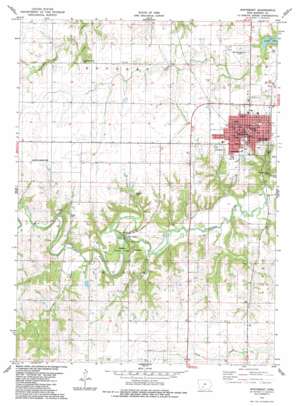
Winterset Topo Map Iowa
To zoom in, hover over the map of Winterset
USGS Topo Quad 41094c1 - 1:24,000 scale
| Topo Map Name: | Winterset |
| USGS Topo Quad ID: | 41094c1 |
| Print Size: | ca. 21 1/4" wide x 27" high |
| Southeast Coordinates: | 41.25° N latitude / 94° W longitude |
| Map Center Coordinates: | 41.3125° N latitude / 94.0625° W longitude |
| U.S. State: | IA |
| Filename: | o41094c1.jpg |
| Download Map JPG Image: | Winterset topo map 1:24,000 scale |
| Map Type: | Topographic |
| Topo Series: | 7.5´ |
| Map Scale: | 1:24,000 |
| Source of Map Images: | United States Geological Survey (USGS) |
| Alternate Map Versions: |
Winterset IA 1983, updated 1984 Download PDF Buy paper map Winterset IA 2010 Download PDF Buy paper map Winterset IA 2013 Download PDF Buy paper map Winterset IA 2015 Download PDF Buy paper map |
1:24,000 Topo Quads surrounding Winterset
> Back to 41094a1 at 1:100,000 scale
> Back to 41094a1 at 1:250,000 scale
> Back to U.S. Topo Maps home
Winterset topo map: Gazetteer
Winterset: Airports
Jackson Landing Strip elevation 363m 1190′Winterset-Madison County Airport elevation 339m 1112′
Winterset: Bridges
Cutler - Donahue Covered Bridge elevation 328m 1076′Winterset: Parks
Discovery of the Delicious Apple Historical Marker elevation 314m 1030′George Washington Carver Memorial Park elevation 342m 1122′
Giffin Fields elevation 329m 1079′
Memory Lane Park elevation 330m 1082′
Monument Park elevation 342m 1122′
Pammel State Park elevation 299m 980′
Tribute to Madison County First Settler Historical Marker elevation 314m 1030′
Whistle Stop Park elevation 343m 1125′
Winterset City Park elevation 314m 1030′
Winterset: Populated Places
Buffalo (historical) elevation 283m 928′Ord elevation 360m 1181′
Winterset elevation 332m 1089′
Winterset: Post Offices
Ord Post Office (historical) elevation 360m 1181′Price Post Office (historical) elevation 347m 1138′
Winterset Post Office elevation 343m 1125′
Winterset: Streams
Fletcher Branch elevation 295m 967′Winterset: Tunnels
Harmon Tunnel elevation 301m 987′Winterset digital topo map on disk
Buy this Winterset topo map showing relief, roads, GPS coordinates and other geographical features, as a high-resolution digital map file on DVD:


