Arbor Hill Topo Map Iowa
To zoom in, hover over the map of Arbor Hill
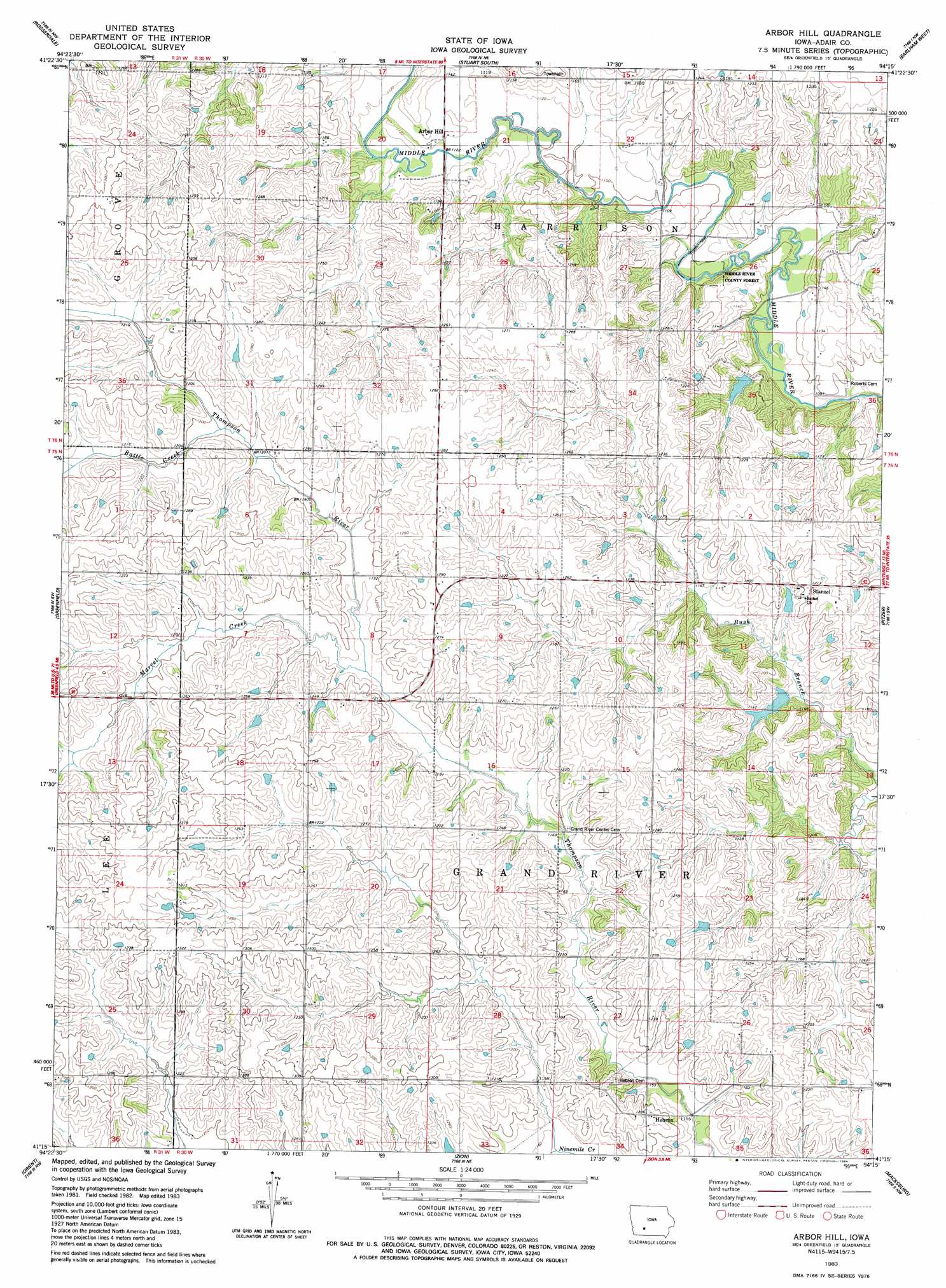
USGS Topo Quad 41094c3 - 1:24,000 scale
| Topo Map Name: | Arbor Hill |
| USGS Topo Quad ID: | 41094c3 |
| Print Size: | ca. 21 1/4" wide x 27" high |
| Southeast Coordinates: | 41.25° N latitude / 94.25° W longitude |
| Map Center Coordinates: | 41.3125° N latitude / 94.3125° W longitude |
| U.S. State: | IA |
| Filename: | o41094c3.jpg |
| Download Map JPG Image: | Arbor Hill topo map 1:24,000 scale |
| Map Type: | Topographic |
| Topo Series: | 7.5´ |
| Map Scale: | 1:24,000 |
| Source of Map Images: | United States Geological Survey (USGS) |
| Alternate Map Versions: |
Arbor Hill IA 1983, updated 1984 Download PDF Buy paper map Arbor Hill IA 2010 Download PDF Buy paper map Arbor Hill IA 2013 Download PDF Buy paper map Arbor Hill IA 2015 Download PDF Buy paper map |
1:24,000 Topo Quads surrounding Arbor Hill
Casey |
Menlo |
Stuart North |
Redfield |
Adel |
Canby |
Rosserdale |
Stuart South |
Earlham West |
Earlham East |
Fontanelle |
Greenfield |
Arbor Hill |
Pitzer |
Winterset |
Nevinville |
Orient |
Zion |
Macksburg |
Lorimor North |
Prescott |
Creston West |
Creston East |
Afton |
Lorimor South |
> Back to 41094a1 at 1:100,000 scale
> Back to 41094a1 at 1:250,000 scale
> Back to U.S. Topo Maps home
Arbor Hill topo map: Gazetteer
Arbor Hill: Forests
Middle River County Forest elevation 330m 1082′Arbor Hill: Parks
Wright Wildlife Area elevation 360m 1181′Arbor Hill: Populated Places
Arbor Hill elevation 342m 1122′Hebron elevation 376m 1233′
Nanito elevation 379m 1243′
Stanzel elevation 368m 1207′
Arbor Hill: Post Offices
Arbor Hill Post Office (historical) elevation 375m 1230′Hebron Post Office (historical) elevation 376m 1233′
Nanito Post Office (historical) elevation 358m 1174′
Stanzel Post Office (historical) elevation 368m 1207′
Arbor Hill: Streams
Battle Creek elevation 365m 1197′Marvel Creek elevation 358m 1174′
Arbor Hill digital topo map on disk
Buy this Arbor Hill topo map showing relief, roads, GPS coordinates and other geographical features, as a high-resolution digital map file on DVD: