Casey Topo Map Iowa
To zoom in, hover over the map of Casey
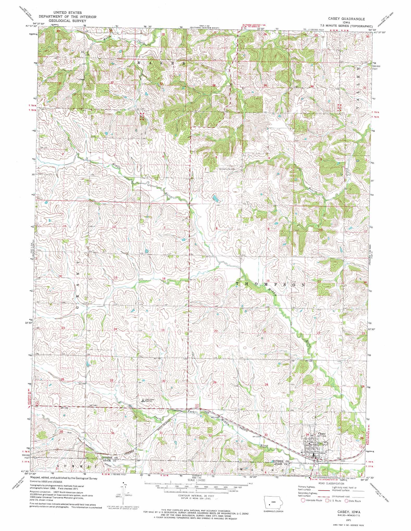
USGS Topo Quad 41094e5 - 1:24,000 scale
| Topo Map Name: | Casey |
| USGS Topo Quad ID: | 41094e5 |
| Print Size: | ca. 21 1/4" wide x 27" high |
| Southeast Coordinates: | 41.5° N latitude / 94.5° W longitude |
| Map Center Coordinates: | 41.5625° N latitude / 94.5625° W longitude |
| U.S. State: | IA |
| Filename: | o41094e5.jpg |
| Download Map JPG Image: | Casey topo map 1:24,000 scale |
| Map Type: | Topographic |
| Topo Series: | 7.5´ |
| Map Scale: | 1:24,000 |
| Source of Map Images: | United States Geological Survey (USGS) |
| Alternate Map Versions: |
Casey IA 1971, updated 1973 Download PDF Buy paper map Casey IA 2010 Download PDF Buy paper map Casey IA 2013 Download PDF Buy paper map Casey IA 2015 Download PDF Buy paper map |
1:24,000 Topo Quads surrounding Casey
Viola Center |
Coon Rapids South |
Bayard |
Bagley |
Yale |
Gardner |
North Branch |
Guthrie Center West |
Guthrie Center East |
Panora |
Exira East |
Adair North |
Casey |
Menlo |
Stuart North |
Anita |
Adair South |
Canby |
Rosserdale |
Stuart South |
Massena |
Fontanelle Sw |
Fontanelle |
Greenfield |
Arbor Hill |
> Back to 41094e1 at 1:100,000 scale
> Back to 41094a1 at 1:250,000 scale
> Back to U.S. Topo Maps home
Casey topo map: Gazetteer
Casey: Parks
Casey City Park elevation 388m 1272′Casey: Populated Places
Casey elevation 377m 1236′Casey: Post Offices
Casey Post Office elevation 377m 1236′Dalmanutha Post Office (historical) elevation 410m 1345′
Safeside Post Office (historical) elevation 414m 1358′
Casey: Streams
Fox Creek elevation 395m 1295′South Fork Middle River elevation 373m 1223′
Casey digital topo map on disk
Buy this Casey topo map showing relief, roads, GPS coordinates and other geographical features, as a high-resolution digital map file on DVD: