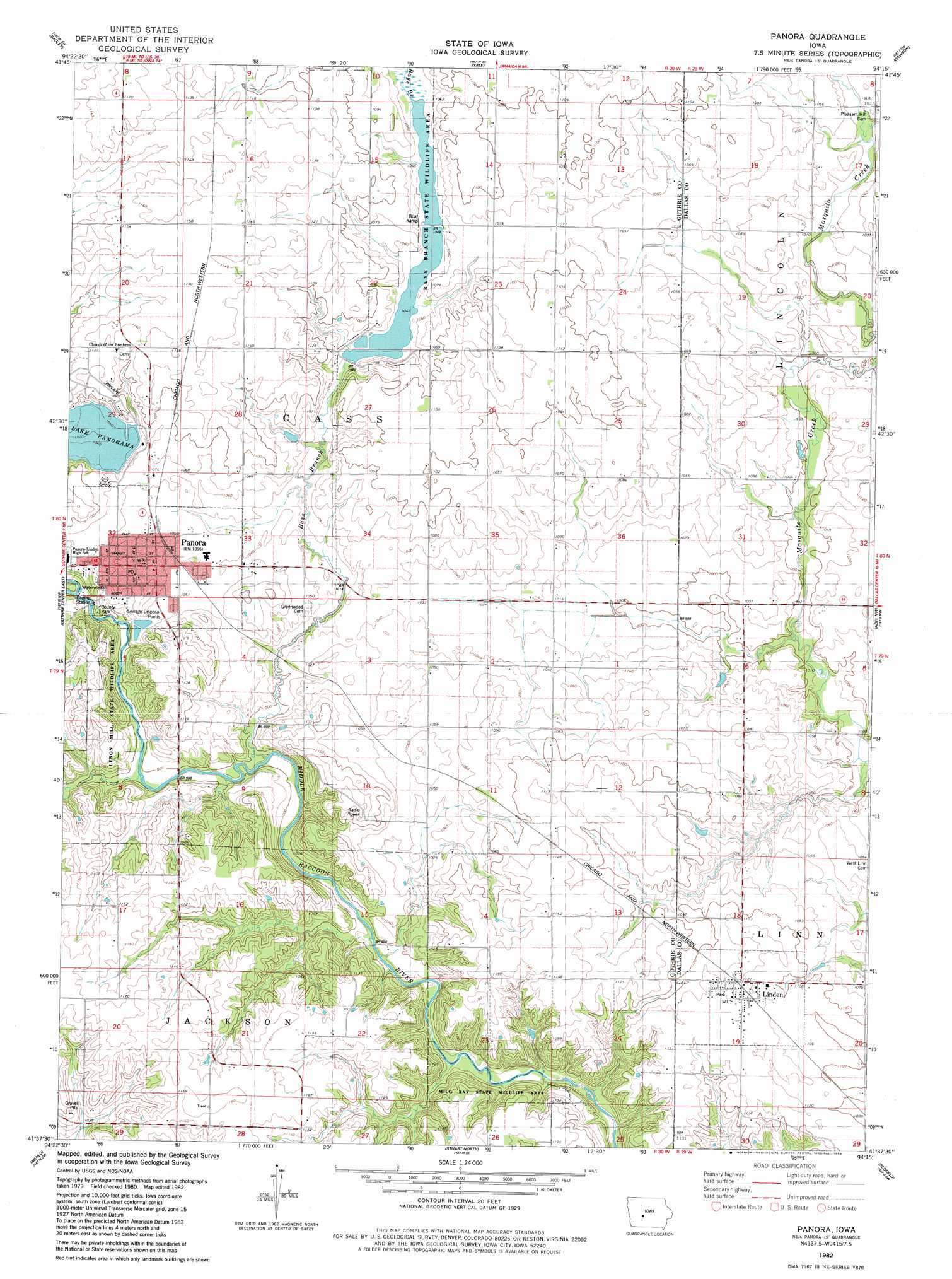
Panora Topo Map Iowa
To zoom in, hover over the map of Panora
USGS Topo Quad 41094f3 - 1:24,000 scale
| Topo Map Name: | Panora |
| USGS Topo Quad ID: | 41094f3 |
| Print Size: | ca. 21 1/4" wide x 27" high |
| Southeast Coordinates: | 41.625° N latitude / 94.25° W longitude |
| Map Center Coordinates: | 41.6875° N latitude / 94.3125° W longitude |
| U.S. State: | IA |
| Filename: | o41094f3.jpg |
| Download Map JPG Image: | Panora topo map 1:24,000 scale |
| Map Type: | Topographic |
| Topo Series: | 7.5´ |
| Map Scale: | 1:24,000 |
| Source of Map Images: | United States Geological Survey (USGS) |
| Alternate Map Versions: |
Panora IA 1982, updated 1983 Download PDF Buy paper map Panora IA 2010 Download PDF Buy paper map Panora IA 2013 Download PDF Buy paper map Panora IA 2015 Download PDF Buy paper map |
1:24,000 Topo Quads surrounding Panora
Coon Rapids Ne |
Bagley Nw |
Cooper |
Rippey |
Berkley |
Bayard |
Bagley |
Yale |
Dawson |
Perry |
Guthrie Center West |
Guthrie Center East |
Panora |
Adel Nw |
Panther |
Casey |
Menlo |
Stuart North |
Redfield |
Adel |
Canby |
Rosserdale |
Stuart South |
Earlham West |
Earlham East |
> Back to 41094e1 at 1:100,000 scale
> Back to 41094a1 at 1:250,000 scale
> Back to U.S. Topo Maps home
Panora topo map: Gazetteer
Panora: Dams
Bays Branch Lake Dam elevation 317m 1040′Panora: Parks
Bays Branch State Wildlife Area elevation 317m 1040′Guthrie County Park elevation 307m 1007′
Lennon Mills State Wildlife Area elevation 318m 1043′
Lenon Mill Park elevation 315m 1033′
Lenon Mill State Wildlife Area elevation 341m 1118′
Little League Ball Park elevation 323m 1059′
Milo Ray State Wildlife Area elevation 321m 1053′
Panora: Populated Places
Linden elevation 341m 1118′Panora elevation 328m 1076′
Panora: Post Offices
Linden Post Office elevation 341m 1118′Linn Post Office (historical) elevation 341m 1118′
Panora Post Office elevation 328m 1076′
Panora: Reservoirs
Bays Branch Lake elevation 317m 1040′Panora: Streams
Bay Branch elevation 299m 980′Cass Creek elevation 297m 974′
Panora digital topo map on disk
Buy this Panora topo map showing relief, roads, GPS coordinates and other geographical features, as a high-resolution digital map file on DVD: