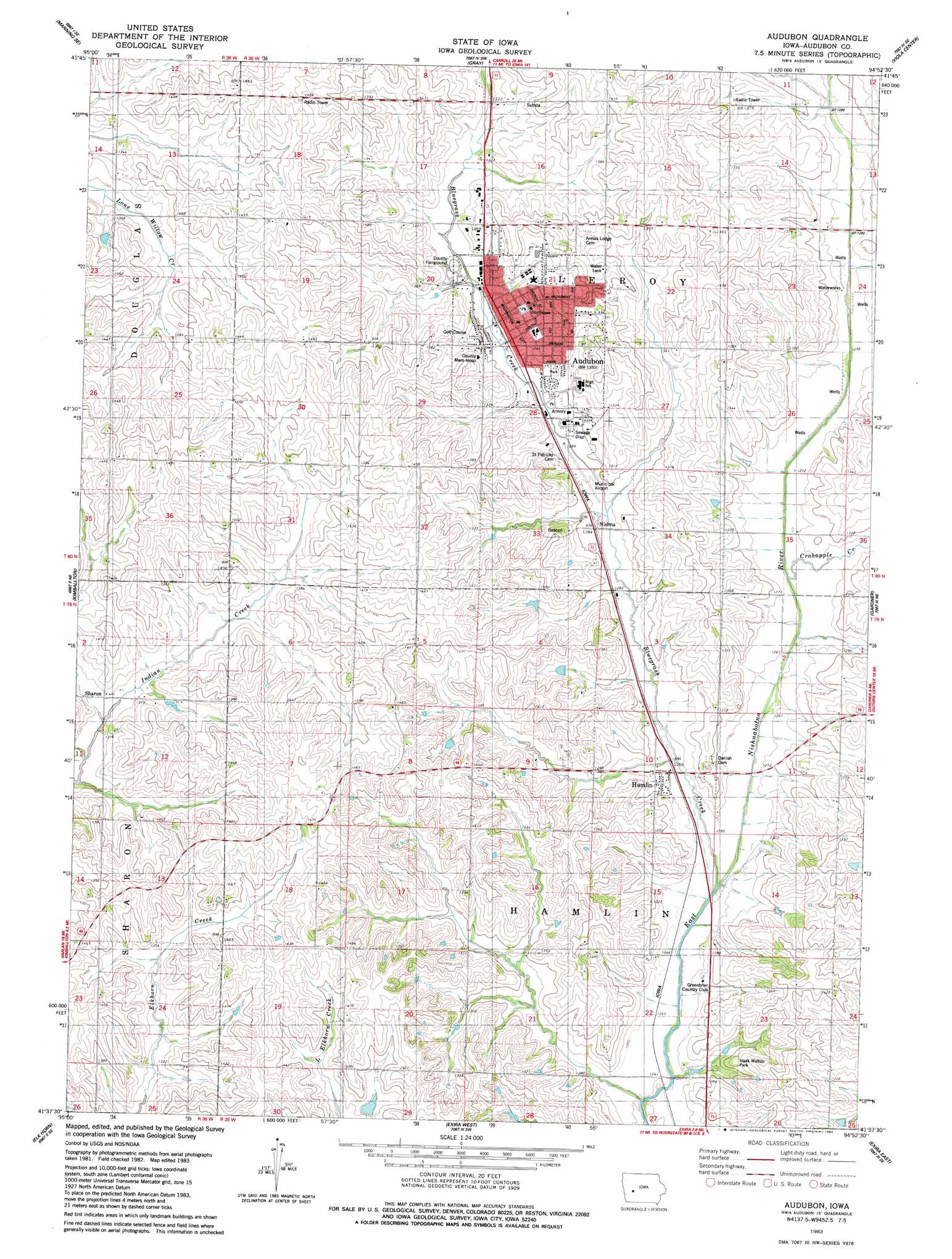
Audubon Topo Map Iowa
To zoom in, hover over the map of Audubon
USGS Topo Quad 41094f8 - 1:24,000 scale
| Topo Map Name: | Audubon |
| USGS Topo Quad ID: | 41094f8 |
| Print Size: | ca. 21 1/4" wide x 27" high |
| Southeast Coordinates: | 41.625° N latitude / 94.875° W longitude |
| Map Center Coordinates: | 41.6875° N latitude / 94.9375° W longitude |
| U.S. State: | IA |
| Filename: | o41094f8.jpg |
| Download Map JPG Image: | Audubon topo map 1:24,000 scale |
| Map Type: | Topographic |
| Topo Series: | 7.5´ |
| Map Scale: | 1:24,000 |
| Source of Map Images: | United States Geological Survey (USGS) |
| Alternate Map Versions: |
Audubon IA 1983, updated 1984 Download PDF Buy paper map Audubon IA 2010 Download PDF Buy paper map Audubon IA 2013 Download PDF Buy paper map Audubon IA 2015 Download PDF Buy paper map |
1:24,000 Topo Quads surrounding Audubon
Manilla |
Manning |
Templeton |
Dedham |
Coon Rapids North |
Irwin |
Manning Se |
Gray |
Viola Center |
Coon Rapids South |
Jacksonville |
Kimballton |
Audubon |
Gardner |
North Branch |
Prairie Rose Lake |
Elk Horn |
Exira West |
Exira East |
Adair North |
Walnut |
Atlantic |
Wiota |
Anita |
Adair South |
> Back to 41094e1 at 1:100,000 scale
> Back to 41094a1 at 1:250,000 scale
> Back to U.S. Topo Maps home
Audubon topo map: Gazetteer
Audubon: Airports
Audubon County Airport elevation 391m 1282′Audubon County Memorial Hospital Heliport elevation 412m 1351′
Audubon: Parks
Albert the Bull Park elevation 402m 1318′Bluegrass Park elevation 396m 1299′
Izaak Walton Park elevation 393m 1289′
John James Audubon Statue elevation 414m 1358′
Legion Park elevation 405m 1328′
Nathaniel Hamlin Park elevation 410m 1345′
Wiemann Area elevation 440m 1443′
Audubon: Populated Places
Audubon elevation 398m 1305′Hamlin elevation 384m 1259′
Nishna elevation 391m 1282′
Sharon elevation 400m 1312′
Audubon: Post Offices
Audubon Centre Post Office (historical) elevation 387m 1269′Audubon Post Office elevation 408m 1338′
Hamlin Post Office elevation 384m 1259′
Leroyville Post Office (historical) elevation 388m 1272′
Audubon: Streams
Bluegrass Creek elevation 378m 1240′Crabapple Creek elevation 383m 1256′
Audubon digital topo map on disk
Buy this Audubon topo map showing relief, roads, GPS coordinates and other geographical features, as a high-resolution digital map file on DVD: