Bagley Topo Map Iowa
To zoom in, hover over the map of Bagley
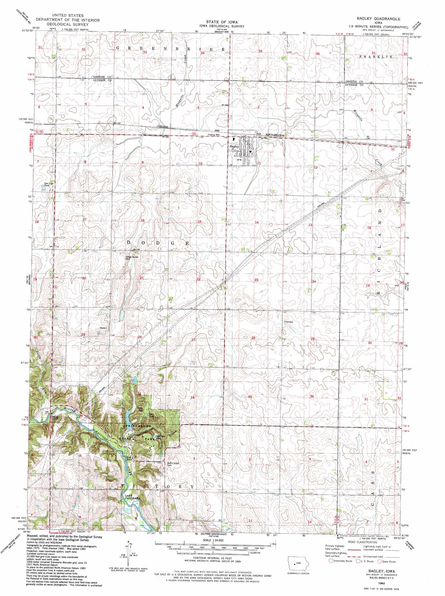
USGS Topo Quad 41094g4 - 1:24,000 scale
| Topo Map Name: | Bagley |
| USGS Topo Quad ID: | 41094g4 |
| Print Size: | ca. 21 1/4" wide x 27" high |
| Southeast Coordinates: | 41.75° N latitude / 94.375° W longitude |
| Map Center Coordinates: | 41.8125° N latitude / 94.4375° W longitude |
| U.S. State: | IA |
| Filename: | o41094g4.jpg |
| Download Map JPG Image: | Bagley topo map 1:24,000 scale |
| Map Type: | Topographic |
| Topo Series: | 7.5´ |
| Map Scale: | 1:24,000 |
| Source of Map Images: | United States Geological Survey (USGS) |
| Alternate Map Versions: |
Bagley IA 1982, updated 1983 Download PDF Buy paper map Bagley IA 2010 Download PDF Buy paper map Bagley IA 2013 Download PDF Buy paper map Bagley IA 2015 Download PDF Buy paper map |
1:24,000 Topo Quads surrounding Bagley
Glidden |
Scranton |
Jefferson West |
Jefferson East |
Grand Junction |
Coon Rapids North |
Coon Rapids Ne |
Bagley Nw |
Cooper |
Rippey |
Coon Rapids South |
Bayard |
Bagley |
Yale |
Dawson |
North Branch |
Guthrie Center West |
Guthrie Center East |
Panora |
Adel Nw |
Adair North |
Casey |
Menlo |
Stuart North |
Redfield |
> Back to 41094e1 at 1:100,000 scale
> Back to 41094a1 at 1:250,000 scale
> Back to U.S. Topo Maps home
Bagley topo map: Gazetteer
Bagley: Lakes
Swan Lake (historical) elevation 344m 1128′Bagley: Parks
Springbrook State Park elevation 340m 1115′Bagley: Populated Places
Bagley elevation 338m 1108′Bagley: Post Offices
Bagley Post Office elevation 338m 1108′Moffit Post Office (historical) elevation 369m 1210′
Bagley: Streams
Battle Run elevation 320m 1049′Springbrook Creek elevation 317m 1040′
Bagley digital topo map on disk
Buy this Bagley topo map showing relief, roads, GPS coordinates and other geographical features, as a high-resolution digital map file on DVD: