Carson Ne Topo Map Iowa
To zoom in, hover over the map of Carson Ne
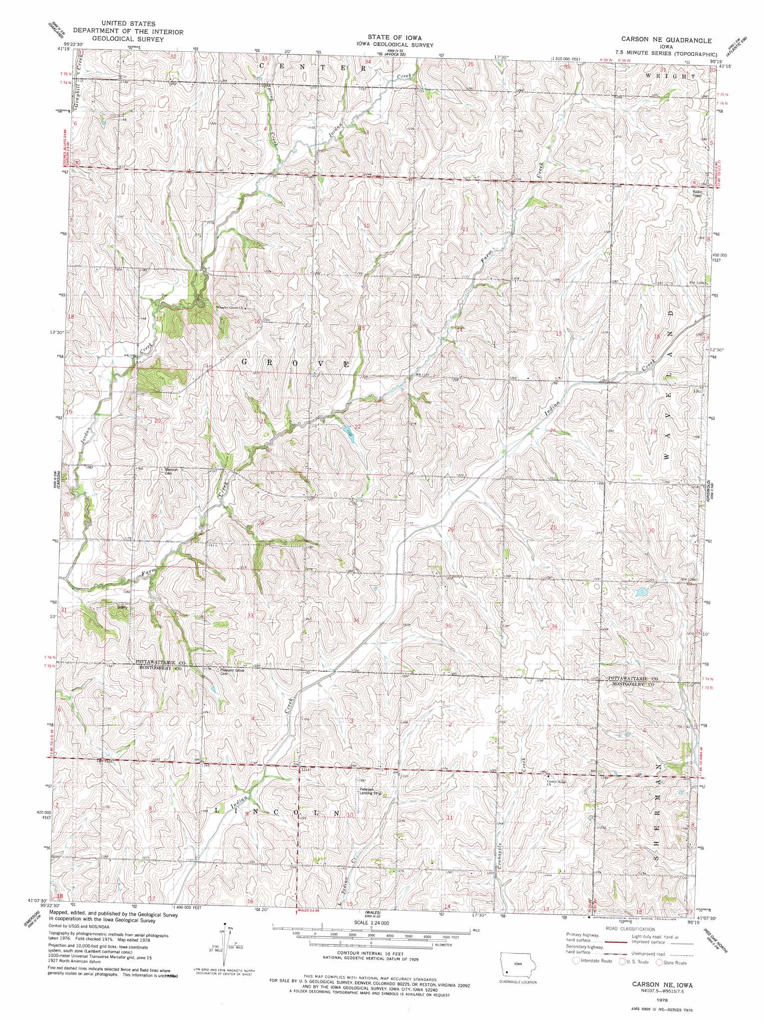
USGS Topo Quad 41095b3 - 1:24,000 scale
| Topo Map Name: | Carson Ne |
| USGS Topo Quad ID: | 41095b3 |
| Print Size: | ca. 21 1/4" wide x 27" high |
| Southeast Coordinates: | 41.125° N latitude / 95.25° W longitude |
| Map Center Coordinates: | 41.1875° N latitude / 95.3125° W longitude |
| U.S. State: | IA |
| Filename: | o41095b3.jpg |
| Download Map JPG Image: | Carson Ne topo map 1:24,000 scale |
| Map Type: | Topographic |
| Topo Series: | 7.5´ |
| Map Scale: | 1:24,000 |
| Source of Map Images: | United States Geological Survey (USGS) |
| Alternate Map Versions: |
Carson NE IA 1978, updated 1978 Download PDF Buy paper map Carson NE IA 2010 Download PDF Buy paper map Carson NE IA 2013 Download PDF Buy paper map Carson NE IA 2015 Download PDF Buy paper map |
1:24,000 Topo Quads surrounding Carson Ne
Neola |
Avoca Nw |
Avoca |
Walnut |
Atlantic |
Taylor |
Oakland |
Avoca Se |
Atlantic Sw |
Lewis |
Treynor |
Carson |
Carson Ne |
Griswold |
Griswold Ne |
Malvern |
Emerson |
Walles |
Red Oak North |
Wallin |
Tabor Ne |
Imogene |
Coburg |
Red Oak South |
Stanton |
> Back to 41095a1 at 1:100,000 scale
> Back to 41094a1 at 1:250,000 scale
> Back to U.S. Topo Maps home
Carson Ne topo map: Gazetteer
Carson Ne: Airports
Petersen Landing Strip elevation 391m 1282′Carson Ne: Populated Places
Kemling (historical) elevation 386m 1266′Carson Ne: Post Offices
Kemling Post Office (historical) elevation 389m 1276′Wheeler Grove Post Office (historical) elevation 356m 1167′
Wheeler Post Office (historical) elevation 339m 1112′
Carson Ne: Streams
Jordan Creek elevation 320m 1049′Spring Creek elevation 338m 1108′
Carson Ne digital topo map on disk
Buy this Carson Ne topo map showing relief, roads, GPS coordinates and other geographical features, as a high-resolution digital map file on DVD: