Taylor Topo Map Iowa
To zoom in, hover over the map of Taylor
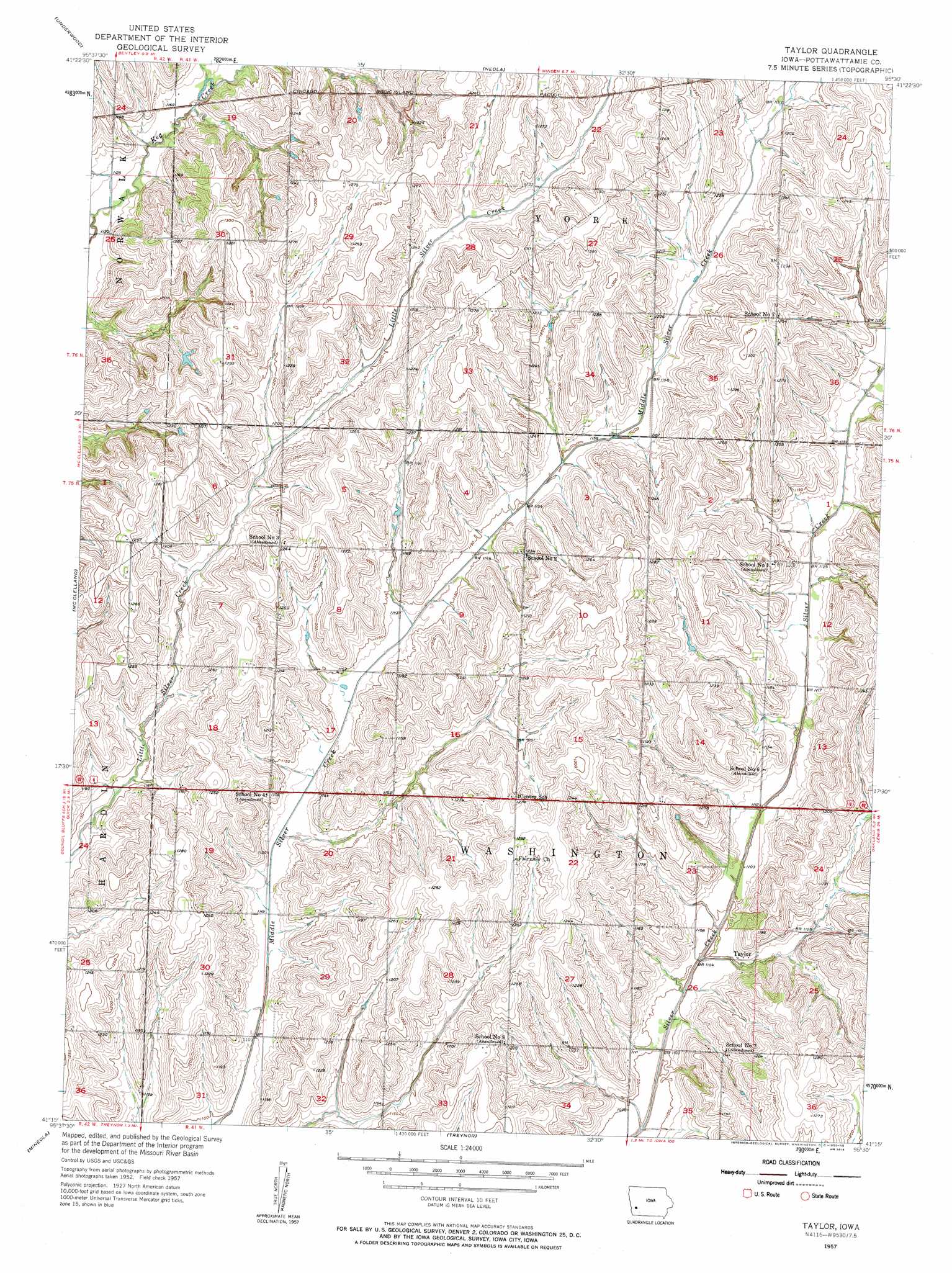
USGS Topo Quad 41095c5 - 1:24,000 scale
| Topo Map Name: | Taylor |
| USGS Topo Quad ID: | 41095c5 |
| Print Size: | ca. 21 1/4" wide x 27" high |
| Southeast Coordinates: | 41.25° N latitude / 95.5° W longitude |
| Map Center Coordinates: | 41.3125° N latitude / 95.5625° W longitude |
| U.S. State: | IA |
| Filename: | o41095c5.jpg |
| Download Map JPG Image: | Taylor topo map 1:24,000 scale |
| Map Type: | Topographic |
| Topo Series: | 7.5´ |
| Map Scale: | 1:24,000 |
| Source of Map Images: | United States Geological Survey (USGS) |
| Alternate Map Versions: |
Taylor IA 1957, updated 1958 Download PDF Buy paper map Taylor IA 2010 Download PDF Buy paper map Taylor IA 2013 Download PDF Buy paper map Taylor IA 2015 Download PDF Buy paper map |
1:24,000 Topo Quads surrounding Taylor
Beebeetown |
Hard Scratch |
Persia |
Shelby |
Corley |
Honey Creek |
Underwood |
Neola |
Avoca Nw |
Avoca |
Council Bluffs North |
Mcclelland |
Taylor |
Oakland |
Avoca Se |
Council Bluffs South |
Mineola |
Treynor |
Carson |
Carson Ne |
Pacific Junction |
Glenwood |
Malvern |
Emerson |
Walles |
> Back to 41095a1 at 1:100,000 scale
> Back to 41094a1 at 1:250,000 scale
> Back to U.S. Topo Maps home
Taylor topo map: Gazetteer
Taylor: Populated Places
Taylor elevation 339m 1112′Taylor: Post Offices
Blair Post Office (historical) elevation 367m 1204′Keown Post Office (historical) elevation 387m 1269′
Taylor Post Office (historical) elevation 339m 1112′
Taylor Station Post Office (historical) elevation 361m 1184′
Taylor digital topo map on disk
Buy this Taylor topo map showing relief, roads, GPS coordinates and other geographical features, as a high-resolution digital map file on DVD: