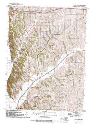
Honey Creek Topo Map Iowa
To zoom in, hover over the map of Honey Creek
USGS Topo Quad 41095d7 - 1:24,000 scale
| Topo Map Name: | Honey Creek |
| USGS Topo Quad ID: | 41095d7 |
| Print Size: | ca. 21 1/4" wide x 27" high |
| Southeast Coordinates: | 41.375° N latitude / 95.75° W longitude |
| Map Center Coordinates: | 41.4375° N latitude / 95.8125° W longitude |
| U.S. State: | IA |
| Filename: | o41095d7.jpg |
| Download Map JPG Image: | Honey Creek topo map 1:24,000 scale |
| Map Type: | Topographic |
| Topo Series: | 7.5´ |
| Map Scale: | 1:24,000 |
| Source of Map Images: | United States Geological Survey (USGS) |
| Alternate Map Versions: |
Honey Creek IA 1957, updated 1958 Download PDF Buy paper map Honey Creek IA 1957, updated 1977 Download PDF Buy paper map Honey Creek IA 1994, updated 1994 Download PDF Buy paper map Honey Creek IA 2010 Download PDF Buy paper map Honey Creek IA 2013 Download PDF Buy paper map Honey Creek IA 2015 Download PDF Buy paper map |
1:24,000 Topo Quads surrounding Honey Creek
> Back to 41095a1 at 1:100,000 scale
> Back to 41094a1 at 1:250,000 scale
> Back to U.S. Topo Maps home
Honey Creek topo map: Gazetteer
Honey Creek: Parks
Hitchcock Nature Area elevation 362m 1187′Honey Creek: Populated Places
Honey Creek elevation 309m 1013′Pigeon elevation 341m 1118′
Honey Creek: Post Offices
Boomer Grove Post Office (historical) elevation 367m 1204′Boomer Post Office (historical) elevation 366m 1200′
Boyer Post Office (historical) elevation 312m 1023′
Harrison Post Office (historical) elevation 312m 1023′
Honey Creek Post Office elevation 309m 1013′
Pigeon Post Office (historical) elevation 341m 1118′
Reels Post Office (historical) elevation 315m 1033′
Honey Creek: Streams
North Pigeon Creek elevation 305m 1000′Simon Run elevation 300m 984′
Honey Creek digital topo map on disk
Buy this Honey Creek topo map showing relief, roads, GPS coordinates and other geographical features, as a high-resolution digital map file on DVD:


