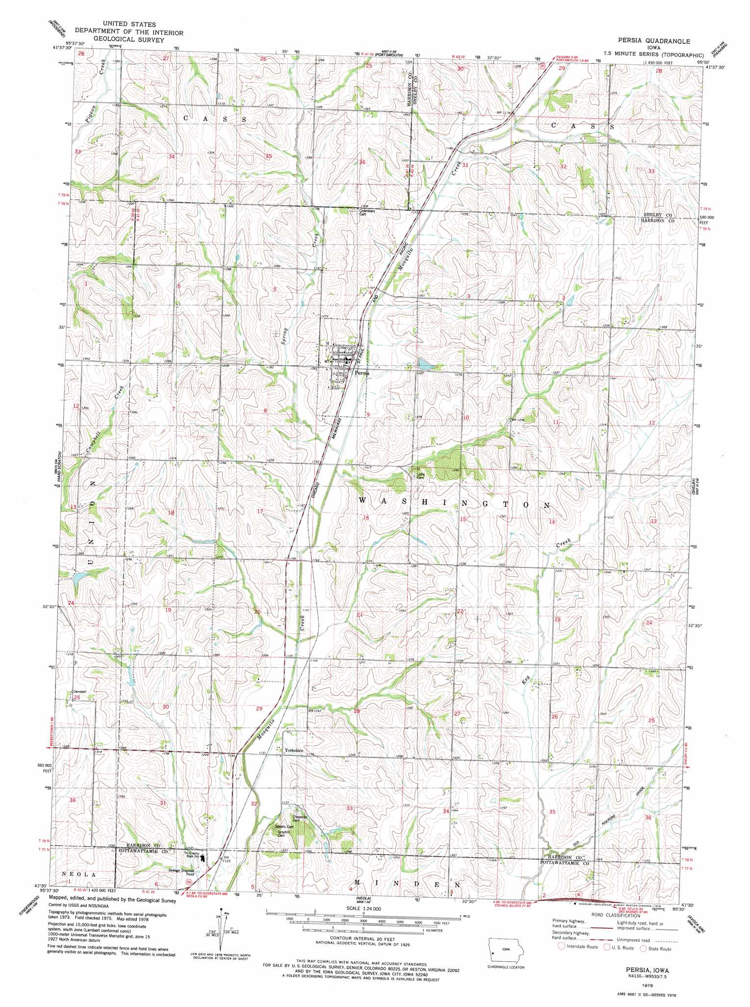
Persia Topo Map Iowa
To zoom in, hover over the map of Persia
USGS Topo Quad 41095e5 - 1:24,000 scale
| Topo Map Name: | Persia |
| USGS Topo Quad ID: | 41095e5 |
| Print Size: | ca. 21 1/4" wide x 27" high |
| Southeast Coordinates: | 41.5° N latitude / 95.5° W longitude |
| Map Center Coordinates: | 41.5625° N latitude / 95.5625° W longitude |
| U.S. State: | IA |
| Filename: | o41095e5.jpg |
| Download Map JPG Image: | Persia topo map 1:24,000 scale |
| Map Type: | Topographic |
| Topo Series: | 7.5´ |
| Map Scale: | 1:24,000 |
| Source of Map Images: | United States Geological Survey (USGS) |
| Alternate Map Versions: |
Persia IA 1978, updated 1978 Download PDF Buy paper map Persia IA 2010 Download PDF Buy paper map Persia IA 2013 Download PDF Buy paper map Persia IA 2015 Download PDF Buy paper map |
1:24,000 Topo Quads surrounding Persia
Moorhead Se |
Dunlap Sw |
Dunlap |
Earling |
Defiance |
Logan |
Woodbine |
Portsmouth |
Panama |
Harlan |
Beebeetown |
Hard Scratch |
Persia |
Shelby |
Corley |
Honey Creek |
Underwood |
Neola |
Avoca Nw |
Avoca |
Council Bluffs North |
Mcclelland |
Taylor |
Oakland |
Avoca Se |
> Back to 41095e1 at 1:100,000 scale
> Back to 41094a1 at 1:250,000 scale
> Back to U.S. Topo Maps home
Persia topo map: Gazetteer
Persia: Parks
Schley Park elevation 364m 1194′Persia: Populated Places
Magill elevation 373m 1223′Persia elevation 358m 1174′
Yorkshire elevation 356m 1167′
Persia: Post Offices
Persia Post Office elevation 359m 1177′Rock Run Post Office (historical) elevation 361m 1184′
Sampson Post Office (historical) elevation 363m 1190′
Yorkshire Post Office (historical) elevation 356m 1167′
Persia: Streams
East Branch Keg Creek elevation 366m 1200′Lytles Creek elevation 343m 1125′
Spring Creek elevation 347m 1138′
Persia digital topo map on disk
Buy this Persia topo map showing relief, roads, GPS coordinates and other geographical features, as a high-resolution digital map file on DVD: