Woodbine Topo Map Iowa
To zoom in, hover over the map of Woodbine
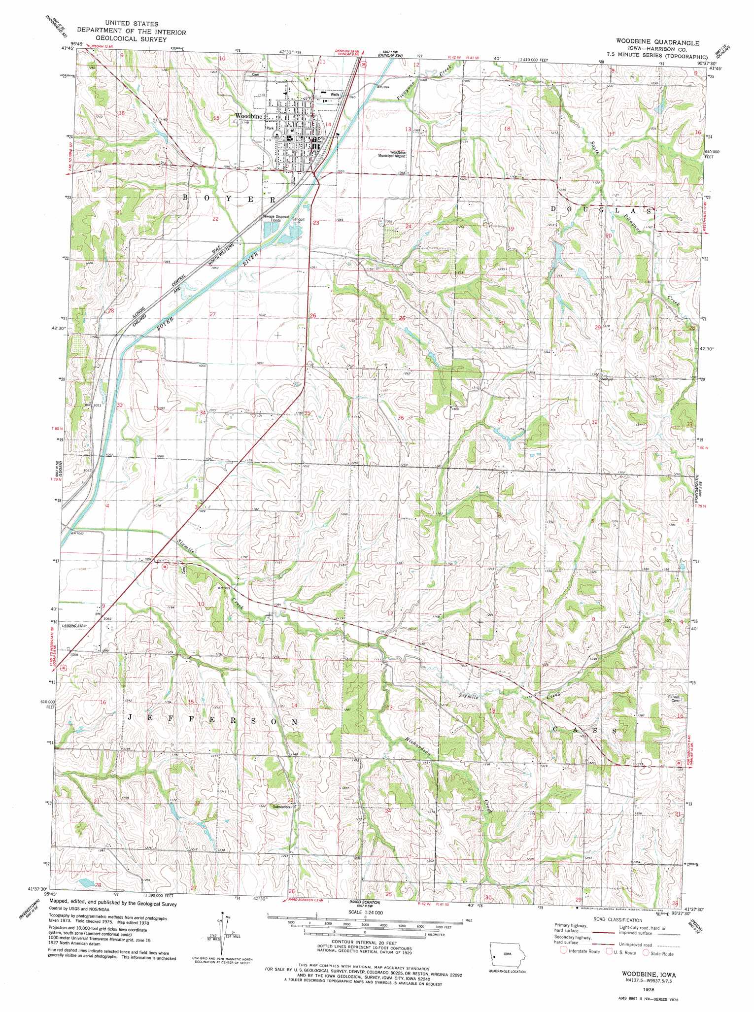
USGS Topo Quad 41095f6 - 1:24,000 scale
| Topo Map Name: | Woodbine |
| USGS Topo Quad ID: | 41095f6 |
| Print Size: | ca. 21 1/4" wide x 27" high |
| Southeast Coordinates: | 41.625° N latitude / 95.625° W longitude |
| Map Center Coordinates: | 41.6875° N latitude / 95.6875° W longitude |
| U.S. State: | IA |
| Filename: | o41095f6.jpg |
| Download Map JPG Image: | Woodbine topo map 1:24,000 scale |
| Map Type: | Topographic |
| Topo Series: | 7.5´ |
| Map Scale: | 1:24,000 |
| Source of Map Images: | United States Geological Survey (USGS) |
| Alternate Map Versions: |
Woodbine IA 1978, updated 1978 Download PDF Buy paper map Woodbine IA 2010 Download PDF Buy paper map Woodbine IA 2013 Download PDF Buy paper map Woodbine IA 2015 Download PDF Buy paper map |
1:24,000 Topo Quads surrounding Woodbine
Moorhead Nw |
Moorhead |
Dunlap Nw |
Dunlap Ne |
Dow City |
Pisgah |
Moorhead Se |
Dunlap Sw |
Dunlap |
Earling |
Missouri Valley Nw |
Logan |
Woodbine |
Portsmouth |
Panama |
Missouri Valley |
Beebeetown |
Hard Scratch |
Persia |
Shelby |
Loveland |
Honey Creek |
Underwood |
Neola |
Avoca Nw |
> Back to 41095e1 at 1:100,000 scale
> Back to 41094a1 at 1:250,000 scale
> Back to U.S. Topo Maps home
Woodbine topo map: Gazetteer
Woodbine: Airports
Woodbine Municipal Airport elevation 328m 1076′Woodbine: Populated Places
Willett elevation 323m 1059′Woodbine elevation 332m 1089′
Woodbine: Post Offices
Jeddo City Post Office (historical) elevation 346m 1135′Needmore Post Office (historical) elevation 363m 1190′
Ojedo Post Office (historical) elevation 385m 1263′
Twelve Mile Grove Post Office (historical) elevation 357m 1171′
Whitesboro Post Office (historical) elevation 323m 1059′
Woodbine Post Office elevation 332m 1089′
Woodbine: Streams
Picayune Creek elevation 323m 1059′Richardson Creek elevation 330m 1082′
Sixmile Creek elevation 317m 1040′
Woodbine digital topo map on disk
Buy this Woodbine topo map showing relief, roads, GPS coordinates and other geographical features, as a high-resolution digital map file on DVD: