Leshara Topo Map Nebraska
To zoom in, hover over the map of Leshara
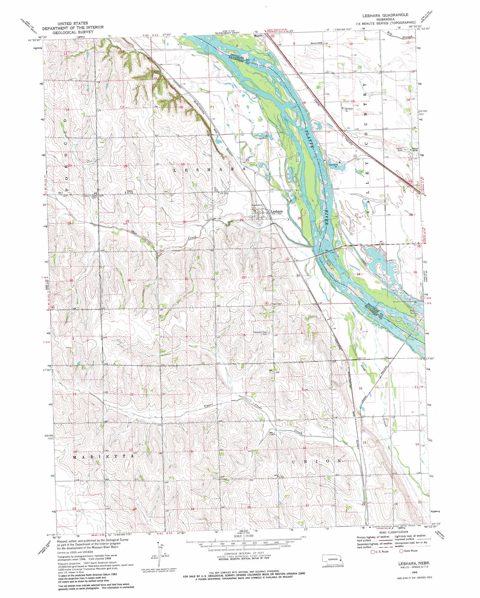
USGS Topo Quad 41096c4 - 1:24,000 scale
| Topo Map Name: | Leshara |
| USGS Topo Quad ID: | 41096c4 |
| Print Size: | ca. 21 1/4" wide x 27" high |
| Southeast Coordinates: | 41.25° N latitude / 96.375° W longitude |
| Map Center Coordinates: | 41.3125° N latitude / 96.4375° W longitude |
| U.S. State: | NE |
| Filename: | O41096C4.jpg |
| Download Map JPG Image: | Leshara topo map 1:24,000 scale |
| Map Type: | Topographic |
| Topo Series: | 7.5´ |
| Map Scale: | 1:24,000 |
| Source of Map Images: | United States Geological Survey (USGS) |
| Alternate Map Versions: |
Leshara NE 1968, updated 1971 Download PDF Buy paper map Leshara NE 1968, updated 1983 Download PDF Buy paper map Leshara NE 2011 Download PDF Buy paper map Leshara NE 2014 Download PDF Buy paper map |
1:24,000 Topo Quads surrounding Leshara
Scribner Sw |
Hooper |
Nickerson |
Orum |
Blair |
Malmo Nw |
Fremont West |
Fremont East |
Arlington |
Kennard |
Malmo |
Colon |
Leshara |
Valley |
Elkhorn |
Wahoo West |
Wahoo East |
Mead |
Wann |
Gretna |
Ceresco |
Wahoo Se |
Ashland West |
Ashland East |
Springfield |
> Back to 41096a1 at 1:100,000 scale
> Back to 41096a1 at 1:250,000 scale
> Back to U.S. Topo Maps home
Leshara topo map: Gazetteer
Leshara: Airports
Werner Airport elevation 353m 1158′Leshara: Populated Places
Leshara elevation 356m 1167′Mercer elevation 357m 1171′
Leshara: Post Offices
Leshara Post Office elevation 356m 1167′Leshara: Streams
Otoe Creek elevation 350m 1148′Leshara digital topo map on disk
Buy this Leshara topo map showing relief, roads, GPS coordinates and other geographical features, as a high-resolution digital map file on DVD: