Bruno Topo Map Nebraska
To zoom in, hover over the map of Bruno
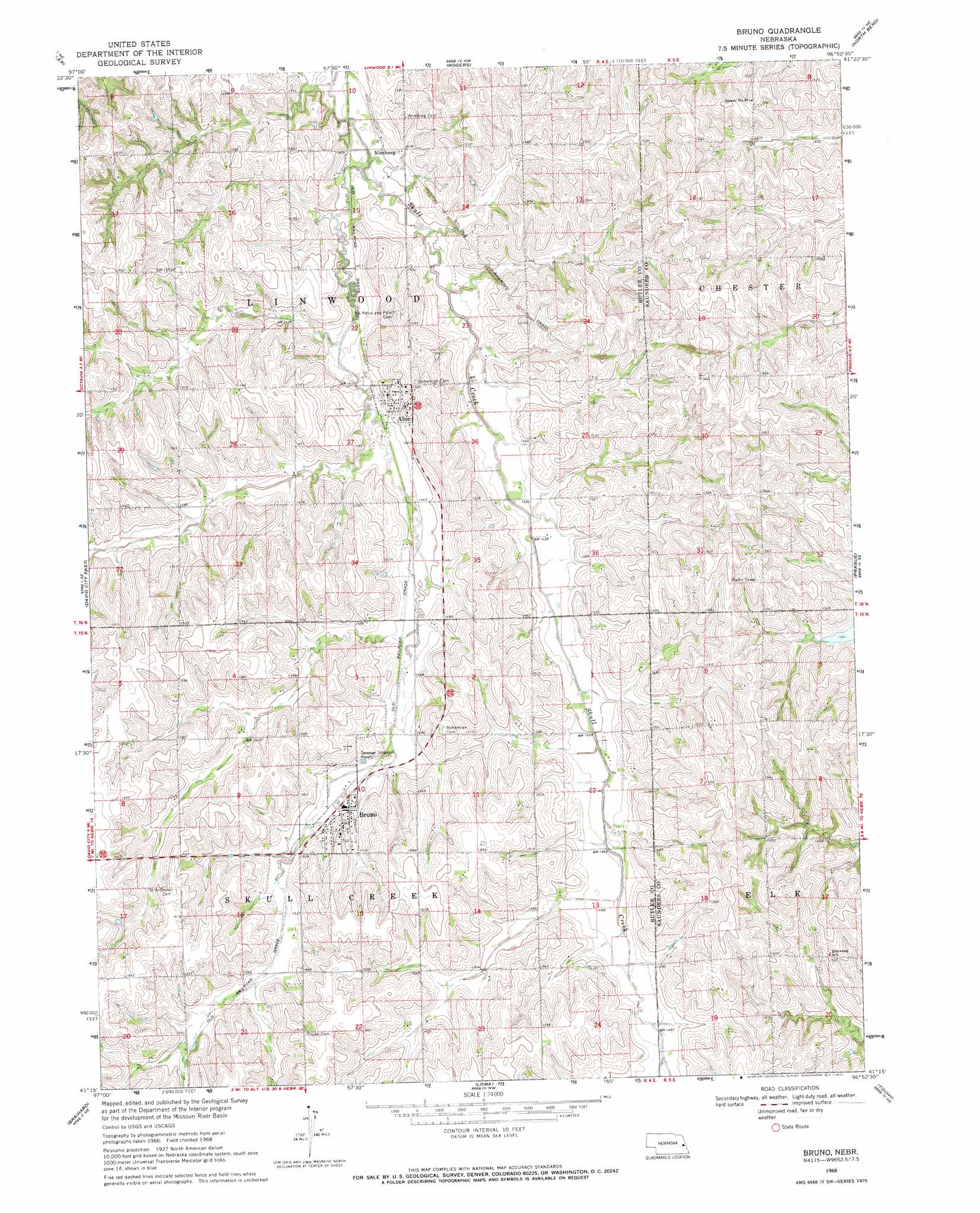
USGS Topo Quad 41096c8 - 1:24,000 scale
| Topo Map Name: | Bruno |
| USGS Topo Quad ID: | 41096c8 |
| Print Size: | ca. 21 1/4" wide x 27" high |
| Southeast Coordinates: | 41.25° N latitude / 96.875° W longitude |
| Map Center Coordinates: | 41.3125° N latitude / 96.9375° W longitude |
| U.S. State: | NE |
| Filename: | O41096C8.jpg |
| Download Map JPG Image: | Bruno topo map 1:24,000 scale |
| Map Type: | Topographic |
| Topo Series: | 7.5´ |
| Map Scale: | 1:24,000 |
| Source of Map Images: | United States Geological Survey (USGS) |
| Alternate Map Versions: |
Bruno NE 1968, updated 1971 Download PDF Buy paper map Bruno NE 2011 Download PDF Buy paper map Bruno NE 2014 Download PDF Buy paper map |
1:24,000 Topo Quads surrounding Bruno
Clarkson Sw |
Clarkson Se |
Dodge Sw |
Webster |
Scribner Sw |
Richland |
Schuyler |
Rogers |
North Bend |
Malmo Nw |
David City West |
David City East |
Bruno |
Prague |
Malmo |
Garrison |
Brainard |
Loma |
Touhy |
Wahoo West |
Ulysses |
Dwight |
Valparaiso Sw |
Valparaiso |
Ceresco |
> Back to 41096a1 at 1:100,000 scale
> Back to 41096a1 at 1:250,000 scale
> Back to U.S. Topo Maps home
Bruno topo map: Gazetteer
Bruno: Airports
Abie Sky Ranch elevation 430m 1410′Bruno: Dams
Jessen Dam elevation 448m 1469′Bruno: Populated Places
Abie elevation 446m 1463′Bruno elevation 457m 1499′
Nimburg elevation 436m 1430′
Bruno: Post Offices
Abie Post Office elevation 446m 1463′Bruno Post Office elevation 457m 1499′
Numberg Post Office (historical) elevation 436m 1430′
Bruno: Reservoirs
Jessen Reservoir elevation 448m 1469′Bruno digital topo map on disk
Buy this Bruno topo map showing relief, roads, GPS coordinates and other geographical features, as a high-resolution digital map file on DVD: