Columbus Sw Topo Map Nebraska
To zoom in, hover over the map of Columbus Sw
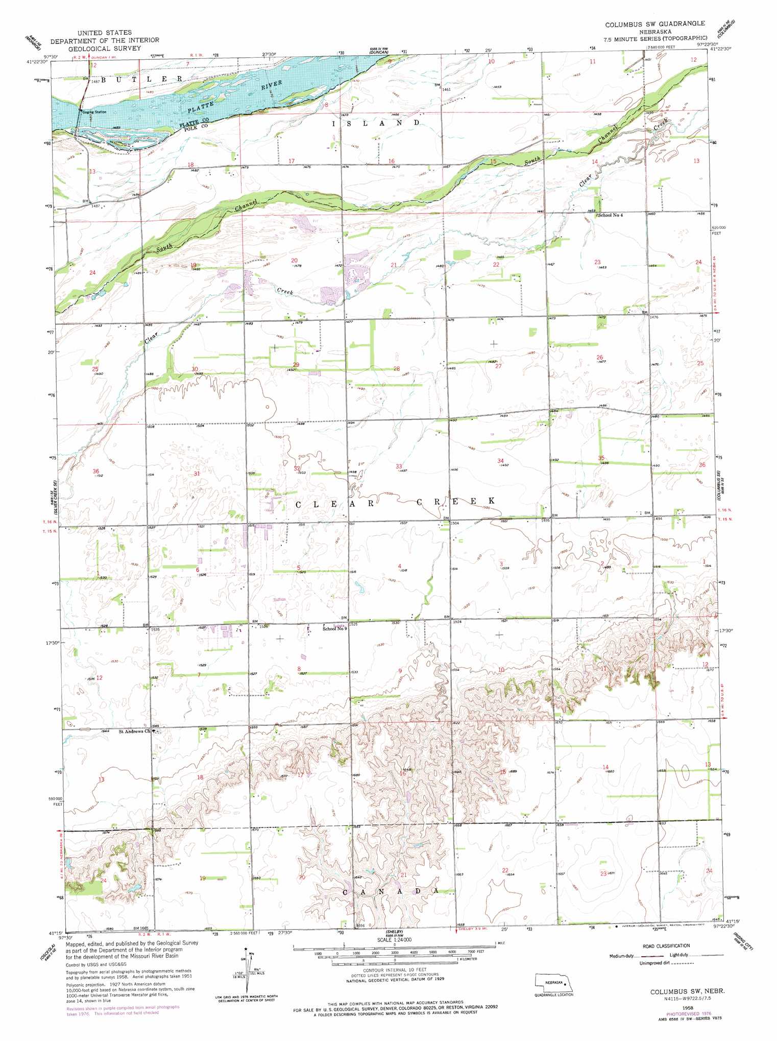
USGS Topo Quad 41097c4 - 1:24,000 scale
| Topo Map Name: | Columbus Sw |
| USGS Topo Quad ID: | 41097c4 |
| Print Size: | ca. 21 1/4" wide x 27" high |
| Southeast Coordinates: | 41.25° N latitude / 97.375° W longitude |
| Map Center Coordinates: | 41.3125° N latitude / 97.4375° W longitude |
| U.S. State: | NE |
| Filename: | O41097C4.jpg |
| Download Map JPG Image: | Columbus Sw topo map 1:24,000 scale |
| Map Type: | Topographic |
| Topo Series: | 7.5´ |
| Map Scale: | 1:24,000 |
| Source of Map Images: | United States Geological Survey (USGS) |
| Alternate Map Versions: |
Columbus SW NE 1958, updated 1959 Download PDF Buy paper map Columbus SW NE 1958, updated 1977 Download PDF Buy paper map Columbus SW NE 2011 Download PDF Buy paper map Columbus SW NE 2014 Download PDF Buy paper map |
1:24,000 Topo Quads surrounding Columbus Sw
Lindsay Sw |
Tarnov |
Platte Center |
Humphrey Se |
Clarkson Sw |
Genoa |
Monroe |
Duncan |
Columbus |
Richland |
Silver Creek |
Silver Creek Se |
Columbus Sw |
Columbus Se |
David City West |
Swedehome |
Osceola |
Shelby |
Rising City |
Garrison |
Durant |
Stromsburg |
Gresham |
Surprise |
Ulysses |
> Back to 41097a1 at 1:100,000 scale
> Back to 41096a1 at 1:250,000 scale
> Back to U.S. Topo Maps home
Columbus Sw topo map: Gazetteer
Columbus Sw: Dams
Messing-Scow Dam elevation 487m 1597′Perry Dam elevation 507m 1663′
Scow Detention Dam elevation 483m 1584′
Columbus Sw: Reservoirs
Messing-Scow Reservoir elevation 487m 1597′Perry Reservoir elevation 507m 1663′
Scow Reservoir elevation 483m 1584′
Columbus Sw digital topo map on disk
Buy this Columbus Sw topo map showing relief, roads, GPS coordinates and other geographical features, as a high-resolution digital map file on DVD: