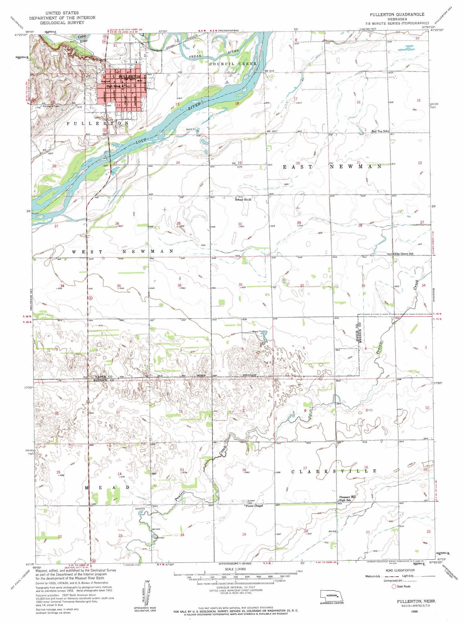
Fullerton Topo Map Nebraska
To zoom in, hover over the map of Fullerton
USGS Topo Quad 41097c8 - 1:24,000 scale
| Topo Map Name: | Fullerton |
| USGS Topo Quad ID: | 41097c8 |
| Print Size: | ca. 21 1/4" wide x 27" high |
| Southeast Coordinates: | 41.25° N latitude / 97.875° W longitude |
| Map Center Coordinates: | 41.3125° N latitude / 97.9375° W longitude |
| U.S. State: | NE |
| Filename: | O41097C8.jpg |
| Download Map JPG Image: | Fullerton topo map 1:24,000 scale |
| Map Type: | Topographic |
| Topo Series: | 7.5´ |
| Map Scale: | 1:24,000 |
| Source of Map Images: | United States Geological Survey (USGS) |
| Alternate Map Versions: |
Fullerton NE 1958, updated 1959 Download PDF Buy paper map Fullerton NE 2011 Download PDF Buy paper map Fullerton NE 2014 Download PDF Buy paper map |
1:24,000 Topo Quads surrounding Fullerton
Cedar Rapids |
Cedar Rapids Se |
Saint Edward Sw |
Saint Edward |
Lindsay Sw |
Belgrade Nw |
Belgrade |
Merchiston |
Fullerton Ne |
Genoa |
Belgrade Sw |
Belgrade Se |
Fullerton |
Havens |
Silver Creek |
Archer |
Hord |
Polk Nw |
Clarks |
Swedehome |
Chapman |
Central City West |
Central City East |
Polk |
Durant |
> Back to 41097a1 at 1:100,000 scale
> Back to 41096a1 at 1:250,000 scale
> Back to U.S. Topo Maps home
Fullerton topo map: Gazetteer
Fullerton: Parks
Fullerton Park elevation 499m 1637′Mormon Pioneer Campsite Historical Marker elevation 500m 1640′
Fullerton: Populated Places
Fullerton elevation 502m 1646′Fullerton: Post Offices
Fullerton Post Office elevation 502m 1646′Fullerton: Streams
Cedar River elevation 489m 1604′Fullerton digital topo map on disk
Buy this Fullerton topo map showing relief, roads, GPS coordinates and other geographical features, as a high-resolution digital map file on DVD: